Vacation Log 2005
Bert & Carey Vermeer
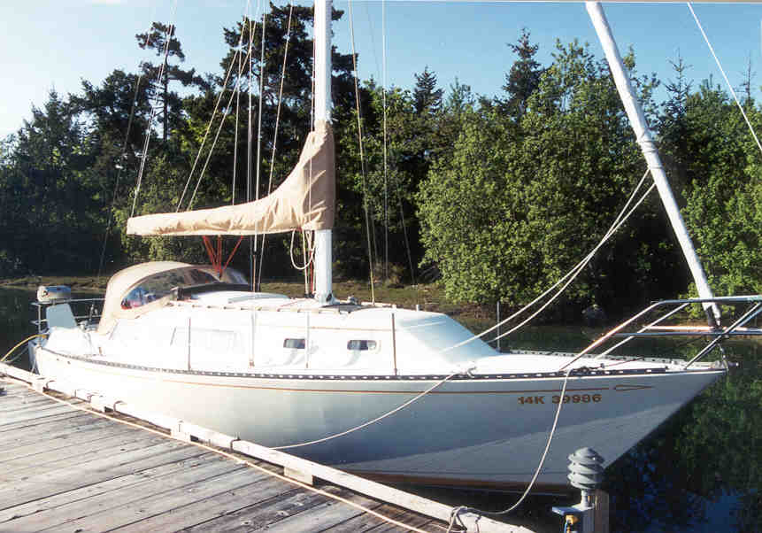
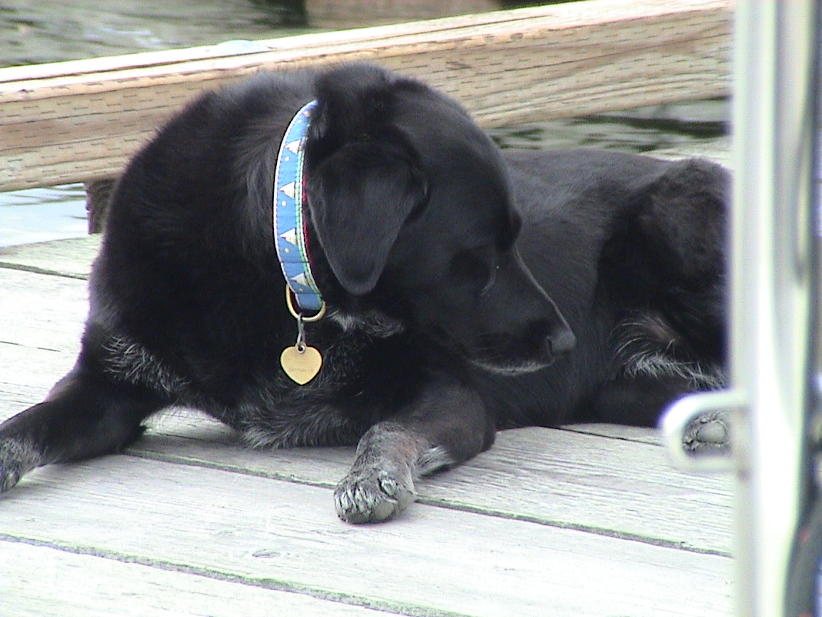
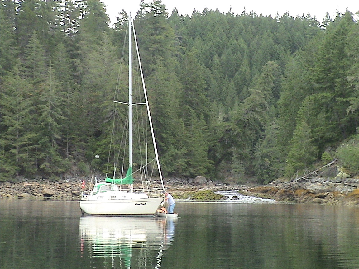
"Natasha"
|
Telgraph Cove |
Small Inlet |
Okeover Inlet |
|
Nanaimo |
Octopus Islands |
Lund |
|
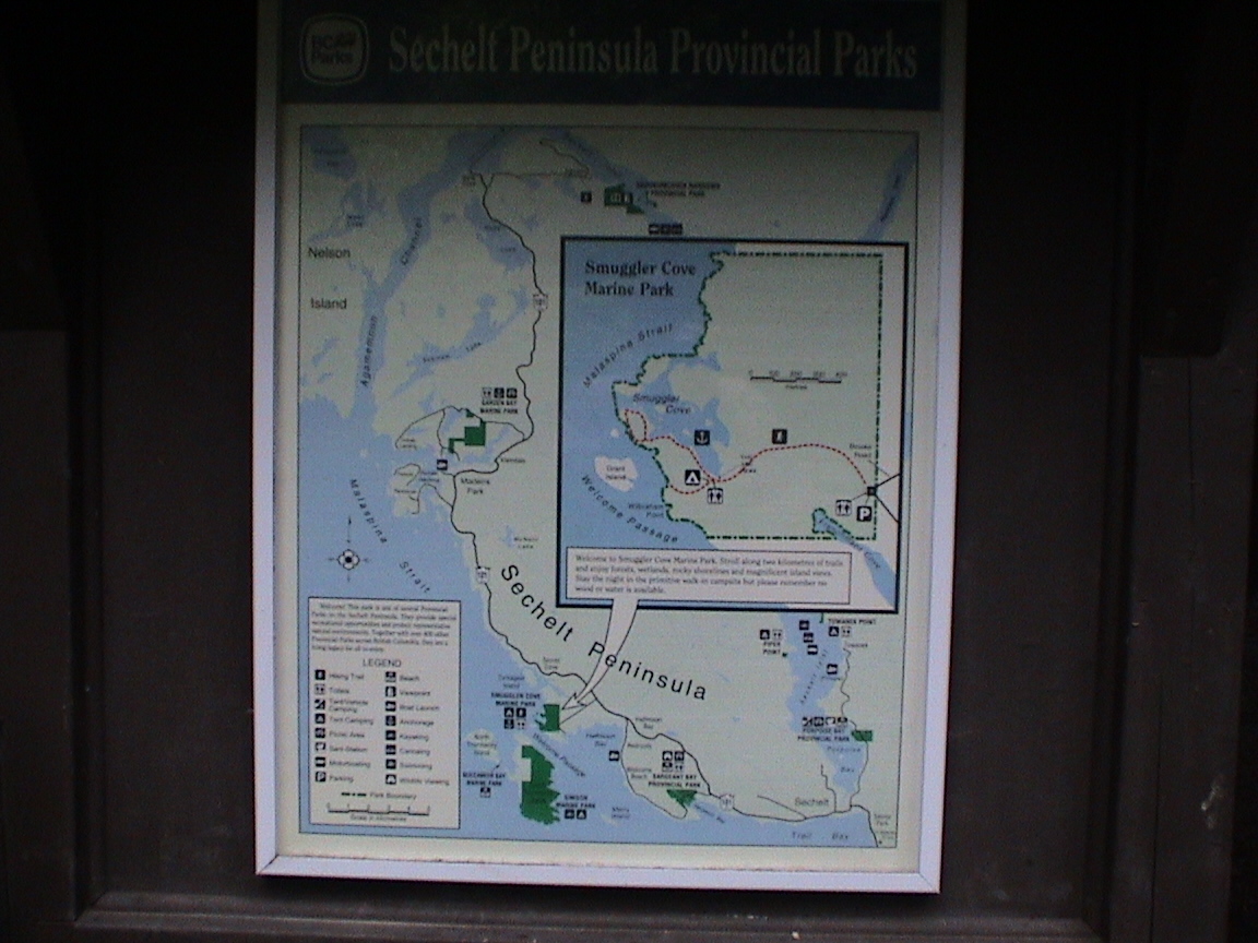
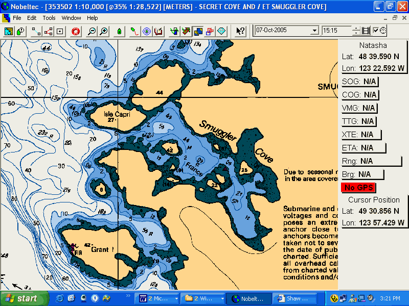
Smugglers Cove |
Octopus Islands |
Lasquiti Island |
|
Westview |
Refuge Cove |
Pirates Cove |
|
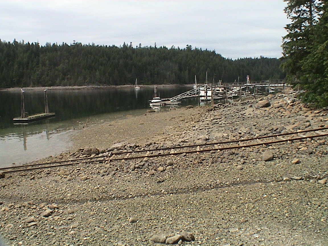
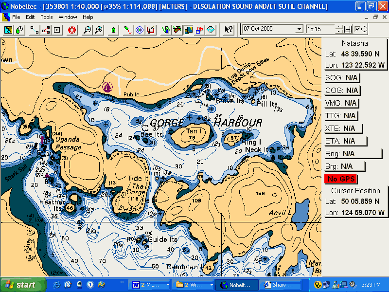
Gorge Harbour |
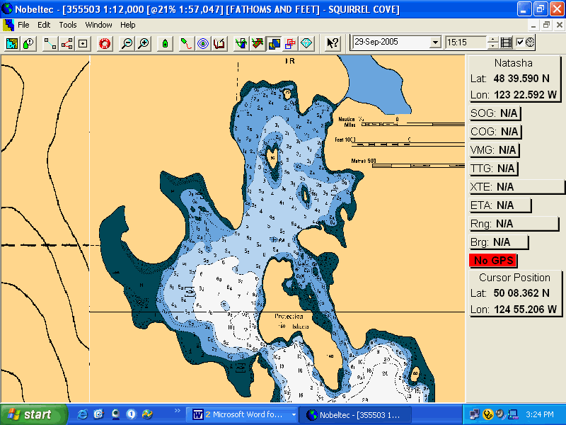
Squirrel Cove |
Annette Inlet |
|
Gorge Harbour |
Melenie Cove |
Home |
|
Campbell River |
Predeaux Haven |
|
|
Campbell River |
Tenedos Bay |
|
|
Small Inlet |
Okeover Inlet |
All dates are hyperlinks to the log for that day. The shaded days are where Carey was aboard. Without shading I was single handed, travelling north towards Desolation or south, homeward bound.
This log was written in two parts. The original log, as written and spoken into a recorder at the time, is printed in this normal Arial type. For the most part it is entered with limited editing (removal of curses and typos). The additional text has been inserted in italics to clarify locations, descriptions and add colour to the log.
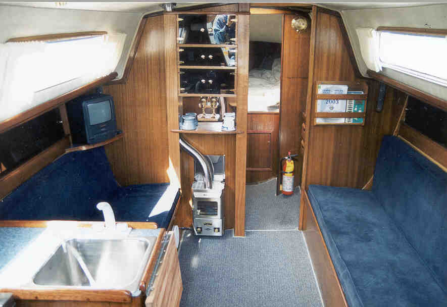
The Boat
The Crew

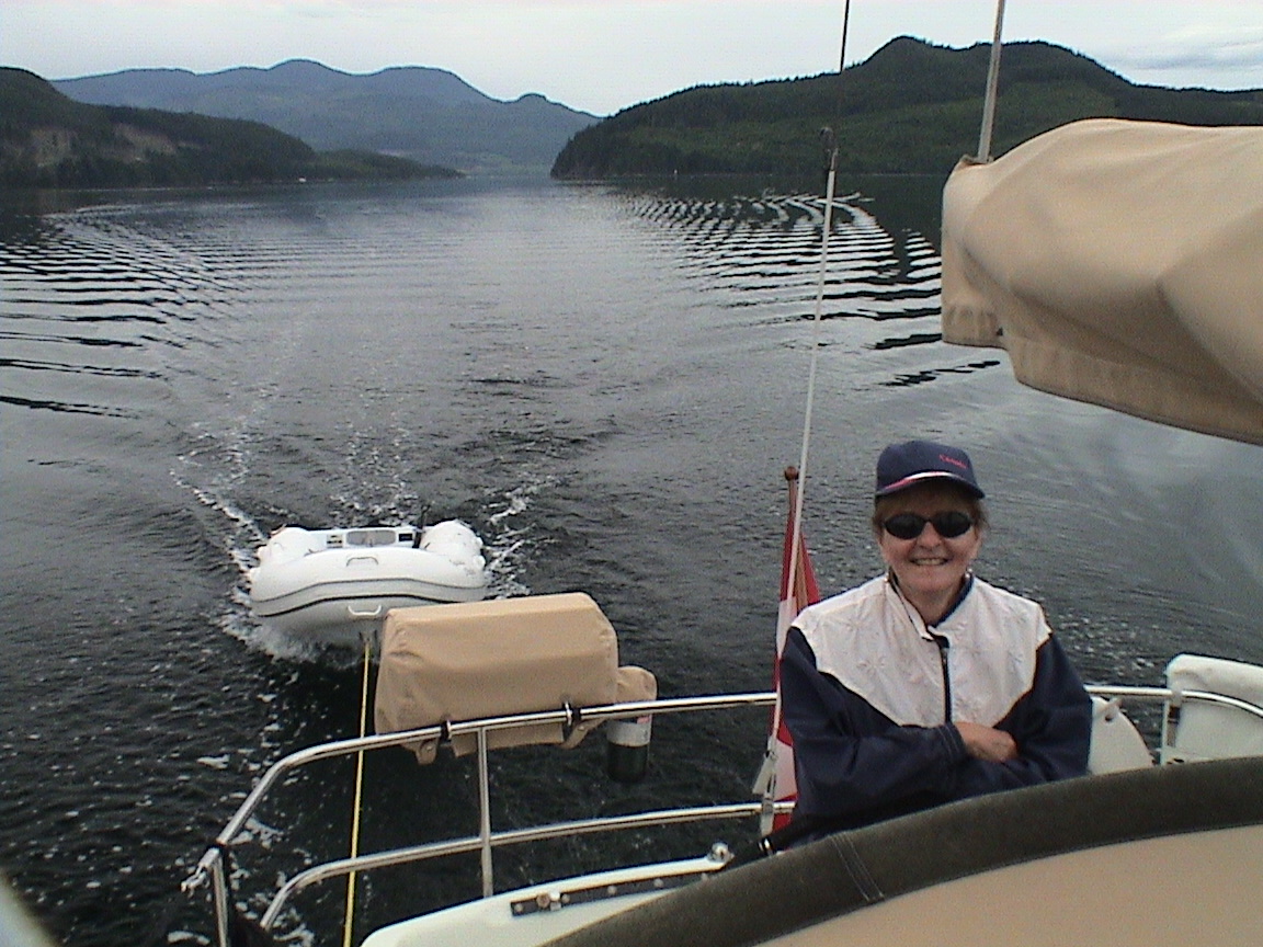
In1992 we had the opportunity to moving to south Vancouver Island near Victoria. Alas, although the move was great, a short time later Carey became very ill and the "toys" had to go. We had to sell "Dreamer" and went without a boat to call our own for a number of years. We managed to keep sailing, using boats in exchange for maintenance. That worked very well, but it’s still not the same as owning your own pride and joy. In 2001, in a partnership with Dick & Marjory Cooksley, we managed to find another 1979 Islander Bahama 30 and named her after our newborn grand daughter, "Natasha".
The Trip
The log of this vacation to Desolation Sound was the first trip back up Georgia Strait since that circumnavigation of the Island ten years earlier. How time flies! As I could get four weeks off work, and Carey was limited to two weeks, the decision was for me to get the boat up near Desolation Sound in the first week of my vacation, then Carey would take the bus up to Campbell River, join me for two weeks, then take the bus home again while I brought the boat home. We’ve done this sort of thing in the past and it’s very doable.
Although Desolation Sound is a relatively small cruising area just north of Lund, B.C., boaters generalize and call the fabulous cruising grounds north and east of Campbell River right up to Johnstone Strait "Desolation Sound". Desolation Sound itself is only a small part of the much larger cruising area.
Sidney, B.C.
The Tides & Currents
I have included the relevant tide and current tables for each day.
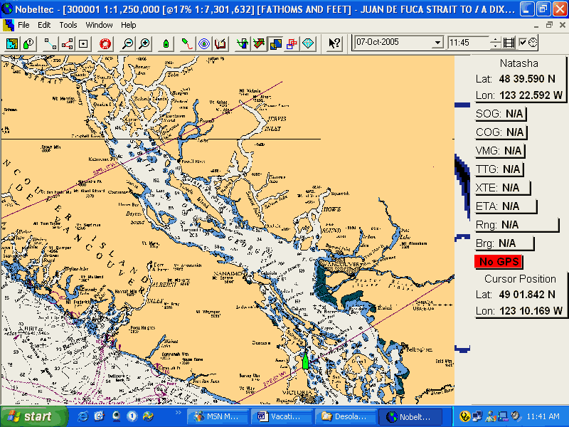
Being a somewhat experienced sailor, I do not take electronic charts and tide / current predictors on their own. I’m a paper chart and pencil kind of sailor who knows what salt water and humidity can do to the electronics. The chart and pencil have never failed me! Not that I don’t have electronics aboard, and not that I don’t use them, but I back everything up with the old paper and pencil system. It’s worked fine for years and I have discovered errors in both systems because I use both systems.
The Weather
In BC waters the prime "cruising season" is generally considered July & August with the premium time within that period being the last week of July & the first week of August. This is when you are most likely (from past history) to encounter sunny, hot weather. Temperatures are likely to be in the mid 80s and if the Pacific High has settled into it’s usual offshore position, not a cloud in the sky. For adventurous sailor the sailing season extends from mid to late March to the middle of November! The "best" time to go sailing is April through the end of June. Although you may encounter some unsettled weather, there are days and weeks where the temperatures will climb into the mid to upper 70s under clear skies, the days are incredibly long with daylight well after 10 pm, there are few cruising boats filling the anchorages and the winds can be fabulous. The spring of 2003 & 2004 were very good with long spells of gorgeous weather in June. Unfortunately for us, that didn’t happen in 2005. We ended up with probably one of the wettest and most unsettled Junes in recent memory. You take your chances! In this log there is numerous mention of mosquitoes. It is mentioned often because of its’ unusual occurrence! For years we sailed up to Desolation Sound without any mosquito netting. The spring of 2005, probably because of its’ wet nature, had us encountering mosquitoes almost everywhere. And not that there were hordes of them, far from it. Usually only one or two would show up as dusk settled. But one mosquito buzzing around your ear in the dark is enough to ruin a good night’s sleep! (I can just hear the east coast and lake sailors having a chuckle over this!).
Monday, June 6th
Top Home to Telegraph Harbour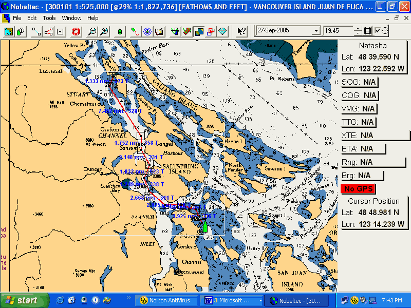
|
Fulford Harbour |
|
|
0325 hrs PDT |
10.2 ft |
|
1120 |
1.0 |
|
1955 |
10.8 |
|
0035 |
9.5 |
25 nm
1200hrs
It’s partly cloudy today with lots of clear sky. It’s warm enough that when I was working on the boat with Doug McNab trying to get this computer to work, I was down to a T Shirt. There is a hint of a SW breeze so far, not like yesterday when it was a solid 12-15 from the SW.
1215
Going into John’s Pass, big flood that’s just beginning. It’s a 14 foot flood so that will help us a lot. The current here in this narrow pass is only about 1.5 knots so far.
Just out of Swartz Bay, the BC Ferries terminal, ferry is late. Lots of current as the flood starts to build. Clear skies with a very light SE breeze.
1300hrs
Close to Cape Kepple on Saltspring Island. The sails are up and we’re sailing. There is a light SE breeze, just enough to get us up to 4 knots, 5.2 over the bottom. I called Dick and left a message thanking him and Marj for the opportunity to be able to do this again. We’re "racing" a Crown 34 with a spinnaker up. Good luck, he’s already ahead.
1400hrs
1415
Abeam of Burial Island in Samsun Narrows. The current is helping by about 2 knots, not a ripple on the water. Even the Crown 34 has given up.
1500hrs
Leaving Maple Bay, a glass table as far as the eye can see. It’s hot enough that I’ve taken my shirt off.
1520 hrs
Just past Grave Point out of Sampson Narrows, a 7 – 8 knot NW breeze right on the nose. The sails are up. No other boats out here.
1530
That didn’t last long! The wind is too light and we have too far to go. Just off Crofton pulp mill and the power is back on. We’ve still got 6 miles to go and the current is against us here by about half a knot.
1630hrs
Approaching Telegraph Harbour. Flat calm. Millions of jellyfish in the water. Endless.
1700hrs
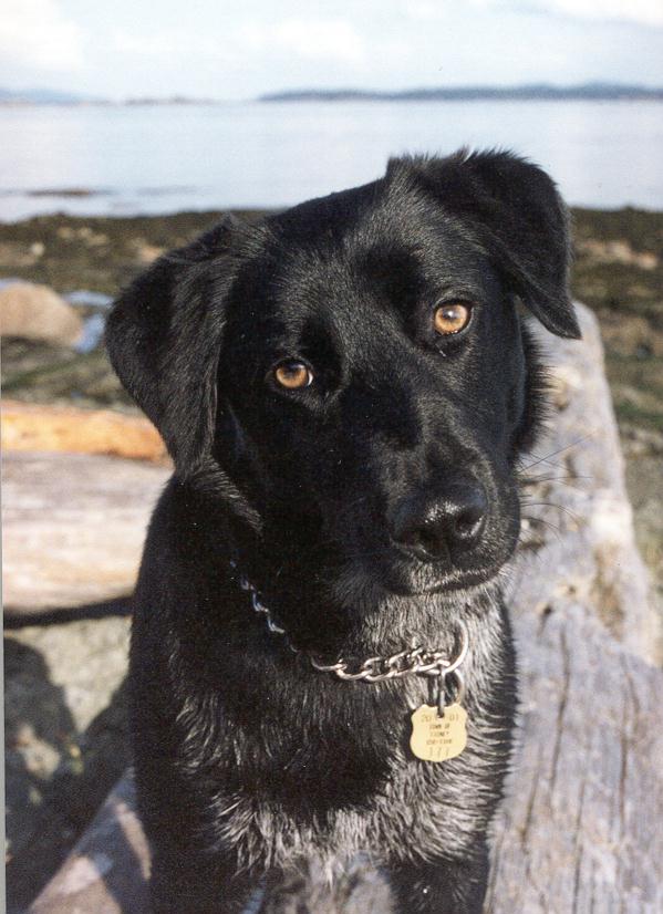
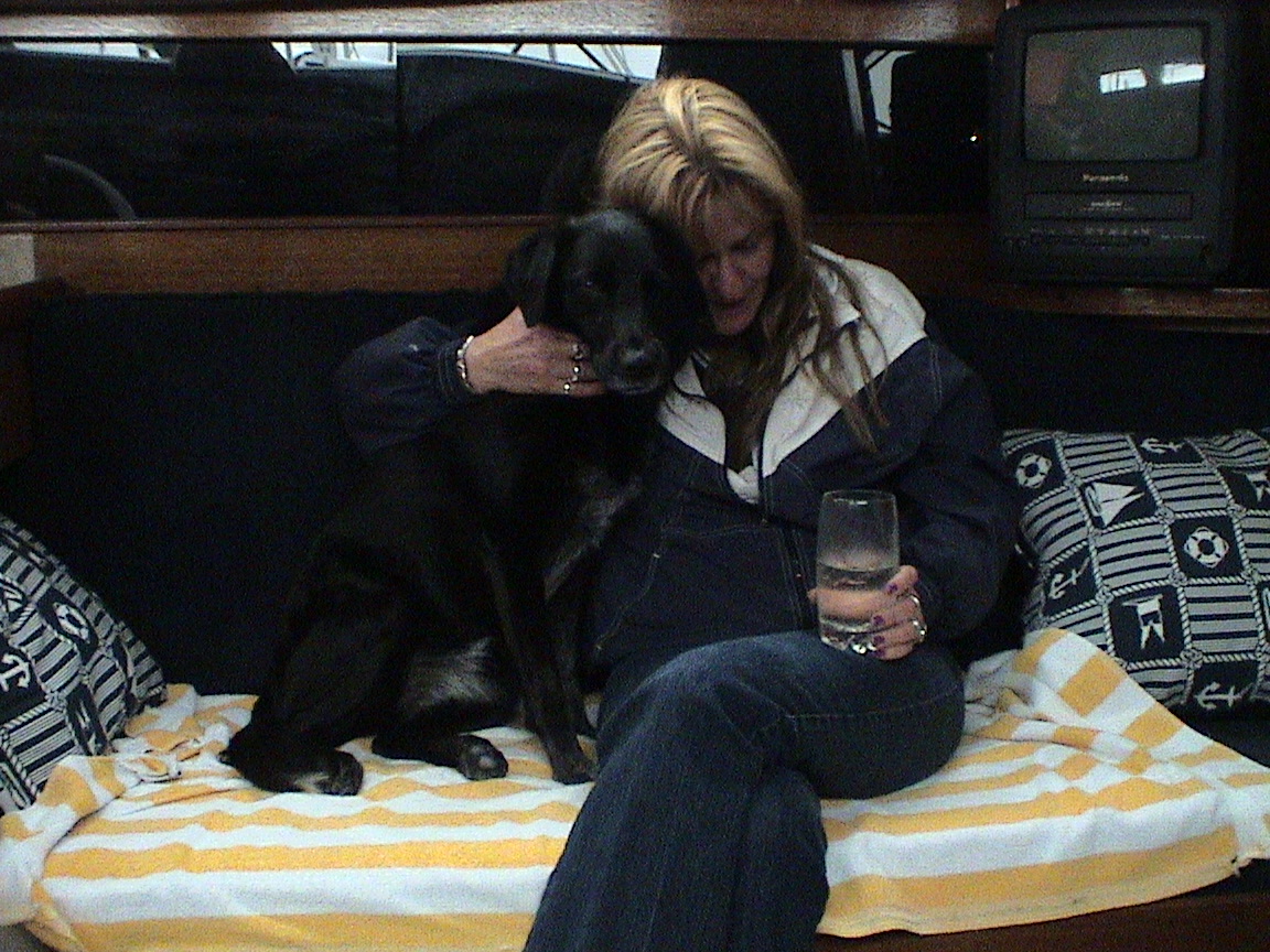
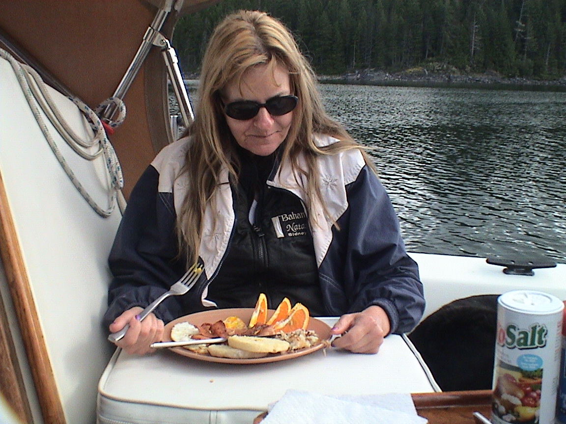
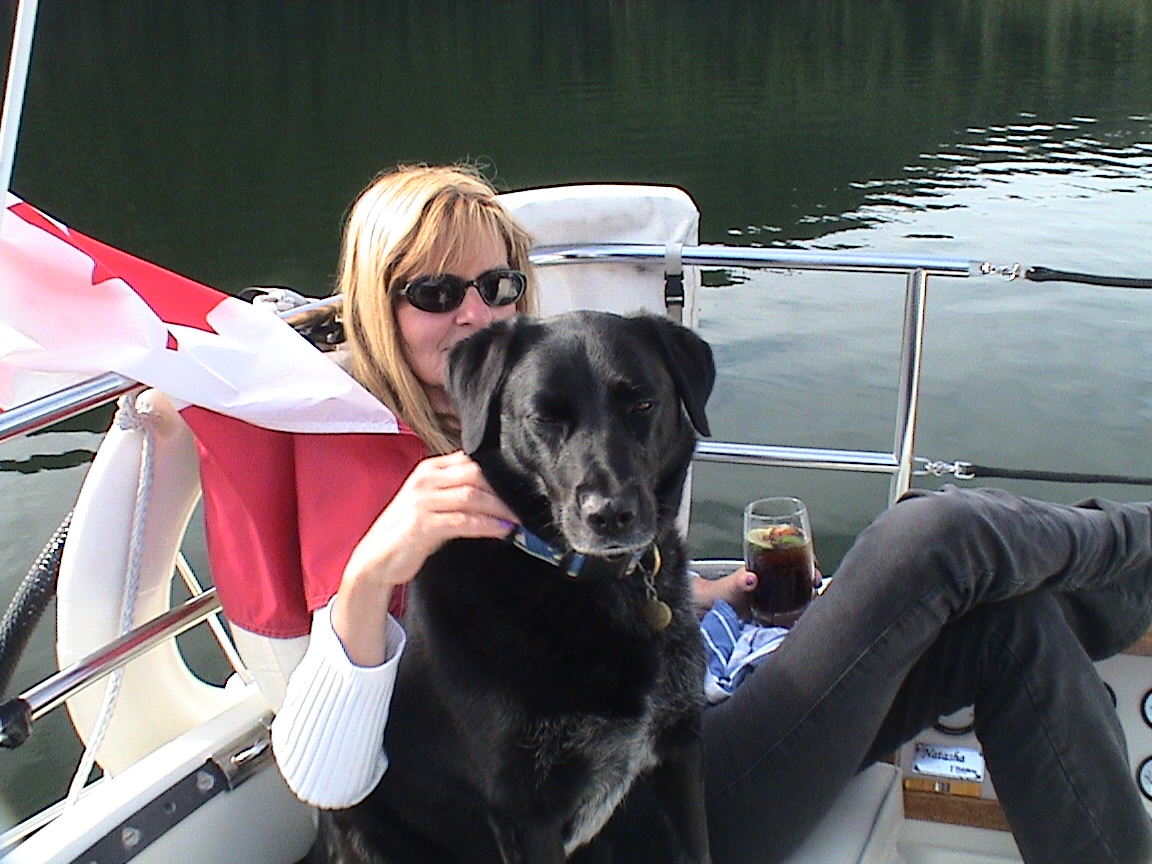
Tied up at Telegraph Harbour Marina. The only sailboat here. It’s warm with a light SE breeze to keep it cool. Time for Trixi to have a short walk.
2130hrs
The sun has long since set and the red sky is darkening. Two other sailboats have come in. One is parked next door, a 47 ft Beneteau with five women aboard. They’re up from Seattle going to Desolation. The other is a Bavarian 32 with three guys. A charter from Bosuns. A very pleasant afternoon doing nothing. Had a pork chop for dinner. Had a look around the marina and took Trixi for a walk down to the Ferry Terminal. It’s getting dark now and it’s almost time to get inside as the dew falls. Very quiet in here tonight, only about 9 boats in here. Very nice day.
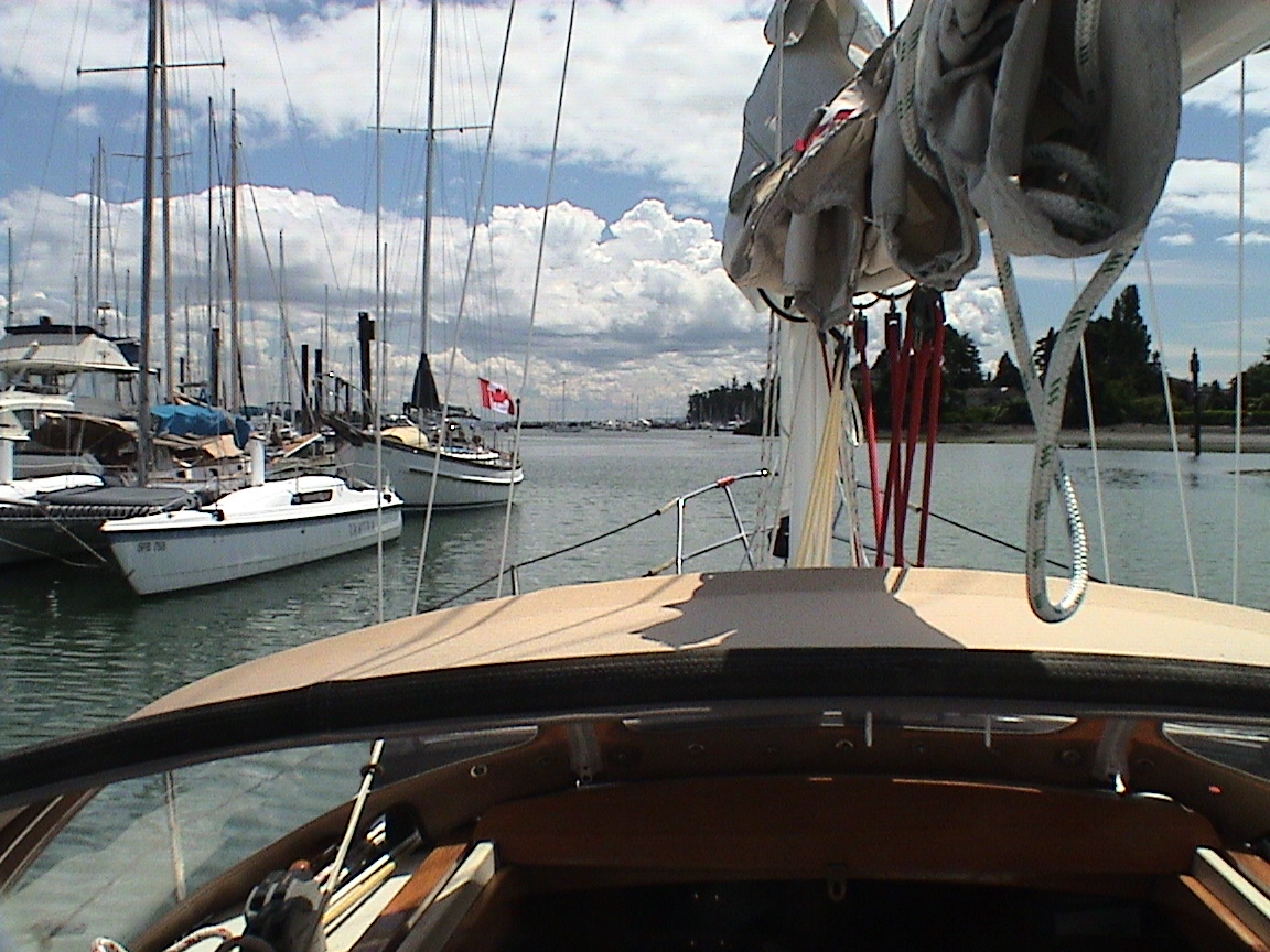
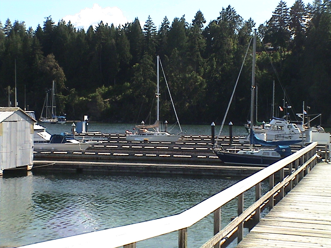
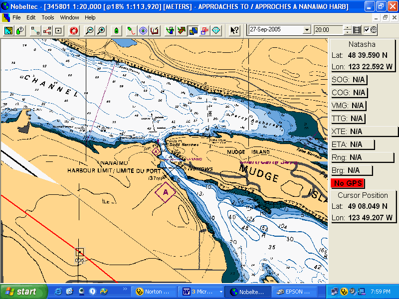
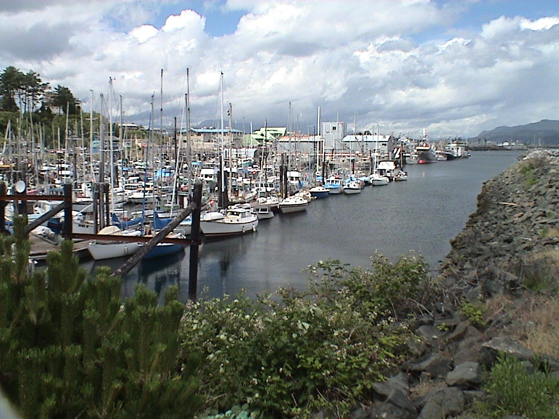
Day two, getting up to the City of Nanaimo, the jumping off point to entering the Strait of Georgia to get up to Desolation Sound. The City has numerous marine oriented businesses and waterfront parks. A very pleasant place to stay with access to almost anything a boater may need or want. To get to Nanaimo from the Gulf Islands one must transit Dodd Narrows that separate Vancouver Island from Mudge Island and the larger Gabriola Island. Dodd Narrows is, as the name suggests, narrow in the extreme. At it’s narrowest it’s about 60 feet from shore to shore, and about 60 ft deep. Lots of fast moving water when there is a significant tide change. Tides flow to a maximum of 9 knots in either direction. It’s a real thrill riding the tide in the right direction, but it’s the massive whirlpools that put a strain on your heart and rudder once you exit the Narrows. That and the occasional log that’s been sucked down into one of these whirlpools and then shooting up out of the water! You hope not to be in the wrong place at the wrong time when that happens! The times of current change are well documented in the Canadian Tide and Current Tables and you can often see a multitude of boats of all description milling about on either side, waiting for slack. Once the first boat ventures through the floodgates open and everyone makes for the Narrows! Makes for an interesting passage. I usually arrive an hour or so before slack with the tide still running in the direction I want to go, then just shoot though. Conversely, I also arrive an hour or so late, again with the tide running in my direction. It’s a very straight run in and out. It’s safer than having to deal with all the pleasure and commercial boats trying to get through at precisely slack (only lasts for about ½ an hour)!
|
Point Atkinson |
||
|
0505 hrs |
13.5 ft |
|
|
1240 |
2.0 |
|
|
2025 |
15.1 |
|
|
Dodd Narrows |
||
|
0415 |
0735 |
-5.9 kts |
|
1050 |
1410 |
+7.8 |
|
1800 |
1950 |
-5.2 |
15 miles
1030hrs
On our way out of the marina under a very high, thin overcast, the sun is still warm. I had a good night’s sleep in the quarter berth, walking up at about 0300hrs for a pee break and then back to sleep until 0715. Went for a walk first thing of course. Took Marina Drive to discover that it’s a circle crescent, eventually coming back to the marina. The channel between Thetis and Kuper is about 1 ft deep at low tide, very shallow. I don’t know if I want to risk the boat through that anymore! I had a simple breakfast of coffee cake and coffee while the sun dried out the cockpit. The store was supposed to open at 0900hrs but there was no-one there. Trixi and I sat on the varanda, watching the humming birds and idle island life go by. At about quarter to 10 Barbara Hamilton showed up from the residence next door, opening the door for her shortlegged dog who, to her surprise, behaved himself with Trixi. I went into the store and told her who I was. She was pleased to meet me and I had a look at the boats that have reserved dockage for the 1st Islander Rendezvous coming up in July;
Wild Hare Bob & Lisa Everson
New Spirit John and Jant Jensen
Holole’a John & Marion Rodall
Passat Jurgen & Karin Hbeln
Frendy Charlie & Jennifer Park
Rihannon (I don’t know, never heard of this boat)
Natasha Vermeers
The BBQ will hold about 60 lbs of coals and they do have a coffee urn that will hold 100 cups and one pound of coffee.
Anyway, we’re on our way with the hope of a SE wind today. Nothing on the water as yet. Weatherman is predicting SE 15 this afternoon north of Nanaimo, switching to NW 15 –20 overnight and then light tomorrow afternoon. If the weather is good at Nanaimo we’ll carry on to Smugglers today. It’s a big flood today (15 ft) with maximum at Dodds at 1410hrs. That should help us up there.
1240hrs
Abeam of Round Island, approaching Dodd Narrows. We’ve been motor sailing for the past 20 minutes as a breeze picked up from the NE. Hard on the wind with just the jib out but it got us up to 6 – 6.5 knots. No wind up to now and the clouds are getting thicker and lower. Very, very little boat traffic out here.
Through Dodd Narrows all by our lonesome with about 4 knots of current. Interesting whirlpools on the outside! Only a very light ripple on the water, it looks like it’s going to be power all the way today.
1335hrs
1350 hrs
Into Nanaimo Harbour, the first floatplane just went by.
The only boat tied up at Newcastle Island! There are plenty of boats anchored out, most of them appear to be the usual cast of permanent residents that move anywhere.
2100hrs
The sky is turning red to the west. Here’s hoping that’s a sign for tomorrow. They are still predicting 20 knots from the west tonight, easing in the morning with variable winds in the afternoon. Unfortunately, the rising tide starts after 1200hrs so we’ll have to wait and see what happens. The westerly has just started up as I was typing this and it’s cooling off rapidly. Trixi is meeting/greeting on the dock.
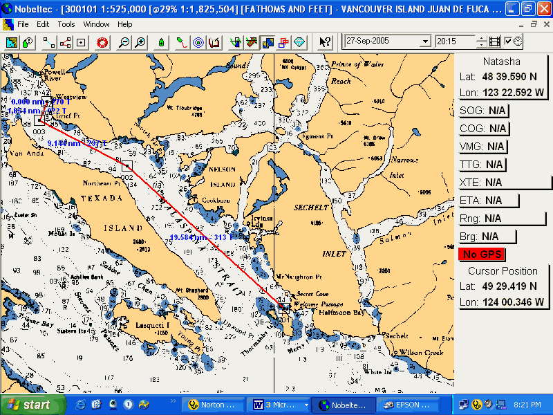
The goal on day three is to get over to the mainland side of Georgia Strait. There’s a couple of reasons for this. The number one would be that there are more available anchorages on that side, very few on the Vancouver Island side from Nanaimo to Campbell River. The mainland side is also more scenic and the distance to get up to Desolation Sound is pretty much the same. However, to get across to the Mainland side you must cross the dreaded WG, referred to as "Whiskey Gulf". There are numerous areas in Canadian waters were the military have set up a reserved area for training purposes. They are referred to as letter combinations and are clearly marked on Canadian charts. The most commonly used is WG. It is wired for submarine tracking and torpedo firings. Although owned and run by the Canadian military, it is "rented" out to numerous other countries for use. The American navy is the most common "renter". Unfortunately, WG lies directly in the path of any boater that wants to go from Nanaimo to the mainland coast, a very common passage for many boaters heading north for the summer. The weather channel indicates whether WG is operational or not and circling torpedo bombers and submarine hunters are an obvious sign. Other than that, it’s a patch of water that looks very much like any other patch. But if you enter it while it’s in use, I suspect that the optical gear used to identify you can read your GPD screen as clearly as you can! The military watchdogs then broadcast on channel 16 and send a patrol boat out to clear you away. Very efficient.
|
Point Atkinson |
|
|
0140 |
11.8 ft |
|
0535 |
13.1 |
|
1315 |
2.0 |
|
2105 |
15.1 |
26 nm
1020hrs
Woke up to rain on the roof this morning and an incessant drip beside me. That one leak is driving me around the bend! I had a very good night’s sleep last night. Only one other boat was here when I crashed at about 2200hrs. Then, just after putting the book down and crawling into the quarter berth, a loud persistent diesel kept getting louder and louder. At first I thought it was the ferry coming back in. But it just kept getting closer. Finally crawled out again and found a small ex fisheries patrol boat backing into the slip next door. A late arrival with a loud engine. Back to bed!
Then it was breakfast of egg muffins (2) and then a bit of clean-up. I re-sealed the leaking head fitting, getting the blue dye all over my hands. Fortunately, the dye cleaned up with the Fantastic/TSP combination. I haven’t figured out where the starboard side leak is yet. It doesn’t appear to the stanchion base.
I’ve just made a coffee, CBC is on the radio and Trixi is sleeping on the settee. The weather forecast is for clouds with occasional showers, winds rising from the SE this afternoon to 20 knots. Perfect (except for the rain part)! The falling tide turns as 1400hrs and we’ll get underway around noon some time. WG is active today so I think I’ll head up to Winchelsea Island and scoot across the north side of WG and then over to Texada. If the wind holds we’ll try to get up to Hardy Island this afternoon. If there’s no wind out there we’ll do the south crossing and get up to Smugglers today. The latest wind reports were from around 0740 and 0900hrs this morning. Kind of useless.
1155hrs
All decked out in my rain gear along with harness and tether, we’re motoring away from Newcastle docks in spitting rain, headed for Newcastle Channel and Departure Bay. There’s a light SE breeze and the weather guys are still predicting 20 this afternoon. Trixi is below.
1230hrs
We’re just abeam of Horsefall Rk, the sails are up with a 5 – 7 knot SE breeze over a bit of a lumpy sea. We’ll be headed for the south end of WG, not enough wind to go straight downwind to get to Winchelsea Island. We’ll head to Smugglers today. We’re screaming along at 2.6 knots with the last of the ebb helping us.
Just abeam of Five Fingers Island, the wind still light and we’re hard on the wind trying to get to SE corner of WG. We may have to throw a few tacks in! BC Ferries is departing on the way to Horseshoe Bay. The light rain has let up, I can put my glasses back on. It’s lumpy and Trixi is starting to lick her chops. This doesn’t look good!
1345hrs
We’re about two miles from the SE corner of WG and some patrol boat is pacing us! Keeps forcing me to tack away and when I do of course, it’s almost like heading back to Nanaimo! Trixi is up on deck (I brought out a cushion and her towel just to get her up here).
1400hrs
Almost made the corner of WG! That damn patrol boat kept paralleling us until good old BC Ferries from Horseshoe Bay appeared out of the mist. And he was was further inside the box than I was! As soon as the Ferry appeared the patrol boat lit a fire and was gone back north, after some unseen target. Bastard! He was just forcing me to the corner! Proud to be a Canadian! The wind is up a bit, probably at 10 knots and it’s a close reach to the NE corner of WG. Nothing in sight.
1600hrs
We’re still about 8 miles from Smugglers but we’re on the other side! The wind has lightened again and we’ve altered course and are not running on a broad reach at about 4 knots. Fortunately the current is with us and boosting the speed over the ground to about 5 knots.
1630hrs
I tried sailing wing & wing for the past 30 minutes, straight downwind from Merry Island. It’s gotten very light with left over slop. The power just came on. Six miles from Smugglers. The rain has just started again.
1650hrs
Abeam of Merry Island light, speed over the ground is 6.4 with the current, still 4.5 miles to go. Just called Carey to let her know we had made it across. No wind at her store either.
1730hrs
2020hrs
Altogether not an unusual crossing other than the issue with the patrol boat. A somewhat over zealous skipper or trainee was trying to make a point where no point needed to be made, and then got embarrassed by seeing a B.C. Ferry inside his protected waters! The SE winds were not uncommon and, if we’d had a spinnaker, would have been great for covering long distances in a straight line! We’ve gone from Nanaimo to Campbell River in one lone day in the past, spinnaker flying the whole distance.
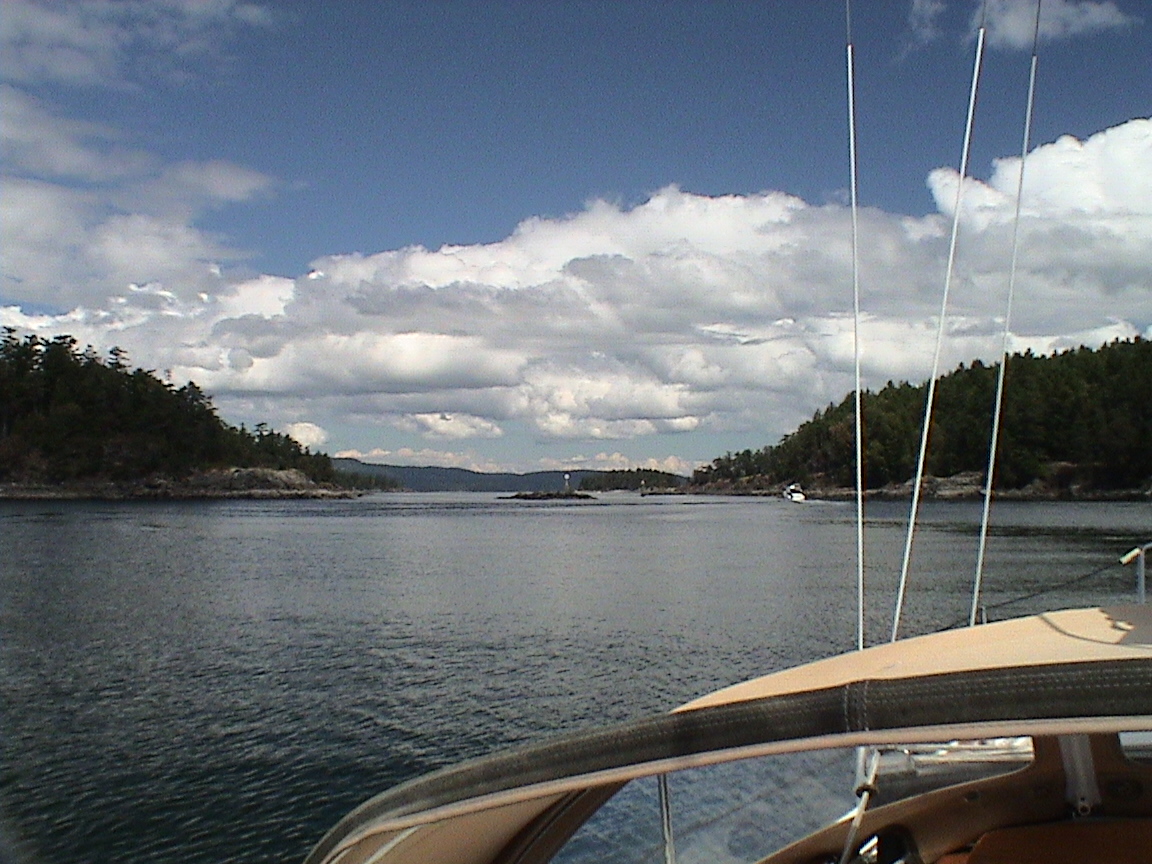
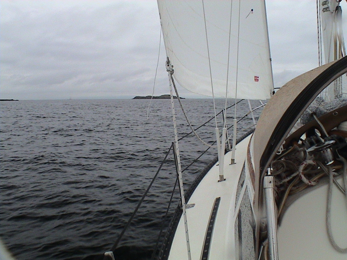
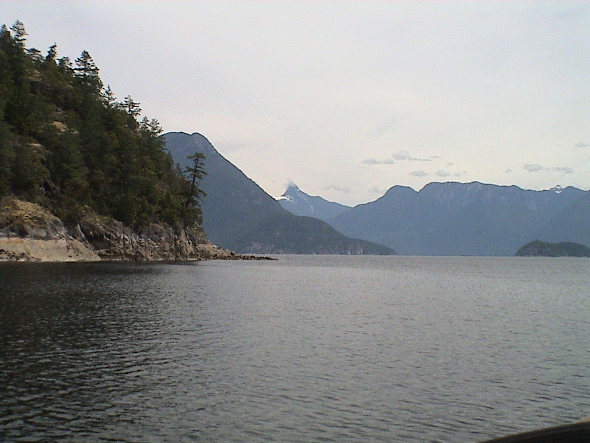
Texada Island separates this side of the water (called Malaspina Strait) from the actual Georgia Strait. Although Malaspina Strait appears more protected from winds due to being a bit more narrow, it can get the same winds and seas as Georgia Strait on the other side of Texada. However, the options for safe havens are far more numerous on this side. And the scenery is much prettier. On a sunny day with a steady breeze, sailing up Malaspina Strait is one of the most invigorating days in the great outdoors. Beautiful, lush green mountains surround sparkling blue waters for as far as the eye can see. But caution and good planning make it the wonderful experience it can be. Tides and currents determine the state of the sea and your progress through it. The flood runs north and if you wish to take advantage of that, a strong NW breeze can create short, choppy seas that you must tack into. Perhaps not the most comfortable passage. Distances are long here and the hope is to use the tide and wind together. We’ve been fortunate to have both in our favour on a few occasions. We’ve also been unfortunate enough to have both against! At that point we anchor and wait for better conditions. Although there were a number of anchorages that I would have liked to visit on this trip, my goal was to reach Campbell River in time to meet Carey. I planned to miss such great places as the Hardy Islands, Harmony Islands, Hotham Sound, Pender Harbour and a multitude of others. I had to cover distance!
|
Point Atkinson |
|
|
0610 |
12.8 ft |
|
1350 |
2.3 |
|
2145 |
15.1 |
27 nm
0930hrs
The muffins are in the oven, about 15 minutes to go before they are ready. Breakfast is kind of late this morning! It’s a high overcast morning with just a hint of a SE breeze drifting in as I type this in. It was flat out this morning in Malaspina Strait when Trixi and I went for a 2 hour hike. I’d forgotten the trails around this park. We went up the trail to the road head, past the beaver lake/swamp and dam, and over to Fishermen’s Cove to see the outside water. Flat. Then over to the loop trail around the head of this cove. I’d never been on it before and it’s quite nice. Ended up sitting on a high rock overlooking the entrance to the cove and watched a C&C 30 from Secret Cove drift by over a flat sea and strong current. Obviously going south with the big ebb. We have to wait till about 1400hrs to take advantage of the equally large flood that will follow. I managed to get a strong signal on the cell phone and when I turned it on there was a message to call the office. Tim answered with no knowledge, I spoke to Ron and he told me that Ian was working last night so the call must have come from him. Nothing new at the office, Ron is envious of where I am.
I called Mark at Waypoint and ordered a handheld portable VHF that Carey can pick up before she comes up. It’s long overdue to have one, I could have used it yesterday with the patrol boat. The I phoned Carey and let her know about the VHF, she will pick it up tomorrow on her day off. Nothing new with her, she plans on mowing the lawn today while it’s still dry (it rained hard there yesterday). She misses walking the dog (and presumably, me!).
I almost forgot to mention the mosquitoes here. Lots of them! One just buzzed past my face. Pain in the ass last night, a couple of them got past the screen and hovered around my head, always in the ears! Very unusual here!
The tide is dropping fast now, more and more rocks are appearing. The muffins are almost done and so is the battery in this laptop. Time to charge it up and see how breakfast is doing.
1200 hrs
We’re headed out of Smugglers at a low tide. It’s a bit shallower than yesterday. A light SE breeze out there, solid overcast. The sails are up and we’re on a very broad reach, headed for Texada at 3.5 knots.
1315hrs
We’re almost abeam of Francis Pt on Francis Island, just west of Pender Harbour. We’ve been wing-on-wing for about the last hour, slowly drifting downwind at about 4 knots. The tide has not changed yet so it’s a bit sloppy out here. The wind is picking up a bit, threatening five knots after a gibe that has put us on a very broad reach for Cape Cockburn.
1400hrs
The wind has eased quite a bit, down from the five knots we were maintaining to about 4 knots. We’re 4.3 miles from Cape Cockburn yet. Still some slop.
1415hrs
A mile and a half off Quary Bay and the power is on. The wind got really light after the last entry and it’s time to make some distance. Decided to go to Stuart Bay on Texada Island today. They’re calling for NW winds tomorrow so it’s prudent to take advantage of the bit flood this afternoon along with a light SE wind. Should be there about 1800hrs
1500hrs
We’re abeam of Cape Cockburn, about a mile off the point. The wind is just starting to pick up but it’s only about 6 knots. The tide has changed and the water has smoothed out. Very few boats out.
1500hrs
1630hrs
We’re off Albian Point, 6.2 miles from Grief Pt. The breeze has picked up a bit and the engine is off. We’re wing-on-wing again, drifting downwind over smooth water. We should be at Grief Pt about 1800hrs.
1735hrs
Approaching Westview Docks, time to take the sails down. It was a fast reach after turning the corner, fast but cold.
2200hrs
Darkness is falling while I sit in the cockpit typing this in. Trixi is on the dock, watching for strangers. We’re tied up at dock 6 on the Government Dock, rocking slightly in the incoming swells. We’re right at the breakwater opening and I can see almost all the way to Campbell River if it was clear enough. Fortunately, the weather forecast is for calm winds tonight and SE winds again tomorrow. I’ve worked out the waypoints on the computer and still have to load them into the GPS but it’s only 15 miles to Copeland Islands, probably 20 to Gorge Harbour. That may be our destination tomorrow.
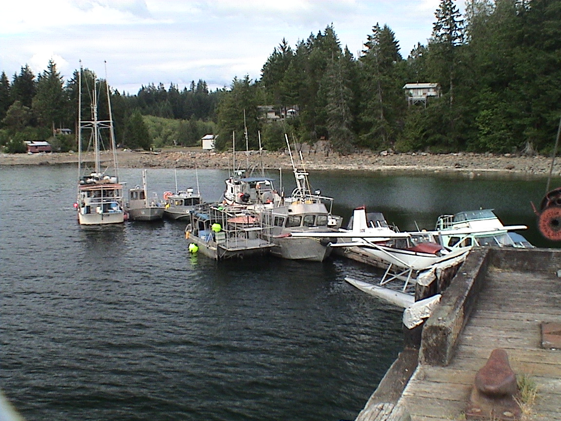
Back to when we arrived though. I was pretty cold by the time we tied up. We’re at the end of finger 6 facing the open sea. It was the only slip available. The office was already closed and if we leave on time tomorrow (0700hrs) it will still be closed! This place is a bit of a dump. It’s not like we need anything here anyway. Trixi and I walked the length of the town along Marine Rd and found nothing even remotely inviting. The docks are filled with fish boats and the like. I was expecting a more tourist oriented town. There are a few sailboats in here but I don’t know if they are permanent or touring. One guy from an Ontario 34 came over earlier. He knew about Islanders, he was going down to Pender Harbour tomorrow to meet with a buddy of his with an Islander 36, Frendy. Frendy is coming to the Rendezvous.
Now the mosquitoes are eating me alive again. Not having been here over the past 15 years, I don’t know if mosquitoes are common here or not. It’s time to enter the rest of the days information, then get the boat ready for tomorrow and enter waypoints in the GPS.
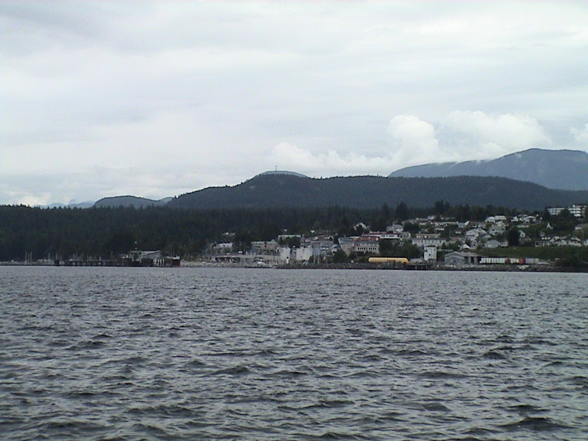
As mentioned above, I hadn’t been in Westview Harbour in over 15 years, and then only as a re-provisioning stop. Although some improvements had been made in the subsequent years, the town is still not doing all it can to make it a destination for cruising boaters. Yet in the summer months it is apparently packed full of boaters visiting and re-supplying. It is the only "town" along this side of the coast that has a large re-supply infrastructure. But it’s not high on my list of destinations!
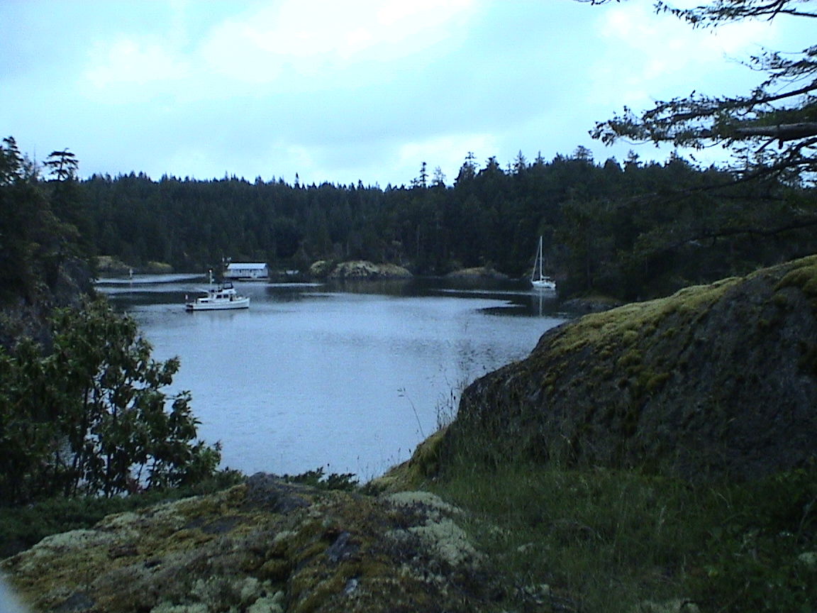
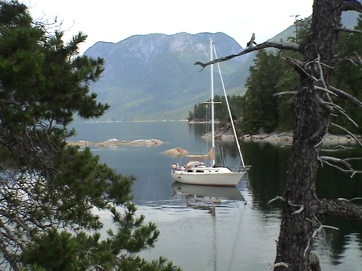
Date Westview to Gorge Harbour, Cortes IslandThe original goal was to get to the Copeland Islands for today’s destination. However, the weather remained unsettled with the potential of strong SE winds. The anchorage at the Copeland Islands are not that well protected from the SE swells that roll up the Strait and into Thulin Passage. With that in mind I elected to head to Gorge Harbour on Cortes Island, a very well protected harbour. The harbour is very large but deep with limited anchorage shallow enough. There is a small marina as well.
|
Point Atkinson |
|
|
0640 |
12.5 ft |
|
1425 |
2.6 |
|
2225 |
14.8 |
28 nm
0610hrs
The sails are up and we’re reaching off at 5.5 knots, headed for the SW corner of Harwood Island. I got up this morning at 0530hrs, planning on an early start to beat the warfinger to the cash. I didn’t want to pay for services I did not have access to. The washrooms (in a temporary building on bricks) were locked so I couldn’t use the showers, none of the services in town were open, and I didn’t use any power. Off we go then. Took Trixi for a walk and then down to the boat, get everything ready and cast off, then start the engine and idle out of the harbour. There is even a SE breeze at about 12 knots already. The prediction is for SE switching to SW and eventually NW later this afternoon. Cloudy with showers. Right now it looks pretty forbidding to the north, clearer behind us over Westview.
0705hrs
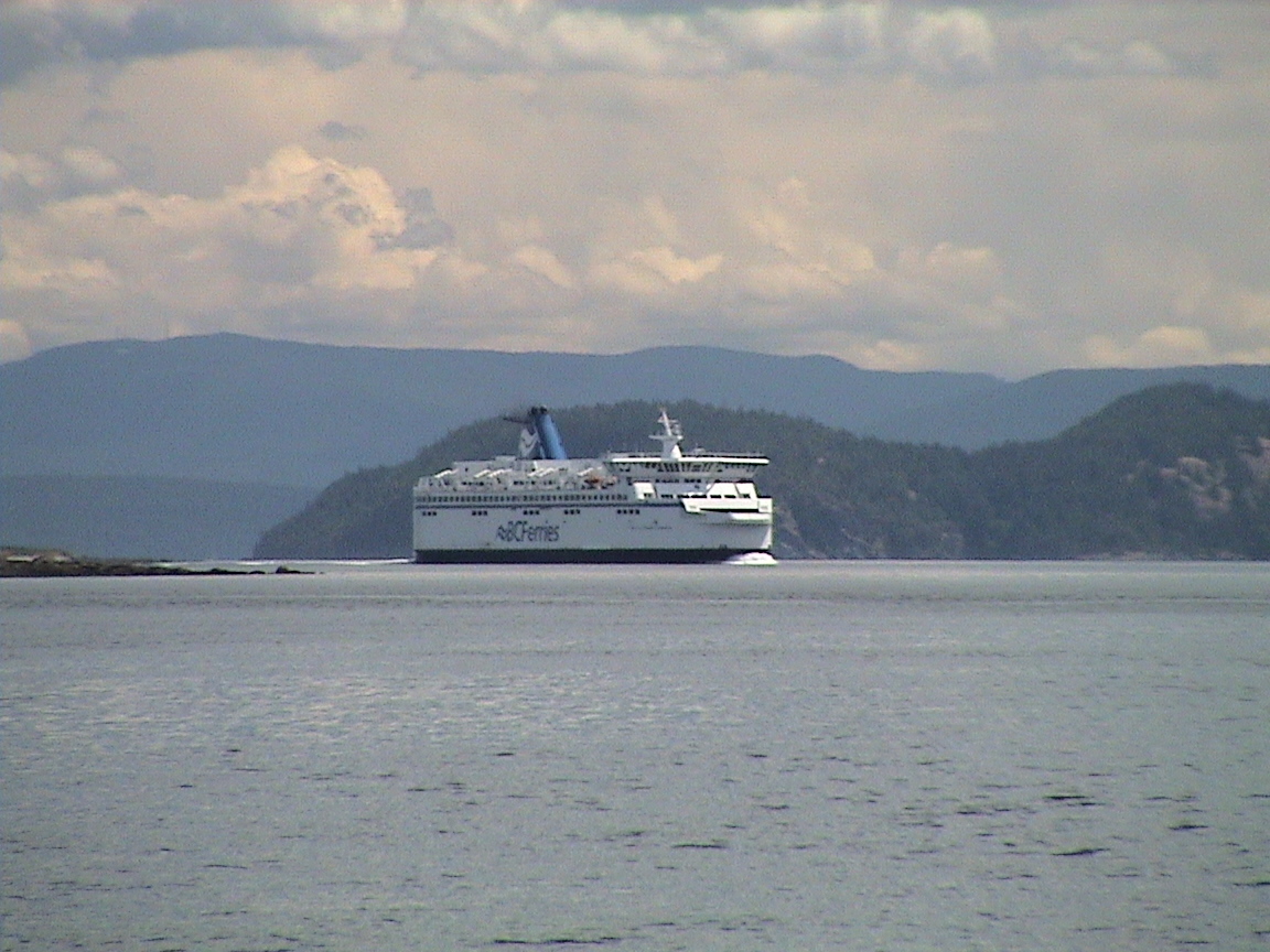
Abeam of Rebecca Rk and then the end of Harwood Is. Still on a broad reach at about 5 knots, BC Ferries coming over from Vancouver Island passing to port. It’s chilly this morning, I may have to put another coat on. It’s also very likely that it’s going to rain on us eventually.
0730hrs
The engine is back on, the wind is at five knots right over the stern. Time to put some miles on.
0800hrs
The wind is back, we’re reaching towards Vancouver Island to get some speed. A bit of chop with the wind against the tide. Trixi is back on deck, licking her chops.
0815hrs
The wind is lightening. I’m in rain gear as it looks like it will rain momentarily. Ahead looks clearer than to the SW. I can see Mitlenatch Island out of the mist now. Nothing but fishboats and crabbers. The seas have calmed somewhat, we’re still 15 miles from the south end of Cortes Island. The engine is coming back on, not enough wind.
0845hrs
Everything is below, including Trixi. The wind is switching to a westerly, the ripples in the water confirm that although the left over slop from the SE continues to roll us. We’re still 9 miles from Cortes Island. It looks like the majority of the rain is behind us, going from west to east. We’re abeam of Mitlenatch Island. We’re getting a few sprinkles. Heavy rain behind us
0915hrs
Abeam of the south end of Savory Island. The wind is from the WNW at about five Knots. Moved over to the Savory Island side, less current against, the water is flatter. Still a few sprinkles.
0945hrs
Abeam of the south end of Harnando Island, back in deeper water. We got too close to the shallows and were in 25 ft of water for a while. The rain is getting closer, Vancouver Island has disappeared in a dark curtain.
1000hrs
No wind to speak of, took the main down to keep it from slating. Can see the bell bouy at the end of Cortes Island. The rain has started.
1045hrs
Just rounded the bell bouy on Cortes. It’s raining good and hard. No wind. We’ll go see Mason Landing first. There are other fools out here with me. Two sailboats headed for Campbell River and one leading me towards the Landing.
1145hrs
Half a mile from the entrance to Gorge Harbour. The worst of the rain seems to be dissipating. It’s still sprinkling lightly. Had a look at Mason’s Landing and it looked pretty exposed to any winds so I decided for Gorge. There is lighter sky to the west. Everything is pretty wet.
1215hrs
2130hrs
Rain is falling gently on the roof, the heater is on, the lantern is lit, and the brandy is good and hot. We’re settled in for another quiet night (I hope). It’s still practically daylight out and the wind has died completely. Trixi is finally crashed for the night, a long sigh and curled up on her blanket on the port settee, one eye still open on me (going ashore again are we, eh, eh, eh?).
Now it’s time for a read and then bed. It’s toasty in here with the first mosquito buzzing by. I hope no more.
1045hrs
In the words of Super Tramp, "It’s raining again…". At least we got a walk in before the rain started falling. Got up this morning at 0730hrs after a very good night’s sleep up in the V Berth, much better than the quarter berth. Heard the rain on the roof earlier and went back to sleep! Anyway, up at 0730hrs and it was temporarily dry. Off to the government dock in another long row. I suppose I could have used the engine but it’s better to work the kinks out of my back to row. We only went for a short walk before the rain started spitting down again. Back to the boat. Read a book for a while with coffee, turn the heat on. It was only 11 degrees in here! There’s a slight wind from the west with the weatherman calling for sunny periods this afternoon. Ha! I’ll have to see that to believe it. I made up a shopping list for tomorrow, then a repair list for the boat. I cleaned and repaired the drawers, then started looking for the leak in the starboard side rear window. Would you believe that the entire upper side of the window is loose and leaking! Damn! That wasn’t supposed to happen. That was that old tube of 3M 5200 again. I’ll have to get a new tube tomorrow at Campbell River and try to remove the entire window and re-seal it. In the meantime there are pots in place to catch the spill.
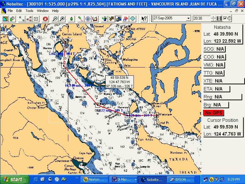
Now it’s time to work on waypoints for tomorrows trip to Campbell River. I use the computer to call up Nobletek, locate the waypoints, then enter them on th GPS. It’s laborious but better (and more accurate) than doing it from the paper charts. It sounds like the rain has slowed down a bit.
2045hrs
Just back after our evening walk. It’s amazing how good the day has gone when the evening brings a bit of dryness and sunshine! You tend to forget about the miserable day that’s been. Not that it’s been all that bad, just a lot of rain. Not heavy all the time, but persistent enough that I couldn’t get out without getting wet. (Just let out more rode. It’s blowing a good 10 knots NW in here with gusts to 20. It’s supposed to calm down later tonight but I’m anchored in 50 ft of water. I’ve got 250 ft out now. That should hold!)
This morning was a slow start with no destination in mind and rain falling. I had toyed with the idea of going over to Campbell River today (on into that area anyway). But it was miserable and why go in the rain. I entered all the waypoints for the next two days. It’s a 16 miles trip tomorrow. We’ll get started about 0700hrs so that we can be at Campbell River at about slack water or the beginning of the ebb. Carey isn’t in until 1700hrs or some time after that I think. Lots of time to clean up, re-supply and get groceries. I made up the grocery list and as I was doing so, we ran out of propane! Good timing or what! I screwed in the adapter and the 1 lb bottle, it’s heating us up nicely again.
Anyway, back to the rest of the day. Around 1300hrs the rain started to let up a bit. I got energetic and fixed / cleaned all the drawers, then started repairing the leaking window. Pried the outside frame as best I could, placed the tube of 5200 into hot water and let it warm up. The, using a putty knife, sqeezed as much into the gap as I could while it was hot. Worked very well but the first hard rain will tell. Although it spit for the rest of the afternoon, it didn’t rain hard enough to be able to be certain that it’s water tight.
Then it was back into the books for a while, waiting for the rain to stop. During one of the mini storms a small Columbia 26 came in with an older couple on board, probably in their 50s (wait a minute, I’m in my 50s!). No furling, no dodger and a very small tarp over the boom. Then, while I was below, they anchored to windward of me, much too close for comfort. They have since moved to the end of the inlet, a long way away without any comment from me. They looked cold.
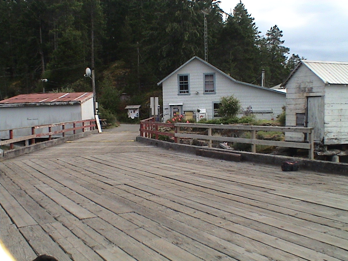
The marina here is quite nice. During the afternoon walk Trixi and I walked along Whaletown Rd and down to the marina. The have nice campgrounds, a small well stocked store and propane! Too late in the day to go back to the boat to get the tank. The also have a small restaurant and inn rooms. Although there were only a few power boats there yesterday, there are now also five sailboats, two of them large charter boats. Speaking of boats, the trawler next to me (also with an older couple on board) is still here from yesterday too. Talk about never coming outside. I know they are on board because I can see them move occasionally, but they never come out. The dinghy is still up on the davits at the back. And their generator will probably come on later tonight again when they go to be. The boat’s name is Carpe Diem from California.
Of course, noise isn’t going to be a problem tonight. The Gorge Hall is having a dance tonight. It’s at th head of the government dock and the band was warming up earlier today. Let’s just say that they have good amplifiers and need a lot of practice!
Date Gorge Harbour to Campbell River
To sail to Campbell River from points south one must enter Discovery Passage by way of Cap Mudge. On the chart it doesn’t seem to be a big deal. It’s a nice wide channel with deep waters. However, on closer examination, there is indications of strong currents and rip tides. In a east/west line just south of Cape Mudge is where the flood current from the south meets the flood current from the north end of the Island. Not much in the way of current where they meet. But Discovery Passage is a fast flowing body of water. The flood is in a southerly direction, the ebb northbound. Ships have gone down in the seas created by a strong flood meeting a SE gale at the entrance to this passage. Planning is essential.
|
Point Atkinson |
||
|
0805 |
11.2 |
|
|
1535 |
4.3 |
|
|
2330 |
14.8 |
|
|
Seymour Narrows |
||
|
0440 |
0700 |
+3.8 |
|
0935 |
1250 |
-5.7 |
|
1535 |
1905 |
+8.3 |
|
2235 |
||
18 nm
0710hrs
0730hrs
Sails are up, it’s a light NW breeze. There is a hint of sun ahead.
0735hrs
The wind is gone, motor is on. I have a distrust of the GPS heading, it seems too close to Marina Reef, I can’t see the buoy yet. I will error in the side of safety and stay east of the lay-line.
0750hrs
I’ve located the buoy and GPS was right. I can also see the end of Cape Mudge. There is still a hint of sun to the west and also a hint of a NW breeze ahead.
0810hrs
Sailing abeam of the buoy at Marina Reef. A light NW breeze and we’re hard on the wind. Had a conversation with Carey, she’s waiting for the bus in Sidney.
0845hrs
0910hrs
In past Fransisco Point. It’s flat out and the sun is warm. I can make out the bell buoy at the end of the reef, lots of guys out fishing this morning. It must be Sunday!
1010hrs
Pulling into Discovery Marina. Channel 66but we haven’t called in. Plan to go to the fuel dock first.
1020hrs
54.9 liters 12.06 gallons
2100hrs
The hatch is closed to the cold wind, we’re tucked in for the night. Sitting at Discovery Marina in a southeast gale with predictions of 40 knot SE wind overnight with "an intense low" coming over. The weather gurus guessed that one right, didn’t they!?!
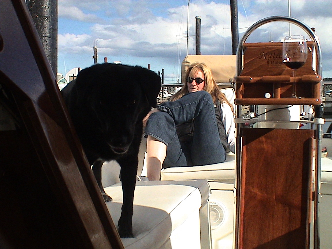
Once I got here it was a compressed afternoon. I went to the office and paid for moorage ($30.00) and got directions to the nearest propane outlet (about a five minute walk up the highway, a Husky station on the right side of the road, can’t miss it). Loaded up the propane tank into the backpack and started the five minute walk with Trixi. About half an hour later the Husky came into sight! Loaded it up and now it’s even heavier! By 15 lbs! I would have taken a cab but I had Trixi with me. A long and sweaty walk back to the boat, hard on the legs and back. I’m not 25 anymore! Anyway, that was done and hooked back up. Then it was off to lunch without Trixi. Finished that and off to Super Foods for groceries. $105.00 later I walked the buggy down to the dock with all the supplies. Then it was off to the office to get ice and an adapter for the power cord (20 to 30 amp connector). Three blocks and three bags later I’m getting tired! It’s also getting close to 1500hrs. Off to find the bus depot. That didn’t take long and after a short wait Carey arrived at 1520hrs, right on time. Very empty bus. Trixi was very happy and cuddled up right close once we were back on the boat. A couple of drinks and we were off to the Super Value looking for meat for the next week. They agreed to freeze our selection for pick-up tomorrow. Once that was out of the way it was back to the boat in the ever increasing wind. Cold too. I went and had a shower once the laundry was done and, once that was all sorted out and a couple of glassed of wine later, we headed off to the Rip Tide Marine Pub for dinner. We just got back from that. I took Trixi for a short walk for a pee and then, here we sit. The rain is just starting to fall. I hope this blows over during the night and tomorrow is dry and calm.
0830hrs
0910hrs
Peter owns a Beneteau 396 that I maintain for him in Sidney.
2100hrs
Quite a change in the weather today. Right now the sun is setting in the almost clear western sky. There are still lots of clouds around but this afternoon was quite pleasant. The wind finally died and it warmed up.
Back to earlier today though, this morning Carey I went for a walk to town without Trixi. We found the library, opening at 1000hrs, and continued for our walk in town. Once 1000hrs went by we got back to the library and signed on to e-mail. I found that there were four more enquiries about the Rendezvous. I sent them all the updates that I had. That took more than half an hour! Then it was off to lunch at the White Spot. We sort of missed breakfast! While we were having breakfast the VanIsle 360 boats were coming in, fast. They had the current with them in Discovery Channel and it was still smoking from the SE out on the water. We heard that more than once spinnaker was blown out and someone off one of the catamarans went over the side. We ended up talking to Tom from "Rampant" (boat parked next to us at the marina in Sidney) who found us on our boat. They were being conservative on the Davidson 40 "Numa" and didn’t break anything. All the boats are out of here tomorrow at 0800hrs so the showers and laundry will be clear by then. The rest of the afternoon was taken up by walks to the far end of town (not very far anymore!) and building Caesars. We bought a rechargeable vacuum for the boat to keep the dog hair under control. I even went to sleep in the cockpit just before Tom found us. He woke me out of a very deep sleep! We went for a couple of walks along the docks (one after I spilled wine all over the cockpit!@!!), looking at the boats that were racing. Some big, some very small! The weather improved during the afternoon and eventually ended up being sunny and warm. Long over due! We did a small Boston Pizza for dinner, neither of us were very hungry. We got a call on Carey’s phone about the Rendezvous as well. I’ll check my e-mail again tomorrow to send that person all the info. Now it’s almost bed time. We didn’t go anywhere today but we’re both tired. Into the relax mode I suspect.
Our stay in Campbell River was a very pleasant one. We would have left on Monday but the morning winds were very strong and it was Carey’s first day on the boat again. Carey is not a strong sailor and prefers light winds over the stern. Forcing passage in strong winds on her first day would not have been a good introduction to our vacation!
|
Campbell River |
|
|
0750 |
9.2 ft |
|
1000 |
9.4 |
|
1625 |
6.2 |
|
2400 |
13.5 |
|
Seymour Narrows |
||
|
0530 |
0800 |
+4.0 knts |
|
1040 |
1345 |
-4.9 |
|
1630 |
1955 |
+7.2 |
1135hrs
Just powering out of the marina under sunny skies and a very light NW breeze. It’s still flooding just a bit but we’ll catch the tide change at Seymour Narrows at 1230hrs. It’s going to rain today because of all the clouds around, but right now it’s very nice and warm. All the racers were out of here by 0800hrs, powering past Seymour to start today’s race at a fish farm just north of the narrows. We got up reasonably early, Trixi and I got up at 20 to seven and went for a walk, coming back at about 0740 with Carey still in bed. We ended up going to the Whitespot for breakfast and then I took a shower while throwing the laundry into the machine. Off to the Library again to check e-mails. Found the one from the phone call last night, sent the graphics to all the newcomers and signed off.  Carey was at the shower when I got back with the last of the groceries, frozen meat from Super Value. Two more bags of ice, fill up the water tank, drain the dinghy and we were set to go. Just as we were ready to cast off, mooring lines in hand, a guy walks up and introduces himself as Dave Dankin, one of the guys coming to the Rendezvous in July. He lives here and saw our boat last night while we must have been out wandering the docks. Nice guy and we’ll see him again in July.
1215hrs
Powering past Race Point, still sunny and warm, very light winds. Current is still negligible. The clouds are getting thicker. We’re looking at this huge house up on the hill at the point, must be all of 10,000 square feet with a small cabin cantilevered out over the water!
1300hrs
Abeam of Maude Island, Seymour Narrows. Not much wind, not much current, the clouds to the west are very dark, the sky to the north is clear.
1330hrs
Abeam of Separation Point, about 2.5 knots of current with us, the water is a bit choppy even though there is no wind.
1420hrs
Turned the corner at the Chain Islets, headed for the entrance to Small Inlet. There is a huge dark cloud over the entrance with sheets of rain falling. There is also wind coming from the cloud that has now spread across Discovery Channel. I’m into my rain jacket.
Approaching the entrance in the rain. It’s cold. Carey is boiling some water to make coffee to keep me warm.
2040hrs
The heat is on and the hatch is shut (with the canvas drop). It’s cold and wet out, a fine rain falling. The stereo is on softly and Trixi is resting with eyes closed. Another day is almost done. After arriving here in the rain it cleared up again. We had a few moments of sunny skies admit the high cumulus clouds. It was a very pretty picture with vivid blue skies, brilliant white clouds and clear water. Makes the trip worthwhile. The lone powerboat is so far away he may as well not be here. There’s a small waterfall off to the south of us that we can hear. Trixi and I went ashore earlier in the afternoon and found it. It’s quite small for all the noise, hidden in the trees. Anyway, it was back to the boat around 1630 hrs with a huge blue/black threat to the west drifting slowly towards us. We fully expected to be inundated with rain soon. That never happened, the cloud was moving so slowly that it never arrived with the rain. We both read in the cockpit for a while and soon it was 1830hrs, time to start dinner. It was cooling off by that time so I turned on the heat and got the BBQ going for the salmon filet. We made some pasta to go with it and it was very tasty. Just filling enough. Carey did the dishes while I took Trixi ashore one last time. I finished reading "Last To Die" by James Grippando, interesting read. Carey just finished Cosmopolitan (July issue, not June, Carey says). Carey’s face is red from the sun today and mine is burning nicely, probably just as red. Carey will be in bed soon. I’ll wait till it’s a bit later (and a bit darker). We have 120 ft of rode out in 20 ft of water so we should be just fine.
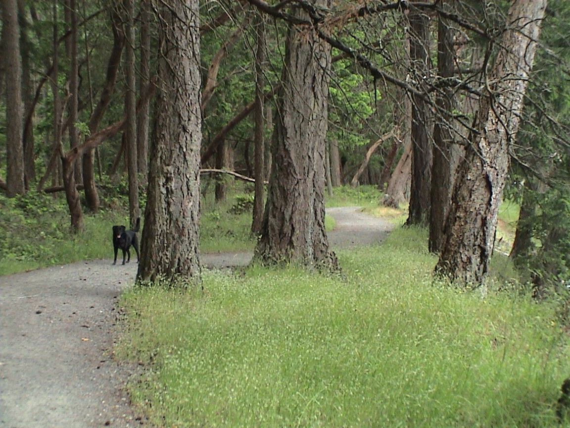
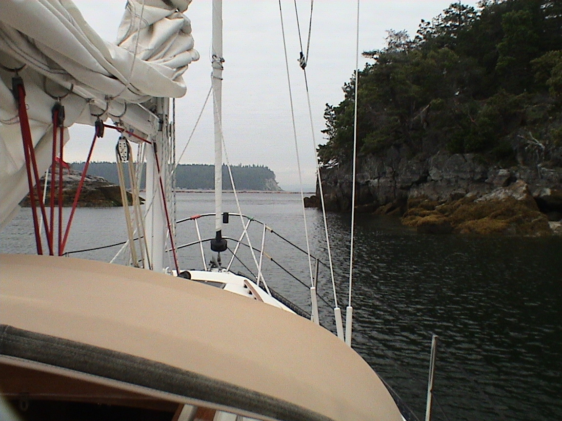
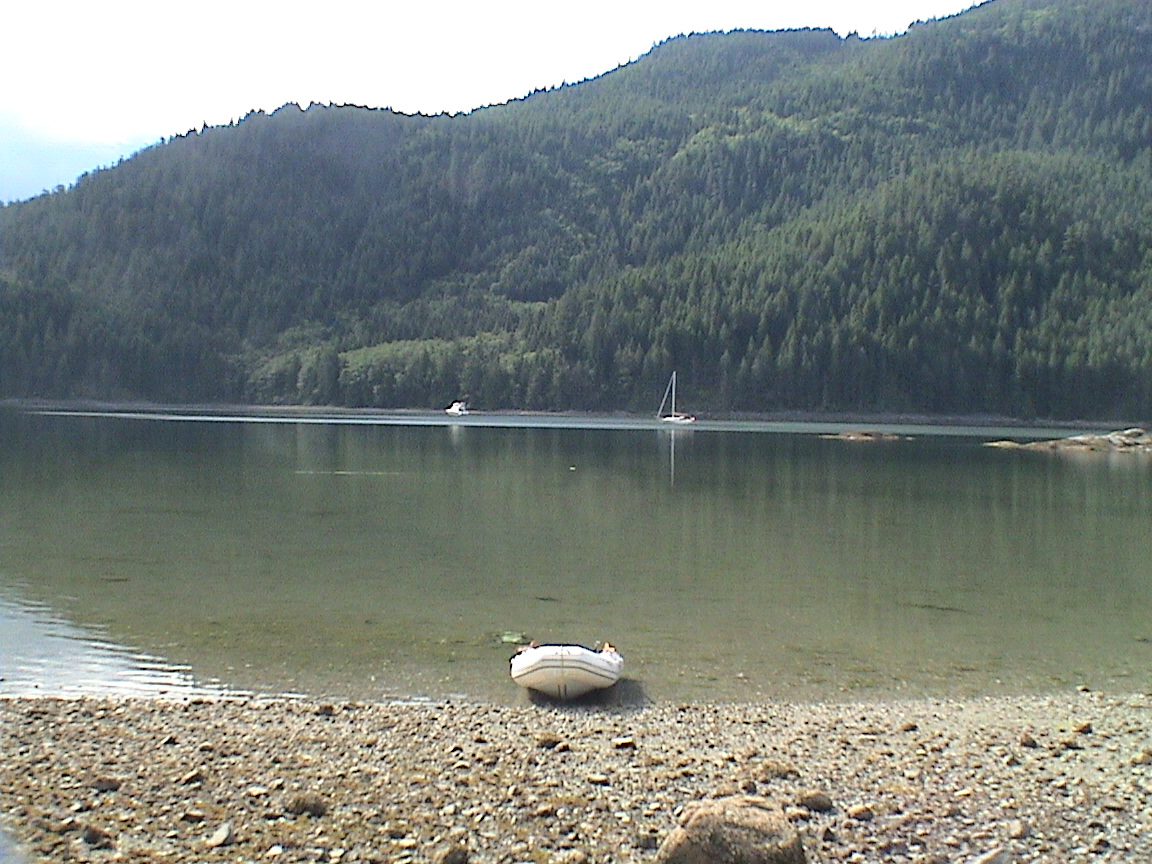
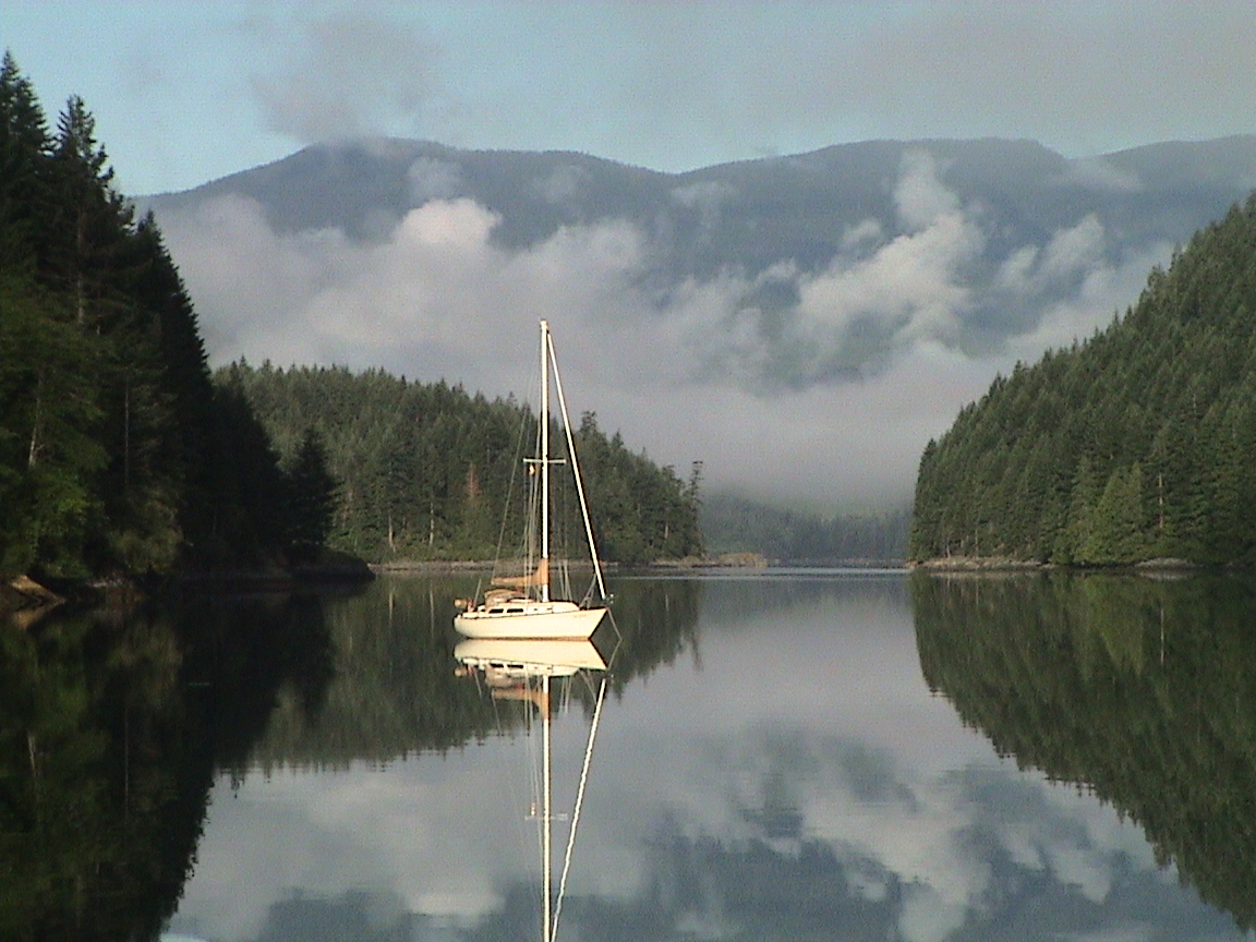
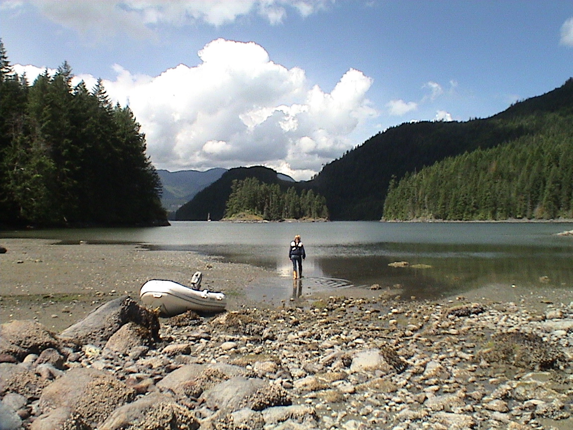
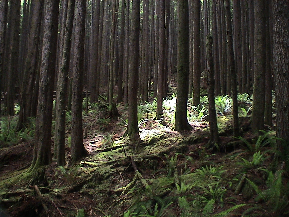
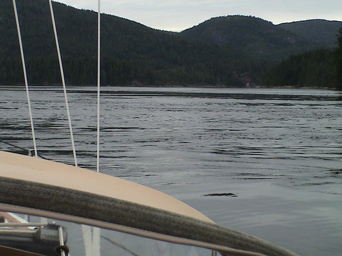
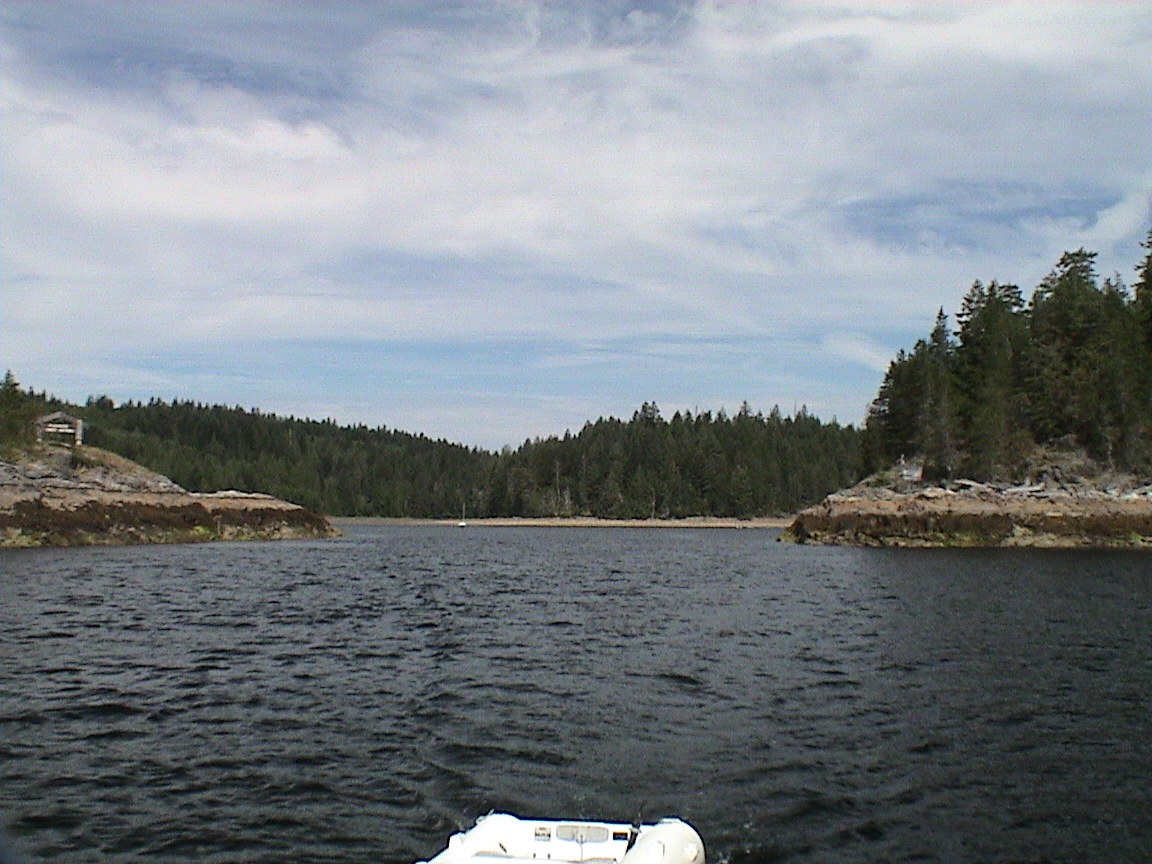
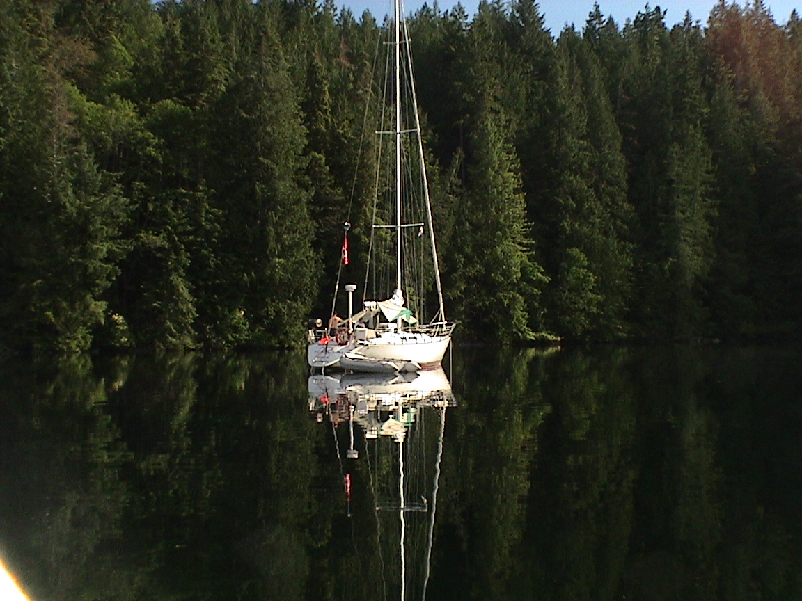
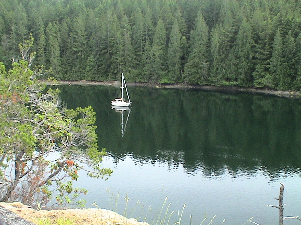
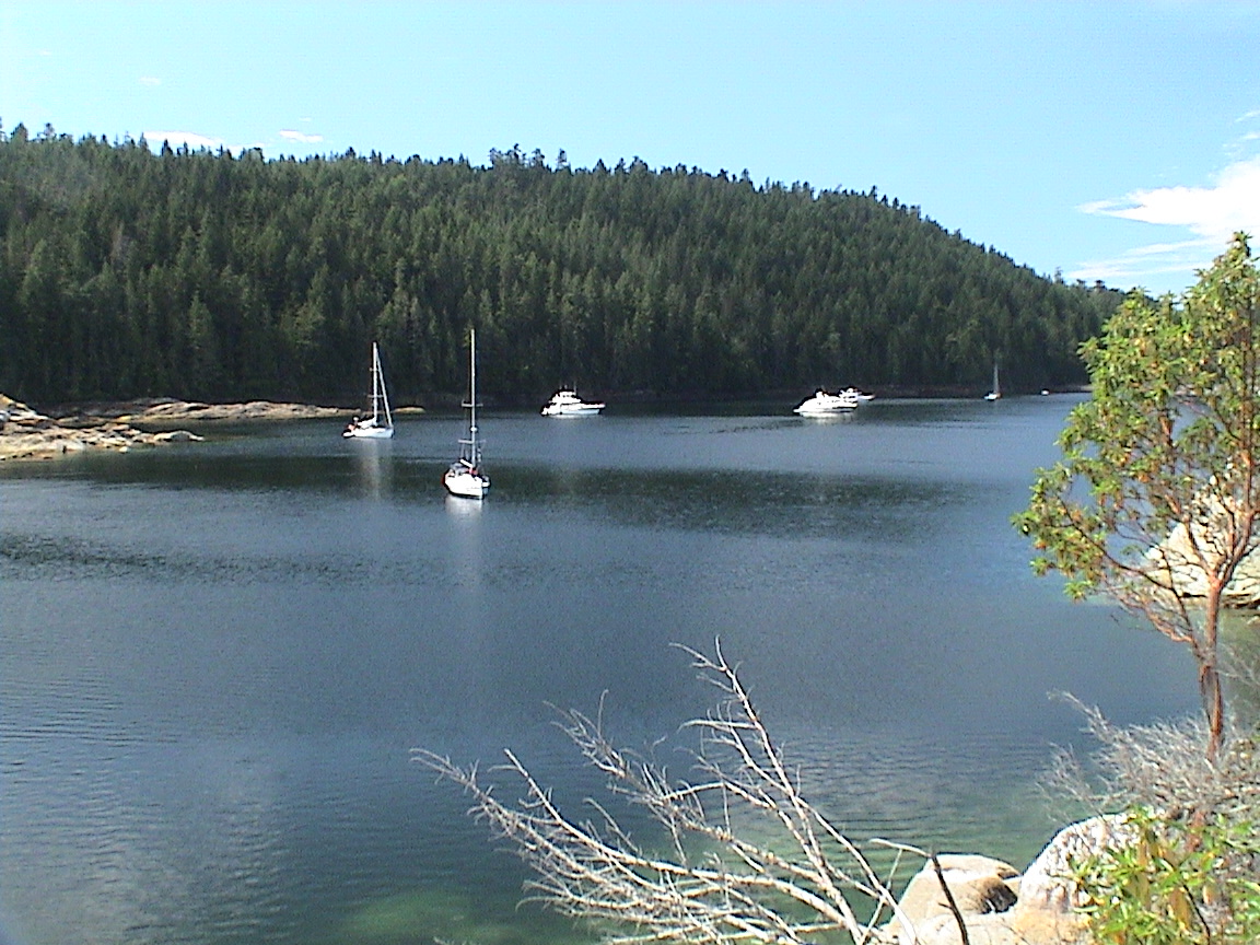
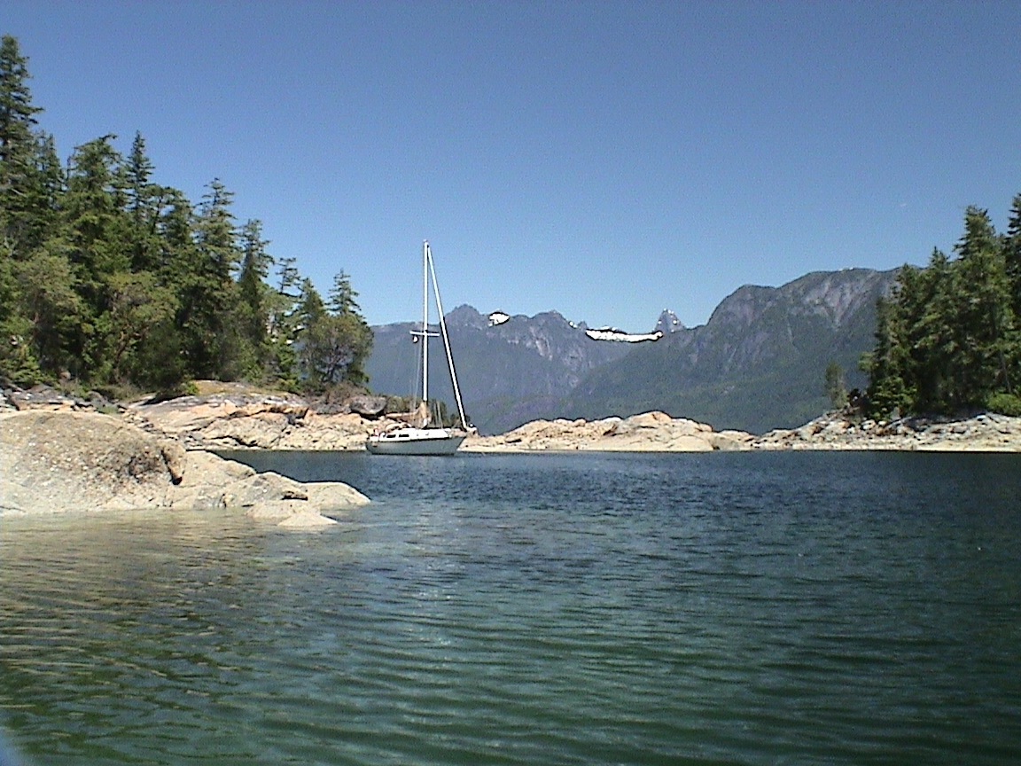
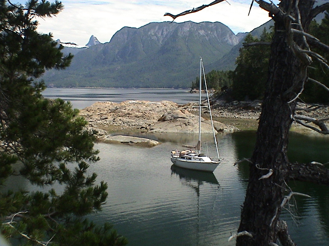
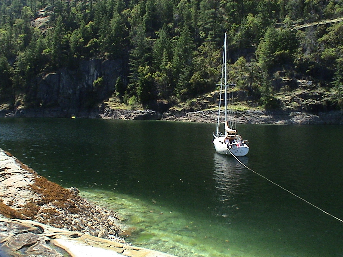
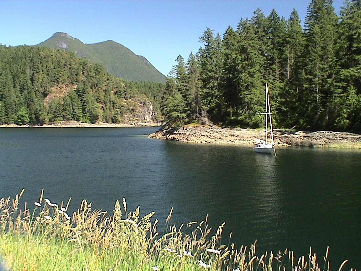
Small Inlet is a boater’s paradise! If you are looking for seclusion and secure anchorage, Small Inlet is what you are looking for. About 1 mile long and half a mile wide, it is about an even 30 ft deep over solid mud. Mountains of lush greenery surround the anchorage with not a sign of human interference (other than signs of old logging). At the head of the anchorage is a shallow delta of mud flats and a wonderful one mile forest trail that leads over to Wyatt Bay. Not a Sunday walk, but not that rugged either. We spent two nights here, the power boat that was here upon our arrival left and one other boat arrived. The boats anchor so far apart that you might as well be alone.
Wednesday, June 15th
Date Small Inlet2020hrs
 blue sweat was blown off the dodger and into the water. It dried out on the stern rail during the afternoon and is now in the wash for when we get to Refuge Cove. A slow afternoon, nothing much going on. Perfect! At about 1630hrs I took Trixi for a short hike up a logging trail on the west side of the bay. I was trying to get a clear photo of the bay above the tree
 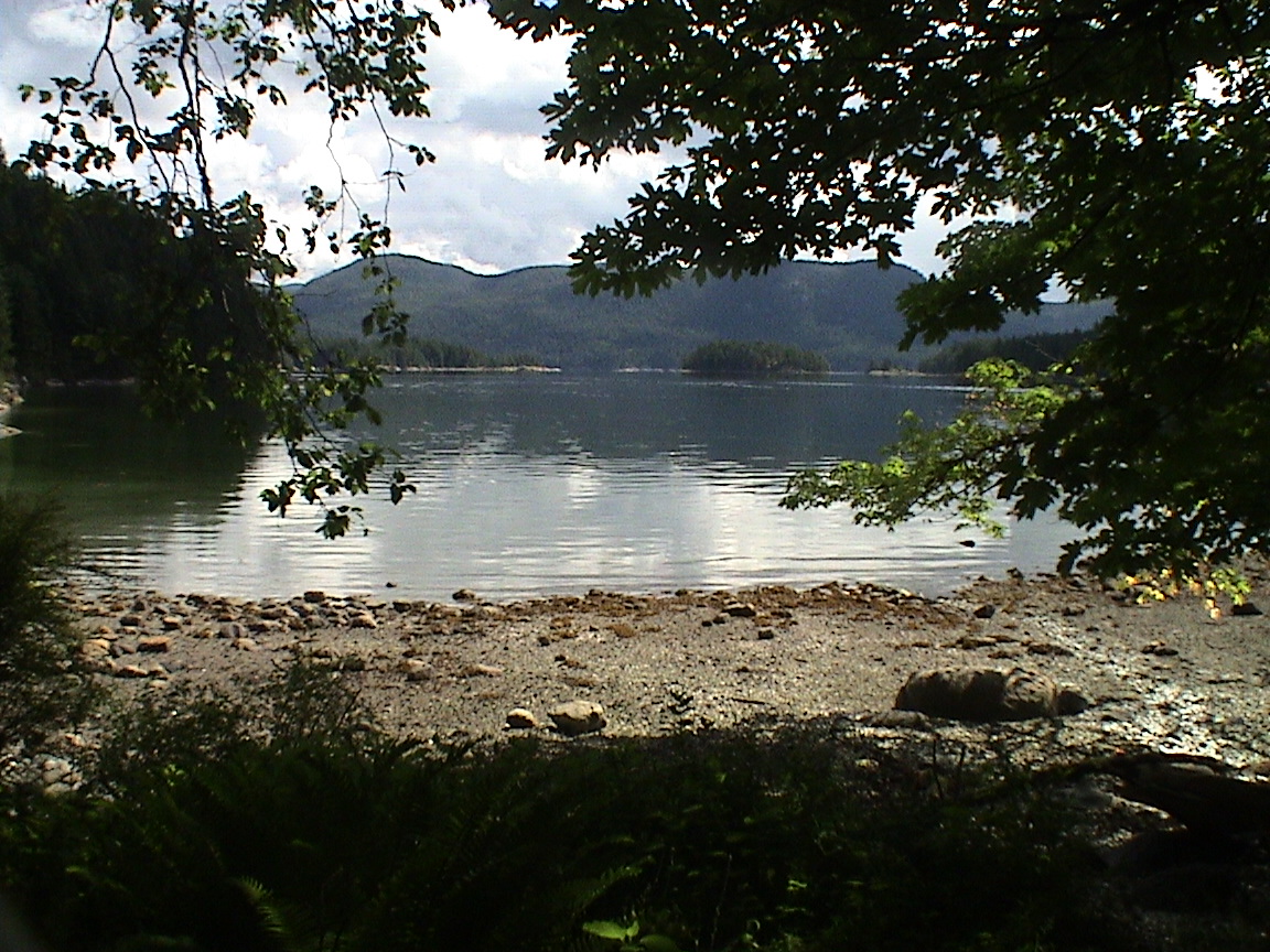 line but couldn’t get high enough,]. Very rough terrain. Another powerboat came in, two actually. A small one went to the head of the bay, past the small islets and out of sight. The other is a blue trawler type of about 60 ft anchored across the bay from us. No sound from them. We eventually got dinner going about 1900hrs, pork chops and rice. Very tasty when it finally got done. Carey cleaned up the dishes and I took Trixi for a last beach run. Not it’s sitting back with a glass of wine and soft music. The end to a perfect day.
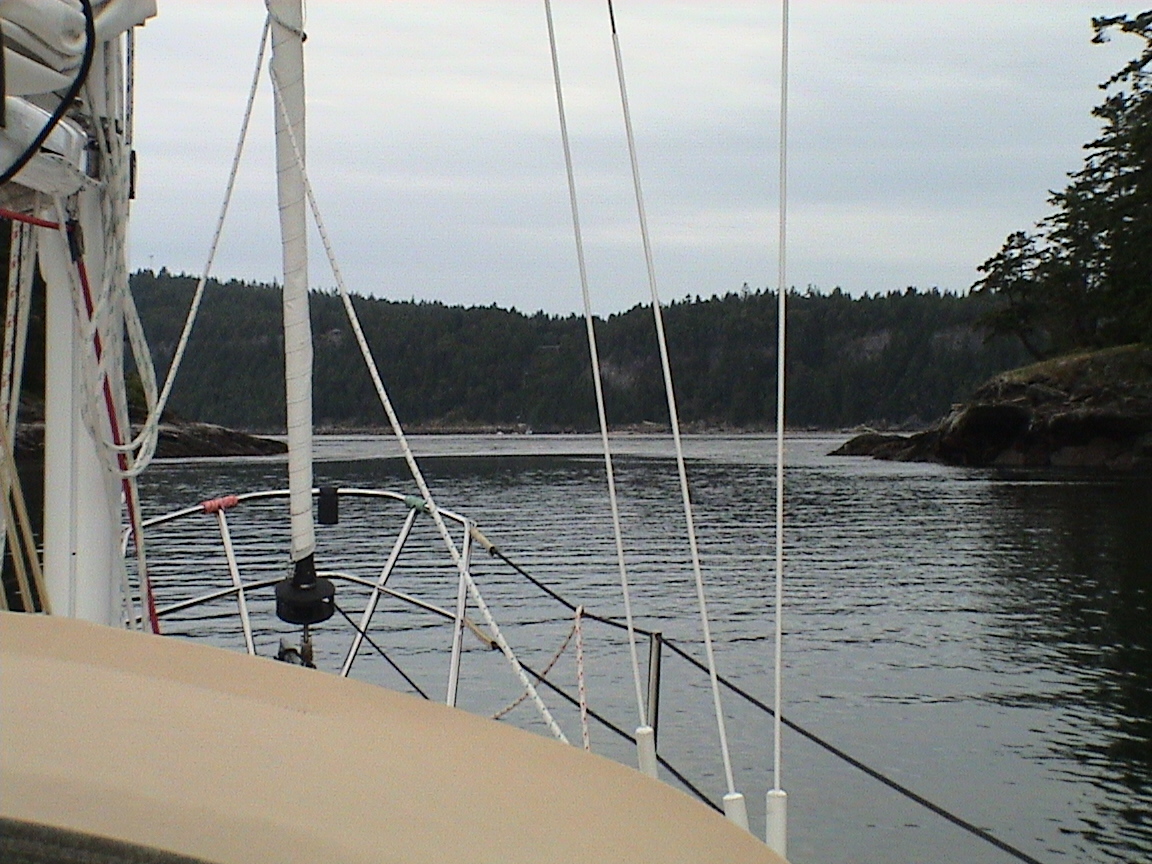
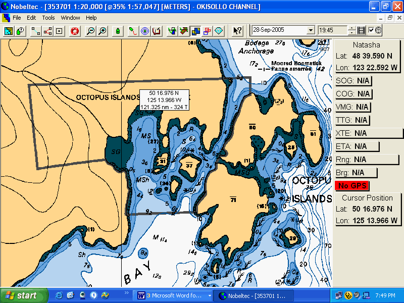
The clouds have moved in and it’s completely overcast now. The prediction is for overcast tomorrow with a few showers. We’re headed for Octopus Island Marine Park, about 3 hours away. We have to anticipate the current through Okisollo Channel and should be out of here by 1000hrs.
Okisollo Channel has two sets of rapids that must be negotiated, both with relatively strong tidal currents. Both are measured in the Canadian Tide and Current Tables with Breezley Pass as a reference point (just south of Okisollo Channel).
Thursday, June 16th
DateSmall Inlet to Octopus Island Marine Park
|
Campbell River |
Breezley Pass |
|||||
|
0815 |
2.5 |
0545 |
0845 |
+5.8 |
||
|
1210 |
2.8 |
1155 |
1440 |
-4.4 |
||
|
1705 |
2.2 |
1710 |
2030 |
+5.9 |
||
|
2440 |
4.1 |
|||||
0900hrs
0950hrs
At Granite Point, rounding the corner into Okisollo Channel. It’s taken us an hour to get here, it’s a long way out of Small Inlet and then Kanish Bay. We’ve also been fighting the flood in the Bay. Now it should turn with us in Okosollo Channel. It’s still cloudy but dry, the sun is trying to get through.
1030hrs
1055hrs
1110hrs
We’re rushing along at 9+ knots through the Upper Okisollo Rapids. There’s a four knot current through here! There are even guys along both walls in their surf kayaks riding the waves! That I didn’t expect. The water in the middle is glassy smooth but I can see the turbulence ahead.
1120hrs
1145hrs
The anchor is down in the inner bay at the Octopus Islands. There are two other boats here, a very large sailboat and a small power boat. The sun is starting to come out from behind the high clouds. Time to relax again.
2200hrs
Darkness is falling on a near perfect day. It’s very quiet here tonight. There is no waterfall creating a background noise like there was at Small Inlet. There are only two other boats here with use, about six more in the adjoining bay. Absolute silence except for the squawk of the occasional bird, some soft music and soft clinks of human activity aboard boats. It’s a perfect night. I have a glass of brandy at hand. Carey has gone to bed, Trixi is down in the cabin. There’s a high cloud cover keeping the dew at bay. The half moon is poking it’s face out from between the clouds.
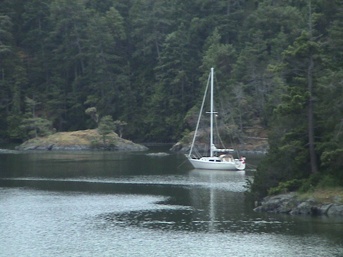
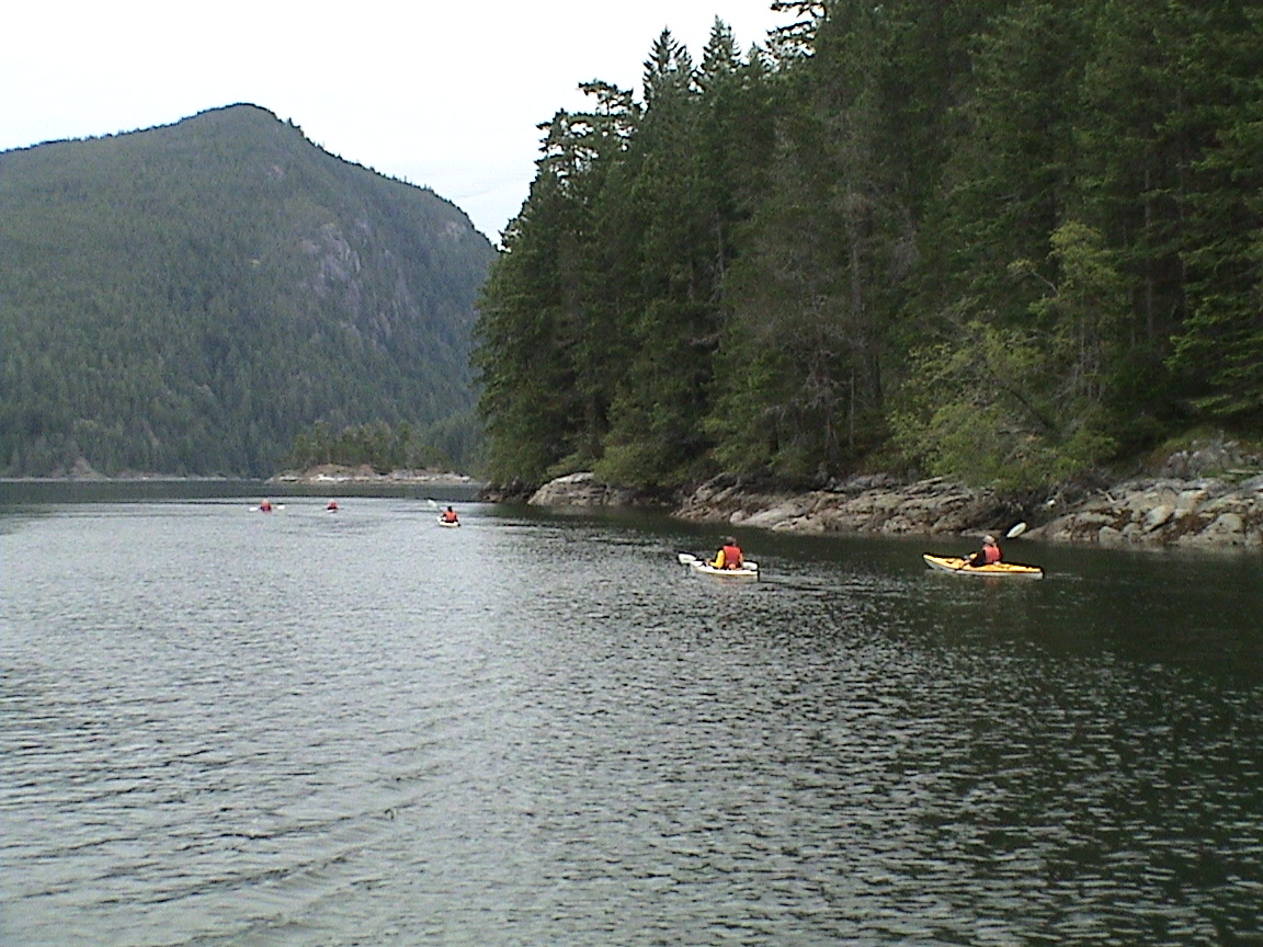
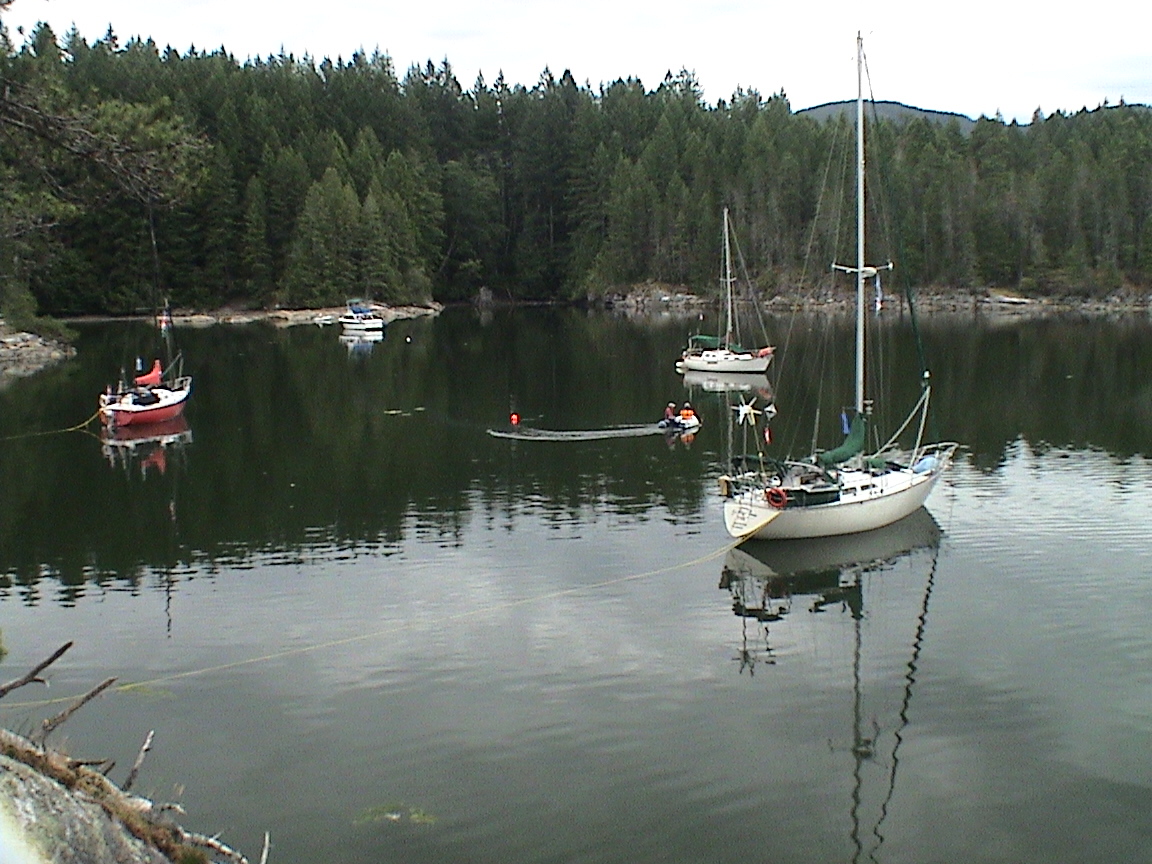
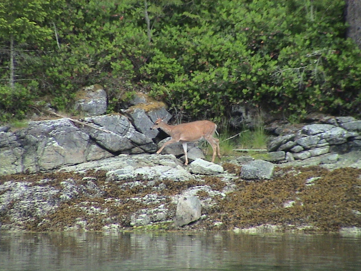
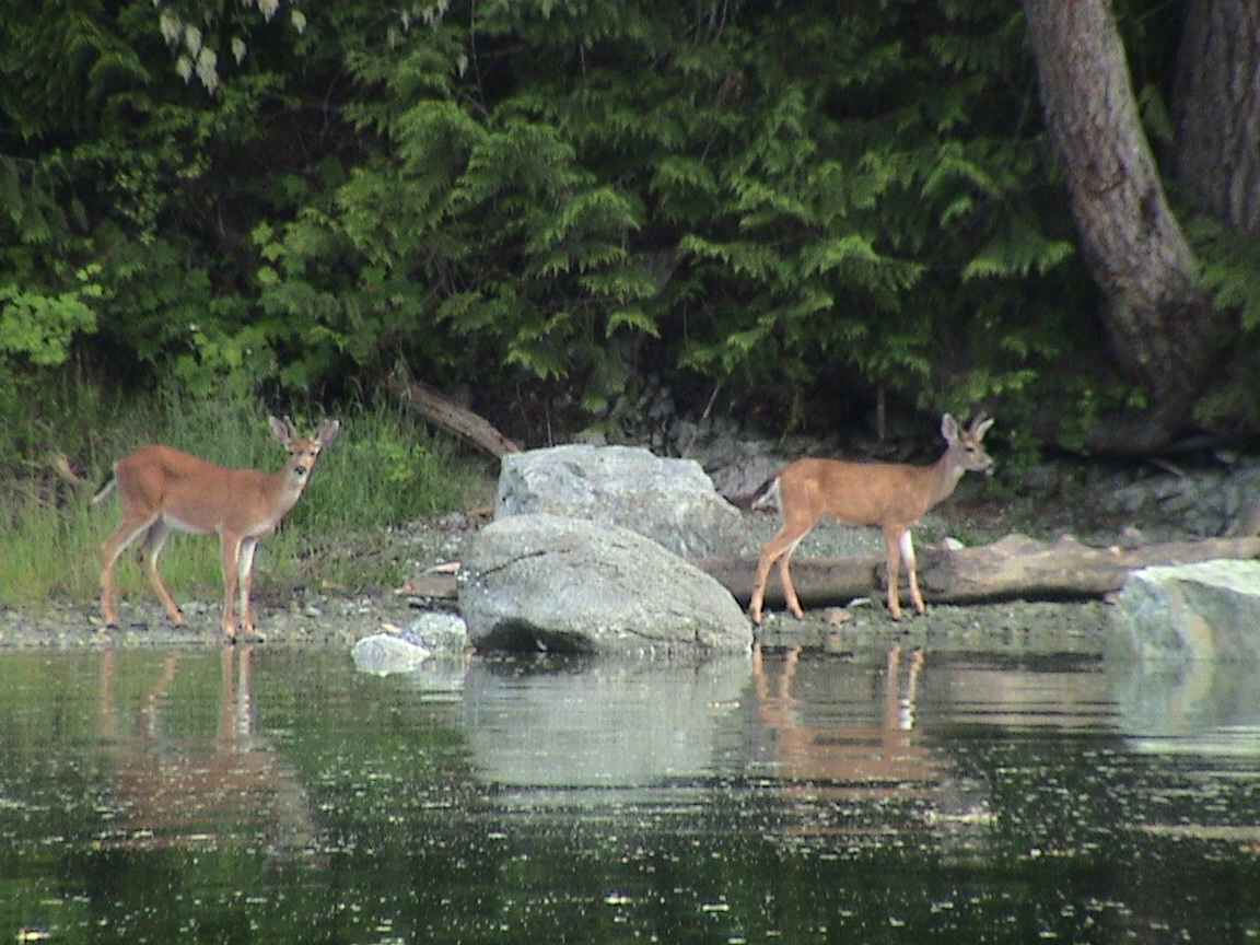
After arriving this afternoon we anchored in the southern bay with a small power boat and a large sailboat. I took Trixi ashore and while doing so, the large sailboat left. The skies were somewhat threatening but it was warm out. We settled in for the afternoon. Carey and I went for a row without Trixi, over through the narrow gap between the islands to the open area facing Surge Narrows. We’d seen a deer along the shore as we powered into the bay but it was gone by now. Very quite and calm. Back to the boat and it started to rain very lightly. The tarp went up. We read books and magazines for a while and the rain stopped. Time for showers? The sun shower wasn’t really warm enough but with boiled water added, it was great. It’s wonderful to feel clean again. About half an hour later the skies started to clear and eventually the sun popped out. What a wonderful afternoon! It got warm, very warm in the sun as we were both a bit burned from the day before. Up to 25 degree in the cabin. A sailboat came in and a trawler powered into the bay next door. The sailboat was a Hunter 35.6 from the SNSYC, Peter and Holly PRICE. I met them ashore when I took Trixi for a walk. Invited them over for drinks after dinner. Carey & I had wonderful streak with all the fixings for dinner around 1830hrs, eating in the cockpit. Very tasty and filling with Trixi finishing off what we could not. By 1930 hrs Peter and Holly were over. But only for a short time because she was tired already. They’d been out for about a month, north of Desolation, and cold and wet. They came back down early to get warmed up and were headed south, back to Sidney. They’re from Calgary with a condo in Sidney. Had a great evening with them, drinking wine and swapping stories about boating and life in general. He is a retired doctor with a long practice in Calgary. I may have another boat to look after. Who knows. Now it’s getting too dark to see the keyboard. I’ll have to finish this in the morning, not that we’re going anywhere tomorrow. The barometer has been dropping all day and the forecast is for clouds and showers tomorrow. We’ll have to wait and see.,
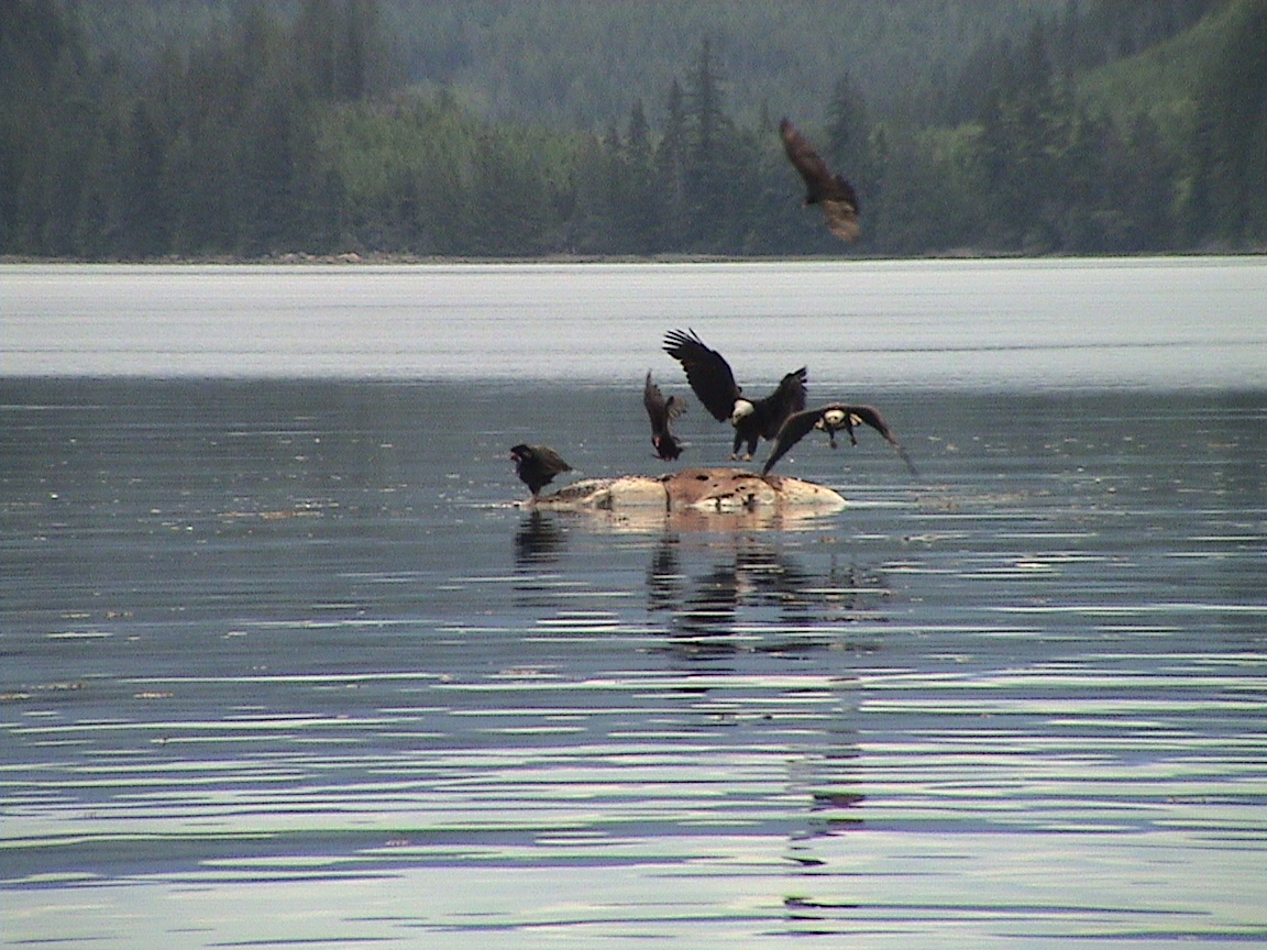
The Octopus Islands are a Provincial Marine Park and have protected status. There are a number of small, perfectly protected bays for anchorage and, if too crowded, anchorage is available almost everywhere in Wyatt Bay. In the smaller bays it’s common practice to stern tie to shore to allow room for more boats. Deer and eagles abound with the occasional hawk circling overhead, fishing in the waters of the bay. It’s no wonder the site is preserved as a park.
Friday, June 17th
Date Octopus Island Marine Park0810hrs
The rain is falling gently on the cabin top. The weatherman was actually right for a change. I’ve been awake for a few hours, Carey is just stirring now. Trixi is shoring on the settee opposite me as I complete last night’s log and this morning’s. I have a hot coffee next to me. There’s no hurry, we’re staying here today anyway.
2145hrs
This morning we had eggs benedict for breakfast, tasting very good and very filling. After that was all cleaned up we watched Peter and Holly get ready to leave in Kotty Laugh. The couldn’t get the anchor out. I rowed over to see if I could lend a hand and when they tried to power out at high speed the anchor rode parted with a thump, probably right at the shackle for the chain. Oh well, they were off for Heriot Bay and could probably get another anchor there if necessary. They did carry a spare just like us, but no extra chain etc.
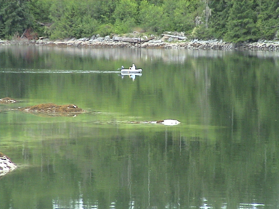
Then it was a bit of a do-nothing day. We weren’t planning on going anywhere. I went for a row alone in the early afternoon while Carey tried to sleep in the cockpit. It was certainly warm enough, the sun kept trying to peak through and we could feel the warmth. We saw a couple of deer close to the water along with an endless supply of eagles and hawks, all looking for food in the water. Boats came and went, there is another Hunter 35 anchored right where Peter and Holly were, and there’s a trawler anchored inshore of us. The other bay is quite crowded with boats, three new ones coming in and no-one leaving. As the afternoon progressed the clouds came in thicker and by 1730hrs it was starting to spit down. Very lightly at first, light enough that I got Trixi to the beach after dinner at 1900hrs without getting too wet. But now it’s coming down pretty good. No leaks that I can find yet so that’s a good thing. Carey is just climbing into bed and I won’t be far behind.
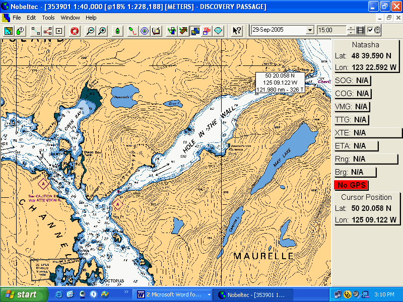
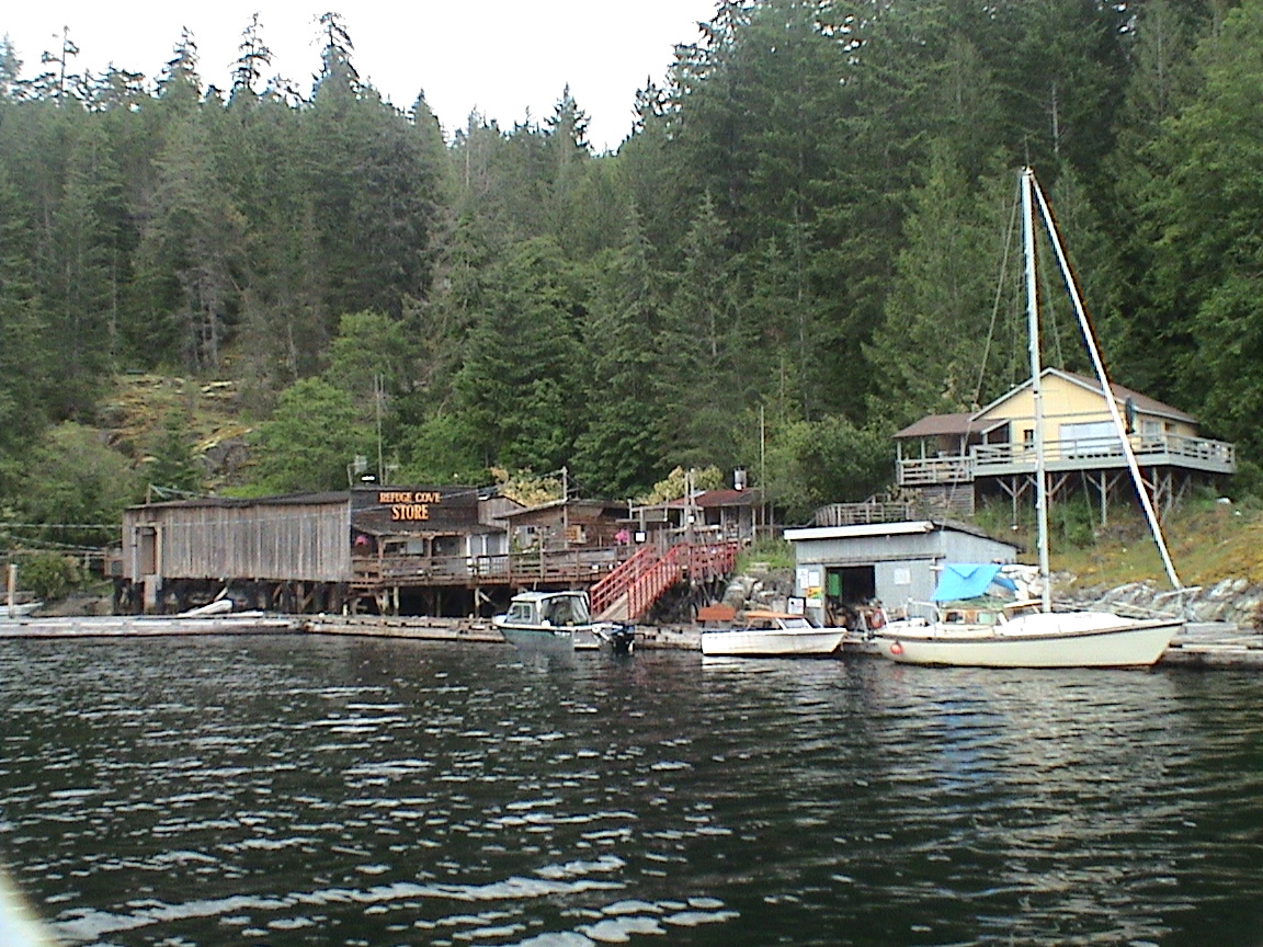
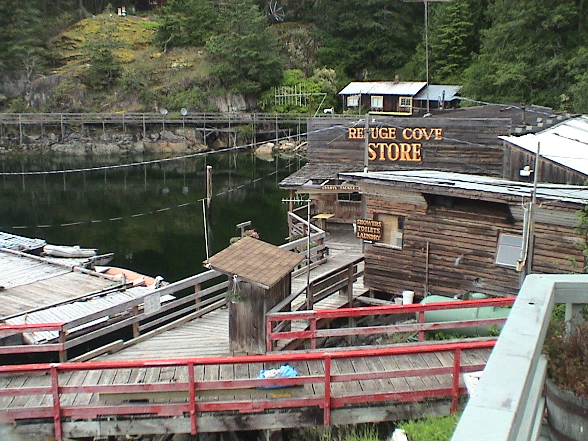
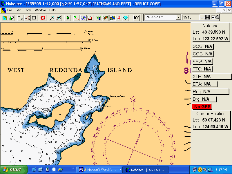
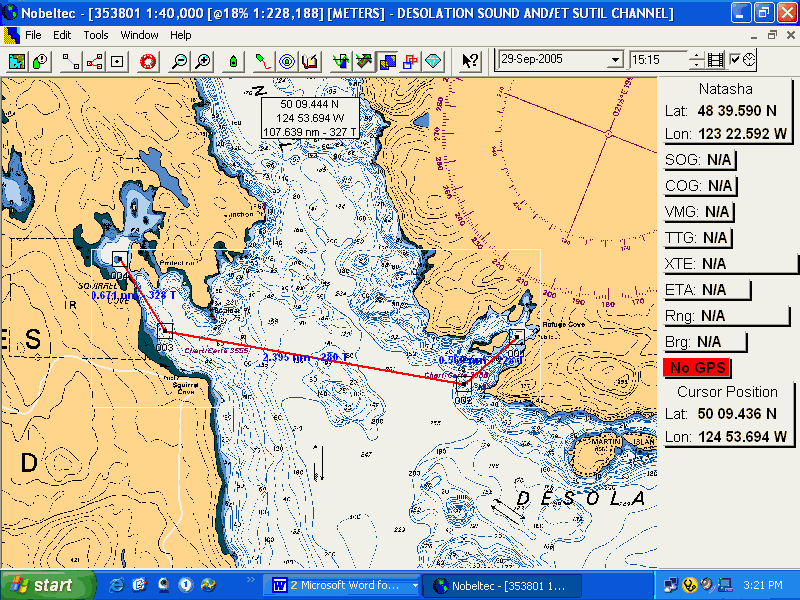
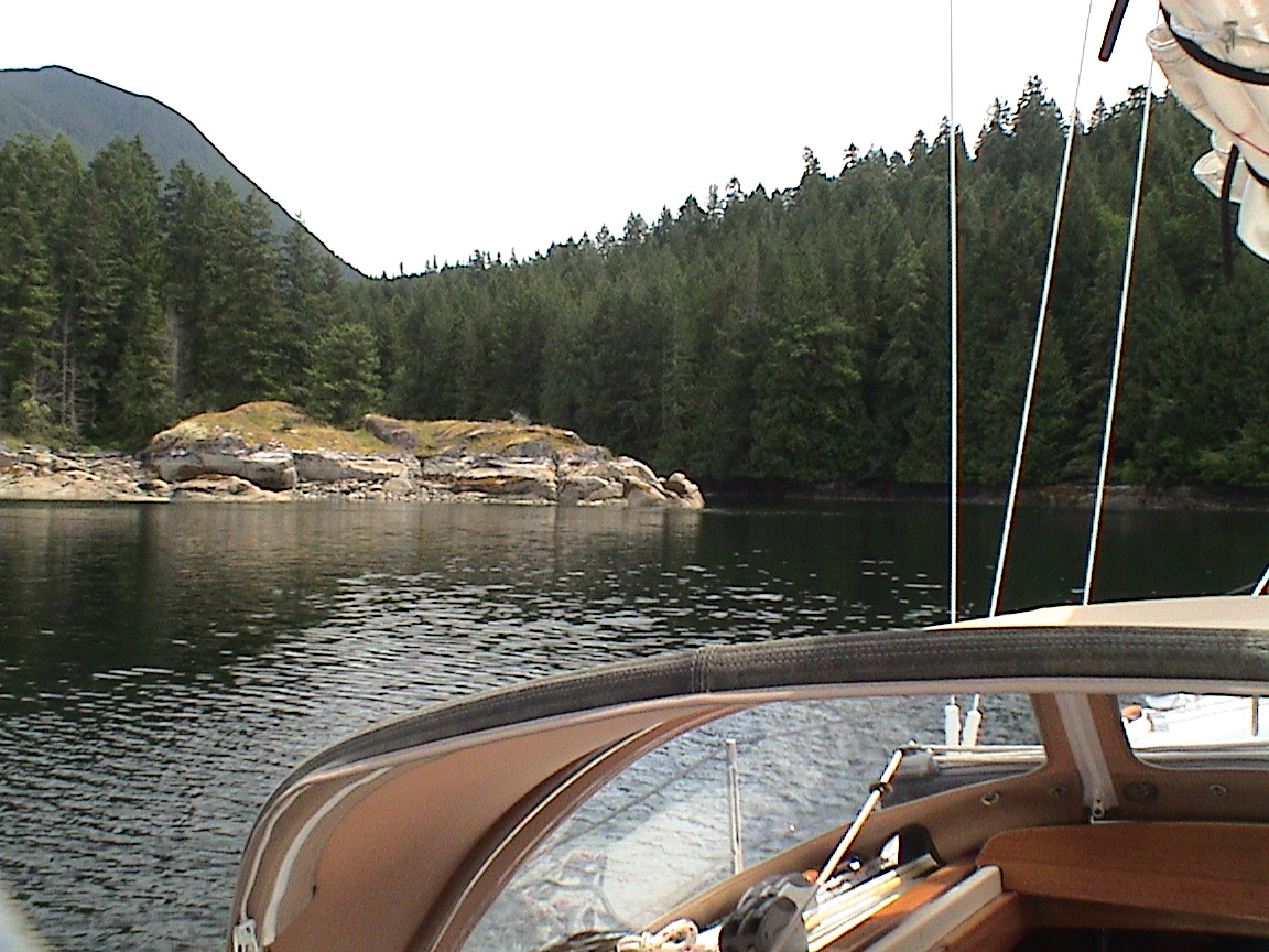
Date Octopus to Refuge CoveThe original plan was to stay up in this end of the Desolation Sound area for a few more days. However, the weather was not co-operating so we decided head for Refuge Cove, a re-supply village and a pleasant place in crummy weather. To get to Refuge Cove we had to transit Hole-In-The-Wall, a channel of notorious currents, and then a long straight line distance in Calm Channel. Hole-In-The-Wall is a channel about five miles long with choke points at both ends, connecting Okisollo Channel and Calm Channel. The flood current runs eastbound, the ebb westbound. The currents are well documented in the Tide book. For whatever reason, I believed that the most viscous current would be at the east end of the channel. I thought that if, upon entering the west end we thought the current too powerful to be safe to transit the more volatile east end, we would simply anchor and await the change of tides before exiting the east end. I should have studied the charts more carefully!
|
|
|
|
0130 |
13.5 ft |
|
0940 |
4.6 |
|
1610 |
11.5 |
|
1945 |
10.5 |
|
Hole in the Wall |
||
|
0125 |
0440 |
-6.9 knts |
|
0810 |
1120 |
+8.5 |
|
1455 |
1750 |
-6.2 |
27 nm
0930hrs
0940hrs
We’re just out of the Octopus Islands, the narrow channel that leads to the anchorage. It’s still completely socked in but the rain has eased a bit. It’s a lot shallower at low tide than when we came in a couple of days ago.
1000hrs
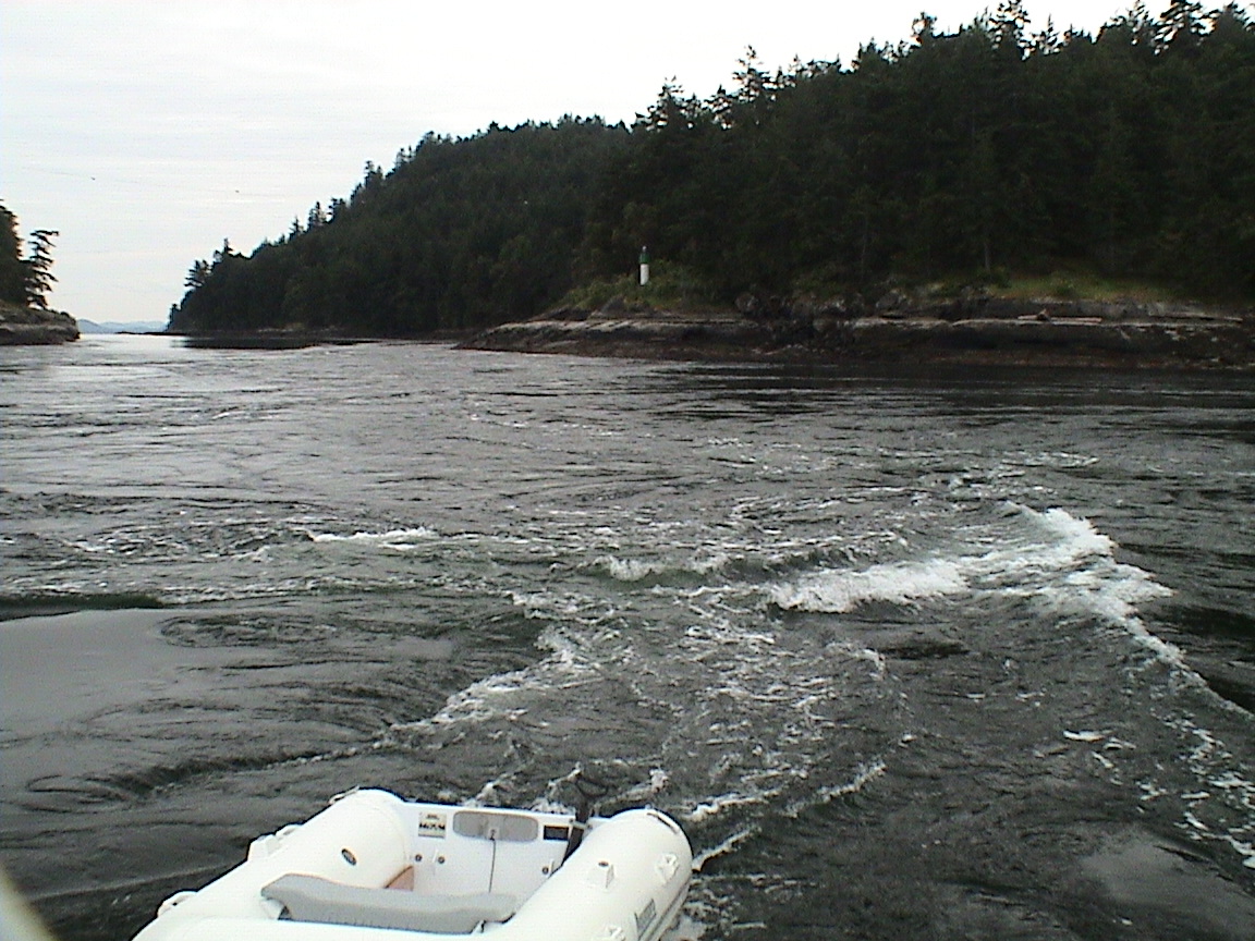
We’re into the current at Hole in the Wall. I expected a cross current sweeping across the entrance to the pass. Instead it looks like all the current is going into the pass. We’re at 6.0 knots, lots of whirl pools.
1010hrs
We’re out of the entrance to Hole in the Wall. What an eye opener! For some reason I thought that the current station was at the west end of the pass. It wasn’t. It was at the eastern end, the one we just came through! At one point we were going 11.9 knots over the bottom, very smooth in the main channel until we got to the inside. Then it was huge turbulence. There was a whirl pool that was about 60 ft in diameter with a depression of about 1.5 to 2 ft! I managed to steer clear of that one! The boat went over about 30 degrees more than once as we fought to clear whirlpools. A bit exciting to say the least! At that point I thought that the really rough end would still be the eastern end. I thought (and mentioned to Carey) that we should anchor in the available anchorage in the middle of the Hole in the Wall passage and wait for slack as I thought that if the west end was rough, then the east end would be too dangerous to go through at maximum tide (1030hrs). Then I checked the charts and found that we were already through the worst of it! Good thing!.
1040hrs
Out of Hole-in-the-Wall. Not a bad boost through the pass. It’s pretty flat with a light SE breeze. Very low clouds and it’s raining ahead.
1125hrs
Abeam of Raza Island. It’s cold with a light SE breeze still on the nose. There is a light rain falling and I just made tea and coffee. There is a current against of all things. Only about ½ a knot but there all the same. The weather is kind of depressing.
1210hrs
We’re into Lewis Channel. We’ve been motor sailing for the past half hour with the jib up. It’s given us quite a boost, up to 5.5 over the bottom from the engine only at 4.7. There’s still a current against. Looks like a wall of rain coming our way.
1355hrs
Coming into Refuge Cove. We’ve been very lucky so far with no rain on deck. Lots of rain in front and behind, but nothing on us. There is still a current against. I have to believe that the flood in Lewis Channel is north flowing at about half a knot. Not what I would expect.
1415hrs
2100hrs
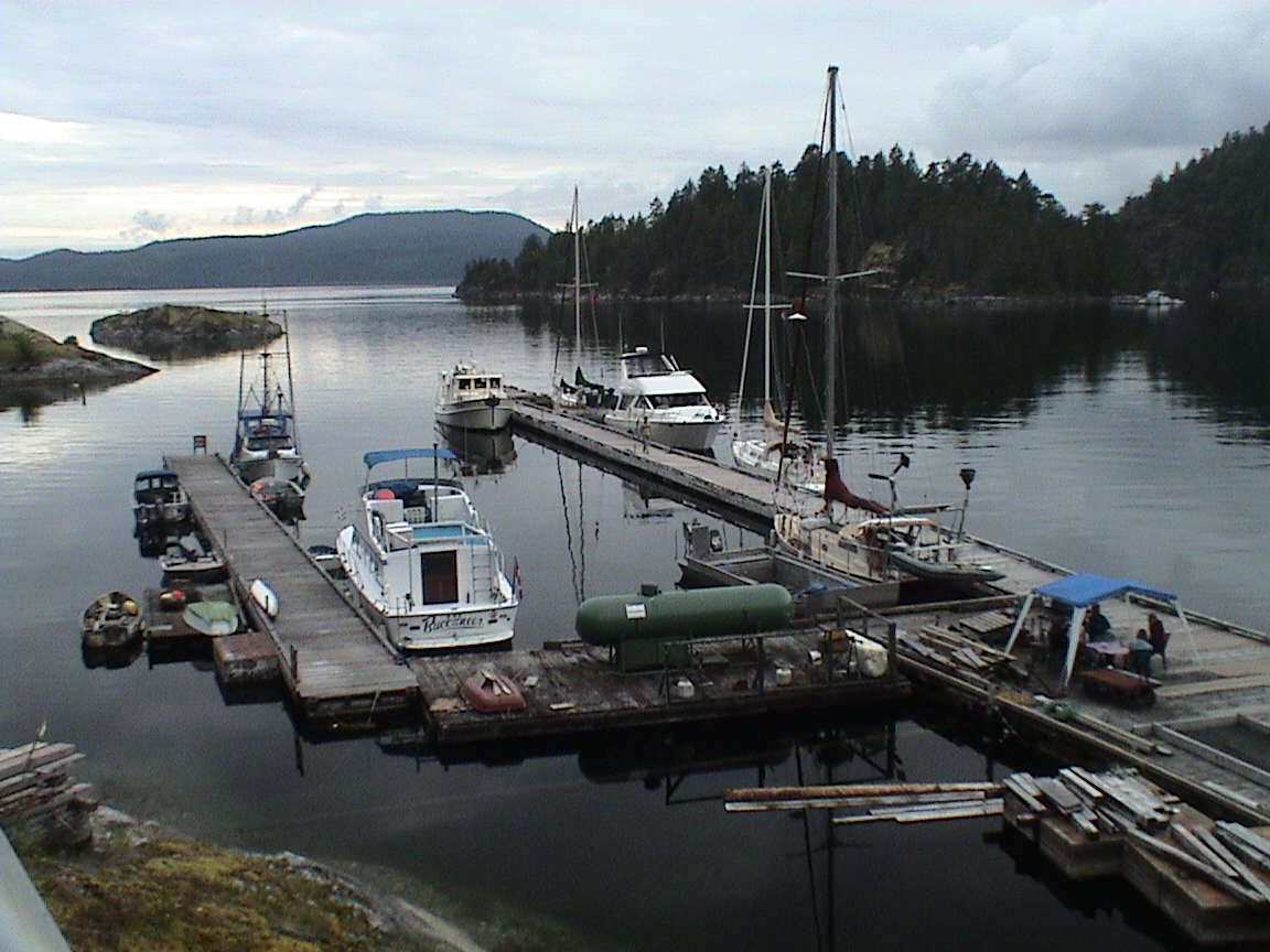
The skies to the west are clearing up nicely as I sit in the cockpit entering the day’s log. It’s too late for a sunset but at this stage we’re happy that it’s not raining. Carey is inside sitting next to the heater, Trixi is sitting on the dock watching whatever is going on. Not that there is much going on. It’s very quiet here at Refuge Cove. There are only six guest boats, four sail and two power. Lots of room for more.
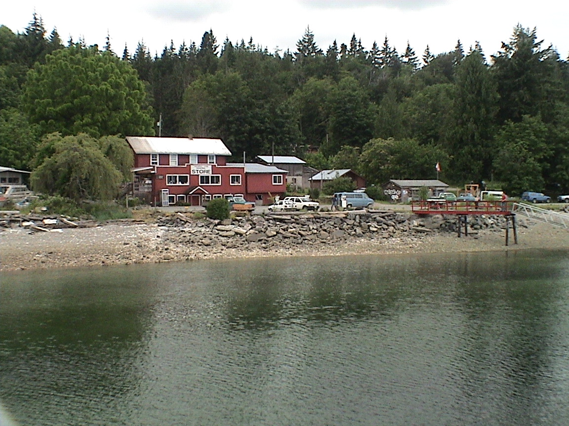
After arrival this afternoon we got started with the laundry. Nothing has changed here in the fifteen + years that it’s been since we were last here. The same buildings, the same docks, the same store and the same laundry and shower facilities. All old and decrepit! Anyway, once the laundry got started I took a shower ($3.50). Very good although the facilities leave a lot to be desired. With just a few bucks invested they could make this a resort destination. But their entire business is two months out of the year so I can understand their reluctant to expand. Carey took a shower once the laundry was done, washing her hair. It looks like the water here is cedar coloured so I filled all the water bottles with water out of our tank before filling the tank tomorrow. We met a few people on the dock, Duane & Jane Landry on Whisper from the SNSYC, originally out of Dallas, Texas. They were waiting the arrival of their daughter and granddaughter by Kenmore Air out of Seattle. Then they were headed for Squirrel Cove. No one else we know here. I finally got cellular connection with four voice mails, one being Ron. I gave him a call and it ended up he was on Saltspring Island with Linda and two other couples on a cycling weekend, staying at cabins on the island at a lake. It was pissing down rain on them as well.
The temperature is dropping with the clearing skies. The weatherman is calling for cloudy with clearing periods tomorrow. The barometer is finally on the way up so there may be hope yet. We’re going over to Squirrel Cove ourselves tomorrow after getting a few supplies and washing the sheets tomorrow morning.
|
Campbell River |
|
|
0155 |
13.5 ft |
|
1005 |
3.3 |
|
1705 |
12.5 |
|
2040 |
11.2 |
5.2 nm
0835hrs
It’s cloudy with a light drizzle falling. We’ve been up early, not that we had to, but because we both did. I was awake at 0530 and tried to get back to sleep without success. Eventually read a book for a while, "The Summons" by John Grisham. Pretty good so far. Finally got up at 0700hrs. The store generator started about 0630hrs so we knew the water was hot for the washing machines. We got a load of sheets in and we’re just waiting for the dryer to finish with them. Then it will be up to the store for some supplies. So far we’re on our same water tank from Campbell River although it must be getting close to empty. The three blocks of ice are still 50% there along with the leftovers of our original block of ice from home. There is also still an almost complete bag of ice yet. Not bad at all. Of course, it’s not exactly been hot out! Once the laundry is done, the groceries 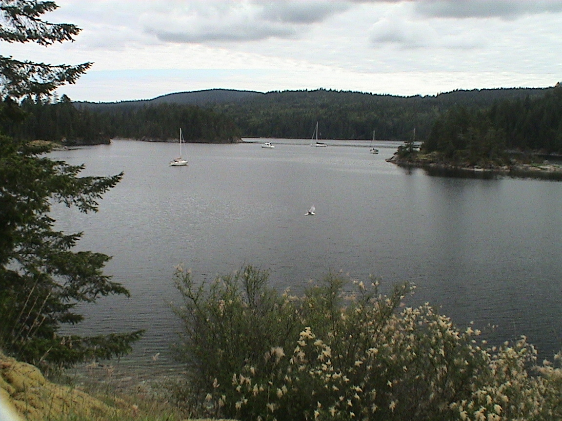 aboard, and the water tank filled we’ll motor over to Squirrel Cove, less than a mile and a half away. The weather is supposed to improve today with clearing this afternoon. It’s currently sunny in Tofino and that’s generally where our weather comes from. The barometer has been rising for the last two days. We can’t get the weather radio in here for some reason. Haven’t heard from our daughter either, on father’s day as well.
2115hrs
A quite night in Squirrel Cove. There are about 15 boats in here scattered all over the anchorage. Sail boats dominate! There is a high cloud in the sky with no wind all day long. Barely a ripple on the water in mid afternoon. The weather channel is calling for light winds again tomorrow, from the NW so hopefully the clouds drift off inland. The barometer is stalled on it’s climb up the scale.
This morning we left Refuge at about 0930. We finished our laundry and got some groceries, filled up the water tanks and shower bag, and were off. For some reason there just isn’t a friendly feeling at Refuge this year. Perhaps the depressing weather is affecting their morale (and business). They don’t seem to care about customer service in the way that we do. Even some of the other boats expressed the same feelings. We bought $100 worth of groceries to last us until Lund, including two blocks of ice and two bags.
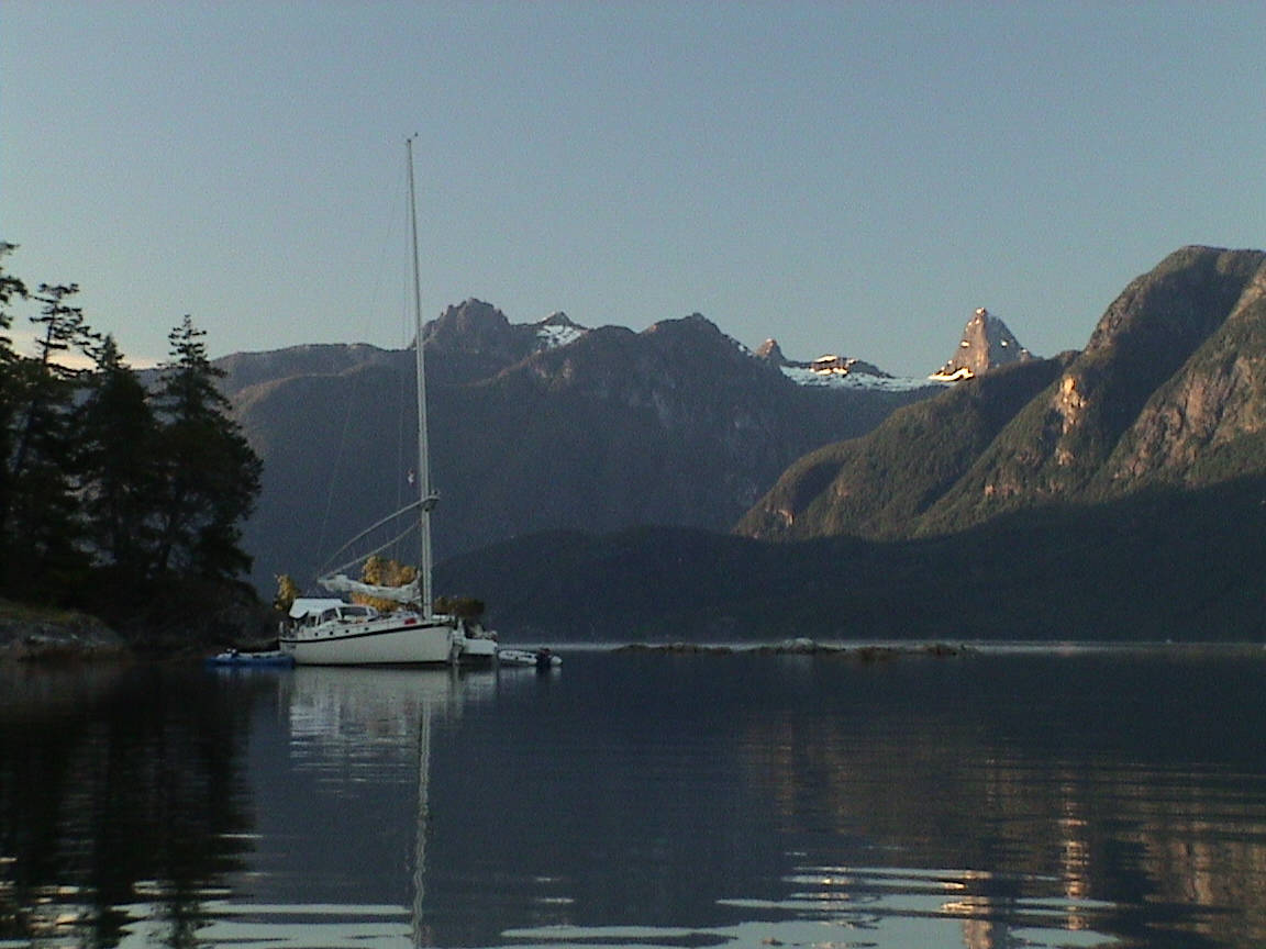
Squirrel Cove to Melanie Cove, Prideaux Haven
Prideaux Haven (pronounced Prēdo) is one specific anchorage but, like Desolation Sound, it is used as a general description fo
r a series of anchorages in and around the actual Prideaux Haven. The series of anchorages include Melanie Cove, Laura Cove and a host of small anchorages in Prideaux Haven itself. Designated a Provincial Marine Park it is the most popular destination in Desolation Sound. Melanie Cove is a long narrow anchorage which, if busy, requires stern ties ashore. Boats can be stern tied in neat rows like condominiums along both long shores. As a rule we have avoided this anchorage during the summer months. Although a beautiful destination, anchoring cheek and jowl with neighbouring boats is not our idea of how to enjoy the great outdoors. But this was still June and we decided to see what it was like 15 years after our last visit during the height of summer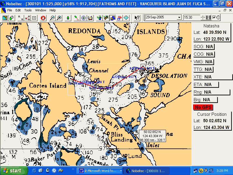
|
Campbell River |
|
|
0230 |
13.8 ft |
|
1040 |
2.0 |
|
1755 |
13.1 |
|
2130 |
11.8 |
12.5 nm
1030hrs
We’re headed out of Squirrel Cove under mostly sunny skies. There are an increasing number of high cirrus clouds along with jet contrails hiding the blue sky but the sun is warm and the day looks promising.
Out of Squirrel Cove and we have the sails up. It’s nice and warm (probably about 20 degrees) with a very light SE breeze rippling the water. Just enough to make about 3 knots through the water on a tight reach. Headed for Martin Island near Refuge Cove. Not many boats around. It’s only 9 miles to go today.
1130hrs
The power is back on, the wind evaporated on us. Close to Refuge Cove and headed for the channel between Martin Island and West Redonda Island. We don’t have to use the channel but it happens to be along the way. No wind anyway.
1200hrs
1240hrs
1330hrs
2250hrs
Writing this with a flashlight hanging over the keyboard from the dodger. Not that I need the light but I can never find the delete key in the dark. And yes, it is getting dark. The western sky still has lots of daylight but the eastern sky is filled with stars. There is a planet hanging in the south-western sky and I don’t know which one it is, Saturn or Jupiter I suspect. It’s absolutely still in here, there is a small waterfall off near the head of the inlet and the lights of a jet crossing the sky at 30,000 feet above. The boats in the bay with us are all dark and silent, not an anchor light amongst them. I don’t know when the moon will be up but I plan on staying up till then.
Now it’s almost completely dark, it’s 2300hrs. Carey went to bed at 2200hrs and the bug screens are in place. There are a few mosquitoes out there, not as many as at Squirrel but a few anyway. It looks like it will be a very quiet night.
|
|
|
|
0310 |
13.8 ft |
|
1120 |
1.3 |
|
1845 |
13.5 |
|
2215 |
12.1 |
2150hhrs
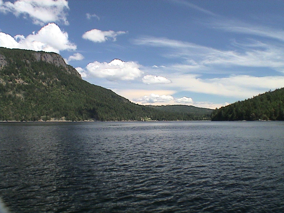
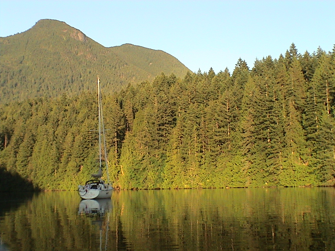
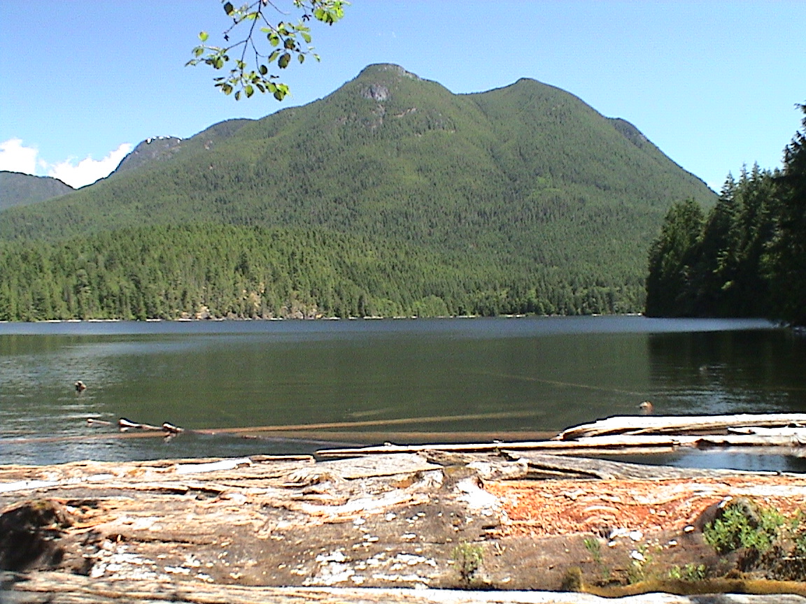
This morning we were up at about 0745hrs to the sound of Teciron’s engine next door. He had been running the engine since about 0700hrs and was conducting lessons on raising the anchor! Such a quiet anchorage too. Oh well, I got up and took Trixi on her morning walk up the trail to Tenedos Bay. Figured out that it was probably not a trail that Carey wanted to walk on, a bit steep and up hill for as far as we went. Back down to the boat to watch one of the power boats leave and then had boiled eggs and toasted English muffins for breakfast while sitting in the cockpit in the sun. Not a cloud in the sky and absolutely still except for the waterfall. By the time that was all done I rowed over to the waterfall (a stream actually) and filled up the sun shower for later in the afternoon. We had already decided to move to the outer anchorage to get a better view up Homfray Channel today.
At about noon we raised anchor and moved into the outside anchorage. It was very low tide and all the rocks very visible! A long climb up the rock to get a stern line into place. I wasn’t happy with the amount of anchor rode I had used but 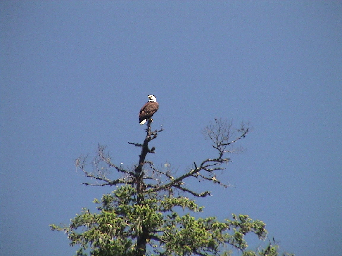 there wasn’t any wind and we were stationary. The afternoon swam along with a slight increase in clouds. It was hot, like yesterday, but there was a cooling breeze from Homfrays Channel to help things out. I actually got into my long whites to fend off the sun. Also went for a couple of long rows around the various lagoons that make up Prideaux Haven. It’s a very pretty place. I rowed over to Laura Cove and then back
  through the narrow channels. The tide had come up enough that I could get over the sand bars to get back to the boat.
By 1800hrs the ugly clouds associated to a thunderstorm were hanging over the southern sky. The occasional rumble could be heard as well. With my short anchor rode I decided to move the boat away from the shore and into deeper water with more room to swing. We did that as the wind started to rise and just before the rain started. We’re in the middle of the bay now, with 50 ft of water under the keel, and swinging on 200 ft of rode. The rain started and came down hard for a while. The wind shifted around, warm, but it blew the rain under the tarp. We eventually moved inside and put burritos in the oven for dinner. Now the rain has stopped as has the wind and all is calm outside. It’s also getting dark. Trixi is wandering around inside, afraid of the occasional mosquito of all things!
Prideaux Haven is but a short two miles over the hills to Tenedos Bay. However, it’s about six miles around the islands and head lands between the two anchorages. Tenedos Bay is also a Provincial Marine Park and protected from development. The anchorage is rather deep to shore and a stern line is the most common solution. At the head of the inlet is a stream from Unwin Lake that spills over the tidal flats into the sea. In hiking up the well defined trail leading up to the lake there are a couple of side paths that lead to the stream. Years of visitors have created a few "bathing ponds" by damming the stream with rocks. A wonderful place to take a bath. So many people have done this over the years that there are now signs asking bathers to restrain from using copious amounts of soap and shampoo! The lake itself has a spectacular view of the Unwin mountain range, a series of green velvety mountains. The lake is warm enough to swim during the summer months. However, generations of logging have caused a jamb of logs against the SE shore where the tail emerges. To swim in the waters you must transverse the logs. Be wary of the non-poisonous snakes that like the same logs and water!
|
Campbell River |
|
|
0355 |
14.1 ft |
|
1205 |
0.7 |
|
1930 |
13.8 |
|
2310 |
12.1 |
6 nm
2100hrs
The tops of the trees astern are still bathed in the setting sun, above them the tops of Unwin Range have shadows of the setting sun on their velvet green mantel. It’s a beautiful evening from Tenedos Bay, the gusty SW winds abating and the waters calming. We’re still rocking a bit but it’s very pleasant tucked into the corner of the bay.
This morning we woke up to rain on deck. Lovely! At least the port side windows appear watertight! I went back to sleep for a while and then by quarter to eight I got up to take Trixi ashore. Carey stayed in bed for a while. The tide was already dropping and no one else appeared up and about yet. The skies were completely covered with low, menacing clouds. It looked like it would rain at any moment again. Trixi and I got back to the boat still dry and Carey was up. The skies started to clear a bit to the west and weather radio was calling for clearing in the  afternoon and better weather for the weekend. Breakfast of eggs benedict was very tasty as we watched the rocks and shells reappear as the water receded in the big tide drop today. It was a lazy morning with an ever brightening sky to the west. A couple of boats left the bay. By 1130hrs we were ready to go. Hauled in all 160 ft of rode in 40 ft of water. We were in but good! We got the last of the ebb out of Prideaux Haven, going about 1 knot at zero speed out the narrow entrance. There wasn’t any wind to speak of outside and we motored all the way to Tenedos between the islands and rocks. Nice to have a very low tide, all the rocks were easy to see.
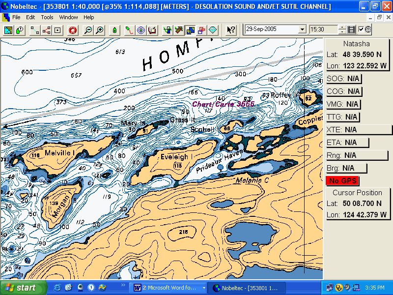
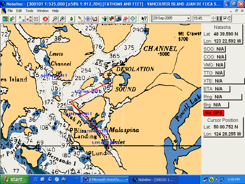
Although the original intent had been to return to Campbell River to have Carey take a bus back to Victoria, communication with my sister, Ena, had changed those plans. She was driving up to Lund, the most northerly town along the B.C. coast accessible by road, to do some camping at Okeover Provincial Park. We would meet her there and she would drive Carey and Trixi home and visit for a while. Okeover Provincial Park has a small public wharf within easy walking distance. The wharf is accessible by way of Malaspina Inlet leading to Okeover Inlet. As can be seen by the accompanying tide table, we were in a large tide change. The entrance to Malaspina Inlet has a considerable tidal current and although the entrance can be somewhat intimidating with all the rocks and islets, it’s pretty straightforward when the current is running in the right direction.
|
Campbell River |
|
|
0445 |
13.8 ft |
|
1250 |
0.7 |
|
2010 |
13.8 |
12 nm
1000hrs
1020hrs
The sails are up and we’re hard on the wind against a very light SW breeze. We’re early for the flood at Malaspina Inlet anyway. Doing about 2 knots
1110hrs
1035hrs
We’re at Zophie Head with a light SW breeze, we’ll sail for a while.
1240hrs
We’re headed up the Malaspina Inlet. We’re been hanging around the entrance, waiting for the 2 knot current against to dissipate. It looks like that has happened.
1240hrs
Just off the government wharf at Okeover Inlet. There doesn’t look like much room here. Powered all the way.
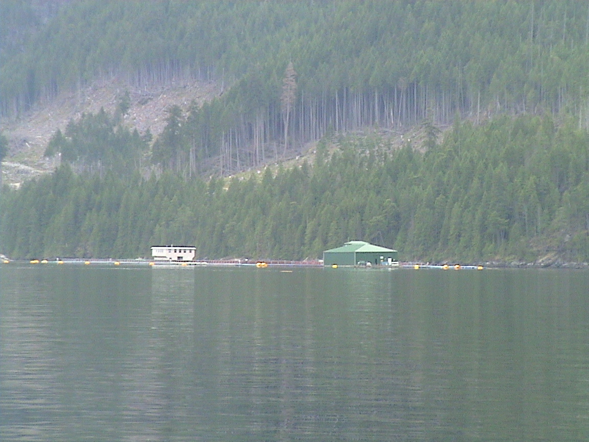
The public dock at Okeover Inlet is relatively small with limited space for visiting boaters. Most of the space is occupied by small commercial boats used for all the oyster farms that line the shores of Malaspina and Okeover Inlets. For July and August the warfinger rafts commercial boats up to make up more room for visitors. There are no facilities within walking distance of this wharf.
Date Okeover Warf2200hrs
Well, we certainly didn’t go anywhere today on the boat! It was a long day none-the-less.
This morning Ena came down to the boat and I made up egg muffins for breakfast with coffee. That went down well and then we were off to Powell River/Westview in search of an internet connection and a power inverter. Mine burned out a could of days ago (over use and two much draw!?) Went through the waterfront of Westview and found the internet café and I saw a couple of weeks ago on the way up. There were no new messages that needed attention so then it was going around trying to find a inverter. We were directed up to Joyce St that had Walmart & Canadian Tire! Who would have thought! Anyway, I found a 400 watt inverter at Walmart and that looks like it will work. Then it was back to the boat for a while and then down to Lund again for dinner. We even bought some mosquitoes coils for tonight!
|
Campbell River |
|
|
0200 |
11.8 ft |
|
0535 |
11.8 |
|
1420 |
3.0 |
|
2140 |
13.5 |
13.5 nm
0600hrs
Trixi and I are sitting on the boat at the dock, watching some construction guys get into Chuck Forest and head out to a work site somewhere down the inlet. I’m going to wake up Carey shortly, have some tea and then Carey & Ena are headed to Westview and the Ferry home. It’s cloudy this morning with a light NW breeze up the inlet. There is a low could base and I’m sure that will burn off this morning as the sun rises. It certainly is not cold out except for that breeze. The mosquito coils really worked last night, didn’t get bothered by any (not that I can remember anyway).
0725hrs
Just pulling away from the government wharf at Okeover Inlet. Carey, Trixi and Ena are on their way to the Ferry Terminal at Westview to catch the 0810hrs ferry. There is a still a light NW breeze but we’re going to have to motor out of here, it’s a 12 mile route this morning. The new inverter is plugged in and the camera and vacuum are charging.
This morning, just after the previous entry, Ena showed up on the dock, parking her car at the head of the dock where there is no parking. She was steaming mad because of a group of campers that came in at midnight last night. I guess the group of six (I noticed them there this morning) made quite a racket and moved right in next to her, having loud discussions until 0200hrs this morning. Of course, Ena likes to complain and doesn’t do anything about it anyway. I offered her the air horn if she wished, she declined.
0745hrs
Had a call from Carey who is at the Ferry Terminal at Westview. There is no wind in the strait. Gee, what a surprise! She had a message from Dick on her telephone. I noticed the same one on mine as soon as I turned it on. I’ll call him later. Coming up on Lancelot Inlet.
0810hrs
Going past Grace Harbour. There are six boats in there now. There were none when we came up this way two days ago.
0840hrs
Just out of Malaspina Inlet, the sails are up and we’re close hauled on the wind, aimed at Sarah Point. It’s about a 10 knot wind, we’ll probably have to tack at least once to get out of the mouth of the inlet.
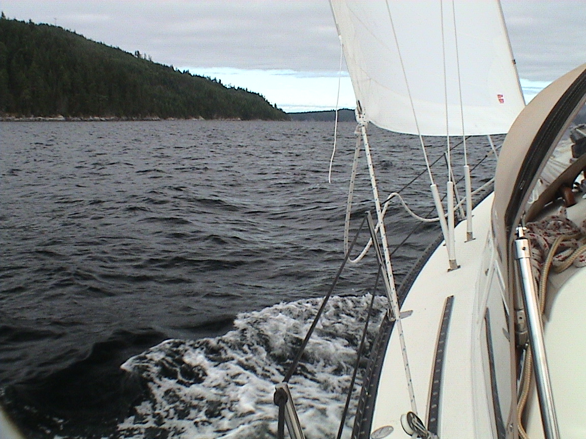
Rounding Sarah Point on a reach at 6+ knots in a nice breeze! The skies are clearing to the west and I suspect the sun will be with us shortly. It looks like a down wind run once we turn the corner.
0930hrs
Into Thulin Pass with a light wind over the stern, wing and wing. The sun isn’t here just yet. I called Dick and he was already down at the Inner Harbour with the kids trying to get onto one of the Tall Ships at the Festival in Victoria. He won’t be able to make it to Nanaimo to meet me so I guess I’m single handed all the way.
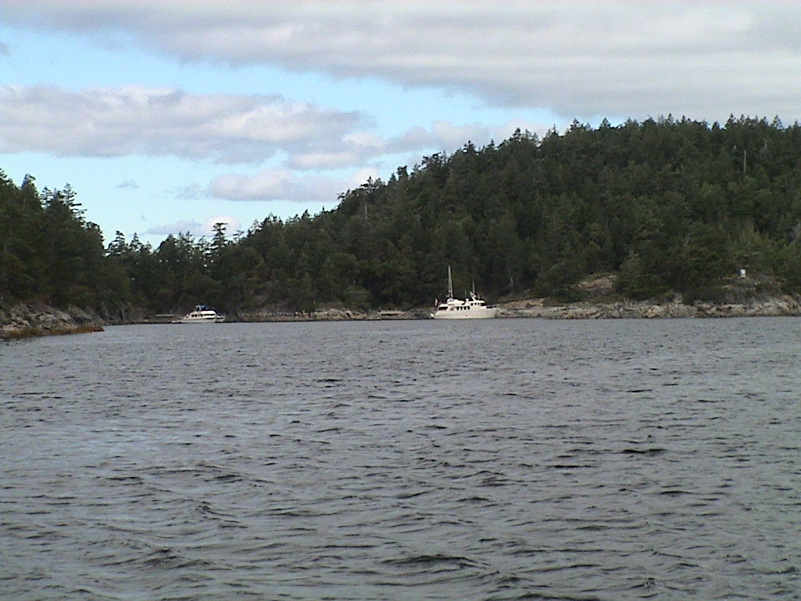
The wind got real light and the engine is on. We’re powering to Lund. Only three boats in the Copeland Island anchorage.
1020hrs
Tied up at Lund on the inside of the floating breakwater. The docks are busy, the sun is out. Time to do some cleaning! The wind has all but died.
2115hrs
A multitude of stereos, the rich smell of outboard engine exhaust and the setting sun, yes, we’re at Lund. It’s actually quiet on the floating breakwater but busy everywhere else. The sun has gone down behind some clouds over Campbell River. It’s supposed to be sunny again tomorrow but I’m not holding my breath. I just hope for some wind, I don’t care what direction.
Tomorrow I’m going to try for the Hardy Islands or Smugglers if the tide holds out. The weather forecast is for light and variable tomorrow so I suspect that I will be powering most of the way.
Date Lund to Lisquiti IslandThe goal for the first step homeward bound was to get as far south as possible in the large ebb tide. The weather forecast was for light and variable winds from the SE with the possibility of showers. I expected light to no winds as the front that was due to come through was very weak. It wouldn’t be the first time I would motor for a 8 – 10 hour day.
|
Campbell River |
|
|
1435 |
3.6 ft |
|
2220 |
13.5 ft |
52 nm
0700hrs
Just motoring out of Lund, not much else is up and running yet. A couple of the fish boats are also cranked up. The skies are completely clouded over and looking quite dark towards Campbell River. There appears to be an easterly breeze out there. The weather guys are saying rain south of Nanaimo with SE 10 – 15 knots this morning, easing to variable this afternoon. We’re going to try for the Hardy Islands today and it looks like it will be motor all the way so far. We’re aimed at Grief Point.
0740hrs
Abeam of Dinner Rk. It’s about a 12 knot SE wind here, a light chop on the water. The current is still against us for another two hours. I can see the bell buoy for the reef south of Savory Island. If the wind holds I’ll probably head over to Cape Lazo, go across today and then get the ebb when the wind dies this afternoon. May even end up at the south end of Texada, possibly Jedidiah Island.
This change of plan was to take advantage of the SE breeze that looked pretty consistent as far as I could see across Georgia Strait. At this point the current was still against me for another two hours and that is about as long as it would take me to cross the strait. The further north at this point in the strait, the less current against. Once across the strait I expected to be close to Cape Lazo with the option of going into Comox / Courtenay if the weather turned against us. If it didn’t, the tide would change and I would take advantage of the ebb to power further south.
0755hrs
The sails are up, we’re headed for Vivian Island on a close haul in about 12 knots of wind, no waves to speak of. Jedidiah Island is 31 miles away (as the crow flies).
0810hrs
Just put a reef in the main, a bit better control. We’re just clear of the bell buoy that marks the Savory Island reef. The wind is up to about 15+ knots, a light chop. Cruising along at 5.2 over the bottom, 5.5 through the water.
0820hrs
Abeam of Vivian Island. The weather report just issued a small craft warning, 15 to 20 knots this morning, easing to variable this afternoon. Looks like I may have to let the reef out as the wind is lightening. No other boats out here at all with the exception of BC Ferries, 810 out of Powell River.
0930hrs
Off the top end of Texada Island. I can see Cape Lazo clearly ahead. The reef is still in the main and the seas are starting to build. The tide must be close to changing. We’re still doing about five knots over the bottom on a close haul. It’s starting to get chilly, time to put my jacket on. The clouds are still very thick to the NW, looks like it’s raining all over Desolation, including Lund. Some showers to the SE.
0945hrs
The reef just came out of the main, it’s getting light. Down to four knots of boat speed.
1015hrs
Another lone sailboat coming out of Comox on opposite tack, going north to Lund it appears. The mountain tops of Vancouver Island are clear above a low bar of clouds. There is rain behind me now over the north tip of Texada.
1100hrs
49.40.583 124. 6.937We’re just inside a line from Cape Lazo to Hornby Island. I suspect the current here is still a bit against us, we went by a fish buoy and it looks like the water was drifting north. No rain on us yet.
1125hrs
The tide has definitely changed, now we’re into short, steep seas with the 15 knot SE breeze. The wind has backed and we’re still headed on the same tack for Denman Island, about two miles off shore. The backing wind has enabled me to curve further south. Sister’s Island is reporting 15 knots, Entrance Island lighthouse is reporting 17. We’re at 5.2 knots over the bottom on a close haul. There is a channel between Denman and Hornby. If it gets too rough out here that’s where I’ll head. If necessary I can power through there and then starboard tack over to Lasqueti.
The wind is building, there are plenty of whitecaps around now. That could also be because of the big ebb against the SE wind too. We’re cruising along the shore of Denman Island, the wind backing enough that I should be able to make the channel without having to tack. I need to get out of the waves for a bit, bladder relief and time to get some water. We’re doing 5.7 knots over the bottom and spray into the cockpit on some of the bigger waves.
1215hrs
We’re getting closer to Denman Island. We’re going 7 knots over the bottom, 5.5 through the water. The swells are easing somewhat as we get sheltered by Hornby Island. I need to take a break soon.
1315hrs
In the channel between Denman and Hornby. The last few minutes have not been fun! Eventually I ran out of room on the Denman side and tacked towards Hornby Island. It appears that there is quite a current through this pass and the seas became very short and steep. I got over to the Hornby side and the wind was really starting to pick up, I suspect a combination of funnel between the two islands and the increased current. I figured that it was time for a break and furled up the jib, cranked up the engine. Although the engine ran, no power. I couldn’t even get the boat to go head to wind. The engine couldn’t get up to speed either. I suspected a bunch of grass (and there is a lot out here!) got tangled around the keel and prop. Reverse didn’t help and I couldn’t get any speed going backwards because of the wind. OK then, plan B. The jib came back out and there was no way I was going to make it up the channel. Back around the north side of Hornby it is then! The furling line is wrapped around the drum. Great! Wall to wall white caps.
1400hrs
Just crossed the north tip of reef that extends off Hornby Island. At one point we were in 15 ft of water! That’s cutting it a bit close but I was using the head while we were cruising on a reach behind Hornby. Now we’re hard on the wind again, it’s not quite as rough on this side of Hornby. Cleared the wrap on the furling gear, then had all sorts of wraps on the sheets because of the flogging while I was fixing the furling. Had to haul lines and sheets out of the water. Lot’s of fun But we’re set up for a close haul on Starboard tack to Lasqueti. Aimed for Texada.
1430hrs
Coast Guard just broadcast a Pan Pan regarding a kayaker at the south end of Hornby Island in distress due to heat stroke. How the hell do you get heat stroke in these conditions! We’re not even half way across, still doing 5.5 knots over the bottom, reef in the main. Quite a short, steep sea.
Weather report from a Coast Guard buoy tender near here indicates it’s 23 knots from the SE here with a five foot moderate sea. Ran into some substantial wave, burying the bow into one hard enough that it took the anchor out of the roller and left it dangling over the side. Eased the sheets and ran forward to fix that. The wind is easing a bit.
1500hrs
Just took the reef out of the main, need the power to deal with the waves. The wind is easing.
1530hrs
We’re at Mowat Bay on Texada Island, still 12 miles from our goal. The seas have moderated somewhat. We’ve tacked away from Texada Island and we’re short tacking up the coast to Lasqueti.
1615hrs
Threw in a tack, headed back towards Texada. The seas are smoothing but the wind is also lightening. That’s a good thing I guess as long as with wind holds out. We’re still at 5.2 over the ground despite the fact that the current has to have changed to a flood by now. That’s probably one of the reasons for the calming seas.
1640hrs
Tacked again off Davey Bay, the island just in front of the bay. The wind has eased, still blowing at about 10 knots. Still clouding but the sun is very bright.
1730hrs
Abeam the light on Fagan Island at the north end of Lasqueti Island. We’re still going about 5 knots to windward, there are no whitecaps left and it’s quite smooth. The latest weather report is for increased wind tonight from the SE! Sure would be nice if they got it right every once in a while. At Sister’s Island (which I can see and is only about five miles away) the wind is 11 knots, 15 at Bellenas Island. So things have settled down somewhat, it’s quite a bit more comfortable at the moment. We’re still 5.8 miles away. Probably two hours away yet, we’re still tacking and will tack shortly to go back to the Texada side. Had a nice conversation with Carey. She and Ena had gone to Victoria to see the tall ships but didn’t realize that you had to pay to get to the boats. They went shopping instead.
1735hrs
Tacked at Spanish Cove, lots of houses along with beach. Headed back to Texada Island. 5.2 miles to go.
1800hrs
The power just came on. We’re still 4.6 miles from our destination. We just passed a current line and the flood is definitely against us. We are down to 2 knots towards our goal.
1830hrs
We seem to have a problem with the power-train. Lots of vibration, no drive. Lot’s of wash at the back, no go. Back under sail. I’m hoping that it’s just weeds. Another challenge.
1900hrs
Under power again, we can maintain four knots at 2200rpm with minimal vibration. Still don’t know what it is but we’re headed for the pass between Lasqueti and Jervis Island instead of going all the way around against the flood. Just have to watch for a couple of rocks awash is all. The wind has become very light. The sails are coming down.
2015hrs
The anchor is going down at Bull Island, no one else around and it’s starting to spit rain. 54.7 miles. Time to turn on some heat and make dinner.
2250hrs
It’s almost totally dark out now. The rocking and rolling has almost stopped and it’s warm inside the cabin. There are mosquitoes here to! I have a coil burning beside me. Almost time for bed, it’s been a long, long day and my face is on fire. As I came in here two cruise ships came by in the channel between Lasqueti and Texada! The cruise season must be upon us. I tied the "main" anchorage first, called Long Harbour. It is very long, very narrow and quite shallow. Not somewhere that I wanted to experiment with this time of night. There were only two other boats here, a sailboat that had two stern lines and an anchor. I didn’t want to bother with a stern line, just too tired. Came into here and just dropped the anchor with lots of rode.
A great day sailing, 11 hours to windward! Carey would have been thrilled! Not! A bit rough at times but the boat held up just fine. The problem with the engine / drive-train was still an unknown at this point. I suspected a large wrap of weeds. During all that sailing I’d had to sail through some large drifts of weeds that I hadn’t seen early enough to avoid or due to circumstances, couldn’t avoid. I had never had weed collect on the prop to any degree that the engine spinning the prop hadn’t immediately cleared the problem. But at 2030hrs after a long day sailing I was in no mood to go into the water to find out! I’d check it out in the morning.
Jedidiah Island is one in a group of islands between Lasqueti and Texada Islands. It’s a fairly new Provincial Marine Park with no dock facilities. The anchorages are somewhat small and deep, requiring stern lines to shore if there is any kind of a crowd.
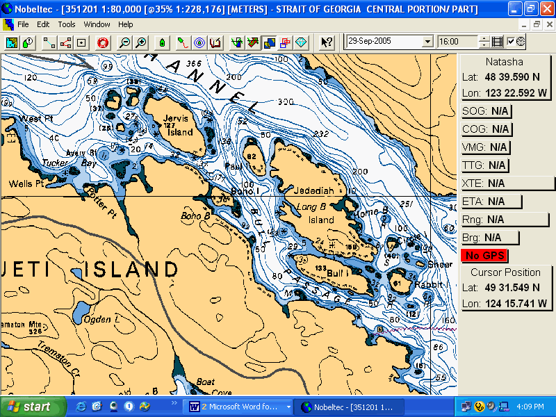
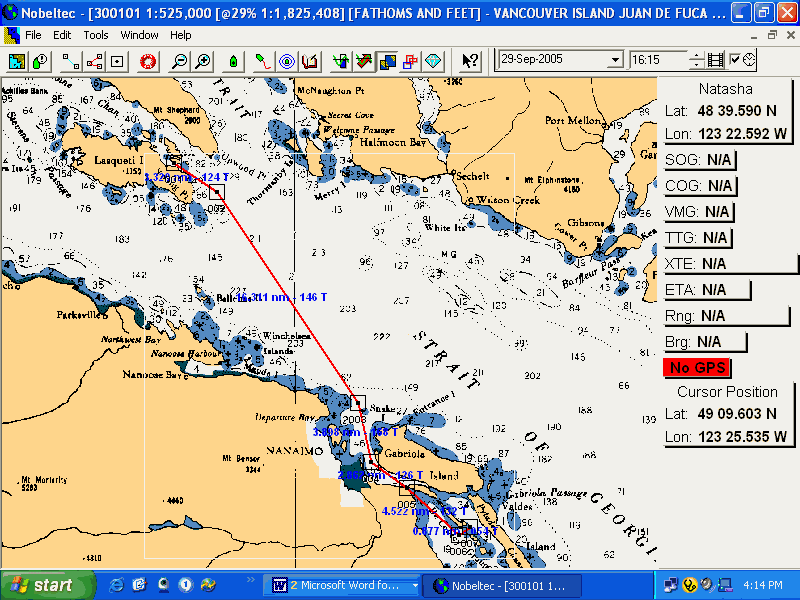
|
Point Atkinson |
|
|
0520 |
9.5 ft |
|
0945 |
11.5 |
|
1620 |
4.3 |
|
2340 |
15.7 |
|
Dodd Narrows |
||
34.5 nm
0800hrs
Already up to a cloudy sky after a restless night. Couldn’t get a good night’s sleep. My face was rather hot and I couldn’t turn my head off. It was quiet except for the rain on the roof. I dragged my but out of bed this morning at 0700hrs. Even that was hard! Anyway, breakfast of two egg muffins is done and the dishes put away. The sky is lightening to the NW and the weather report is for NW wind today until this afternoon when it’s supposed to get light and variable. The tide turns to ebb at about 1045hrs so I’m going to get going soon. The breeze in the anchorage is about 5 knots so far. WG is NOT active today so it’s going to be a straight shot at Nanaimo. I’m listening to the Q this morning and the weather is supposed to improve tomorrow and Wednesday, getting back up to the 20s. It’s time to get going.
Although the engine / drivetrain issue was still there, the wind was blowing from the NW and the conditions were perfect to heading to Nanaimo. If necessary I could pull into the commercial marinas there to effect repairs. If the prop shaft was bent (a possibility considering the vibration) I couldn’t do anything about it here anyway.
0820hrs
We’re underway, sailing off the anchor against a rising NW breeze. Had to haul up 150 ft of rode. That got me warm! It’s 20 miles to Horsewell Rk at Nanaimo.
0830hrs
Sailing in Bull Channel, wing & wing at 4.5 knots on the knotmeter, 5 over the bottom.
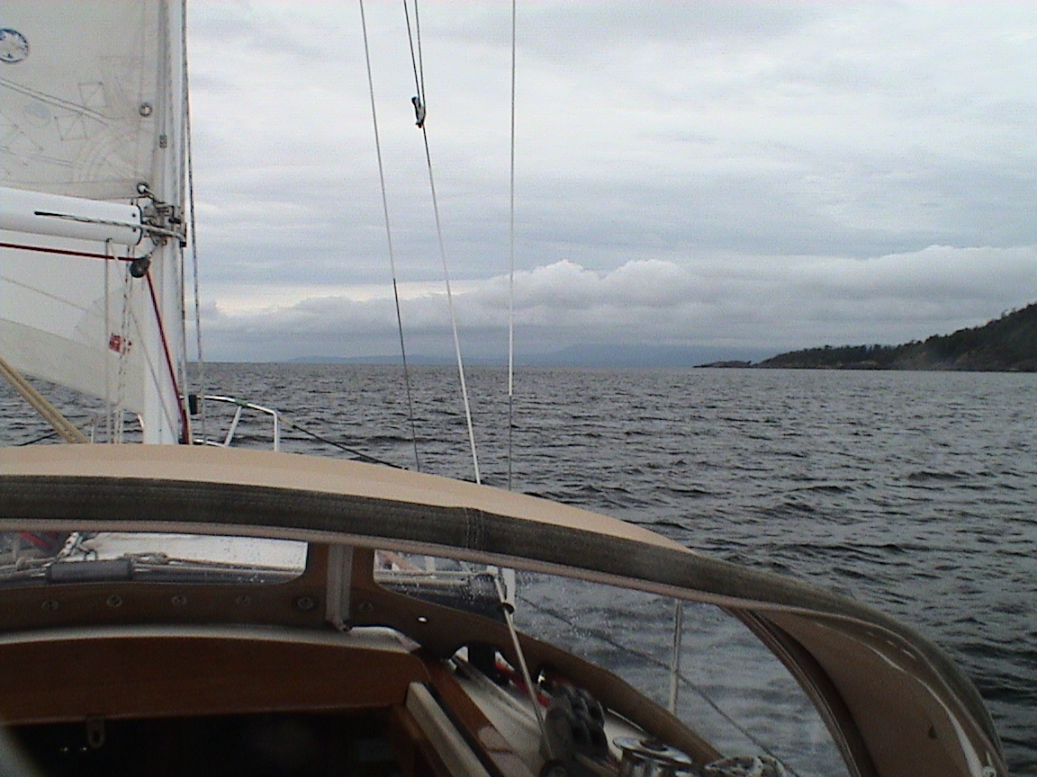
Just clearing the south end of Lasqueti Island. I can see Nanaimo from here, it’s clear out although cloudy to the SE. There is blue sky to the NW. We’re 18 miles from Horsewell Rk. A light NW breeze, wing & wind.
0930hrs
Just spoke to Carey, she says it’s raining hard in Sidney! The wind is picking up here and we’re on a very broad reach directly for Nanaimo. WG is not active today.
1000hrs
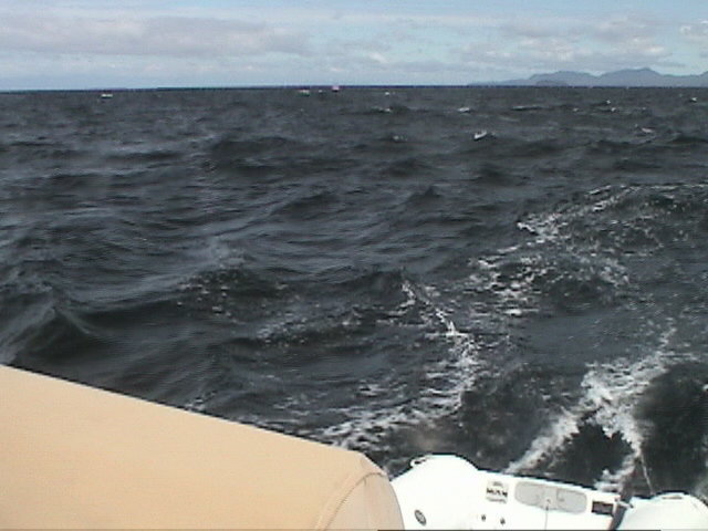
1100hrs
We’re averaging 6.5 knots over the bottom, the wind is easing slightly. At times we were up 8.2 surfing down some of the waves. Great sailing! We’re 6 miles from Horsewell Rk. Lasqueti is looking very distant. Entrance Island is reporting 17 knots of wind and there is a lone sailboat headed out of Nanaimo towards Smugglers.
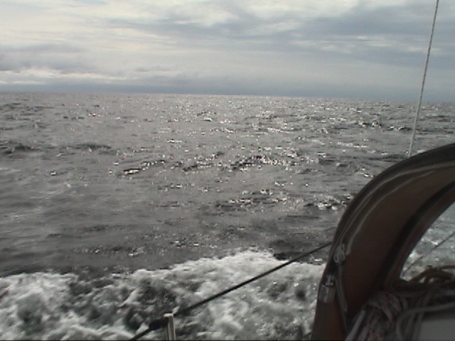
Just about at Five Fingers Island and about to reset GPS. We’ve covered 18 miles so far. Headed to Dodd Narrows as the slack there is not until 1435hrs, lots of time to get there, seven miles away. The wind is still about 15 knots with the seas easing just a little. A few more boats are coming out of Departure Bay, fighting their way north against the wind and the current. Still doing about 6.5 knots over the bottom. Still on a very broad reach.
1230hrs
Just 3.2 miles from Dodd Narrows, we’re wing and wing as we go by BC Ferries terminal. The wind has eased somewhat.
1300hrs
About half a mile from Dodd. I can see though it and it looks like there is a breeze all the way through. I’m planning on sailing through as I still don’ t know what’s wrong with the engine. Lots of vibration this morning, not a whole lot of thrust. The wind is a bit more finicky now.
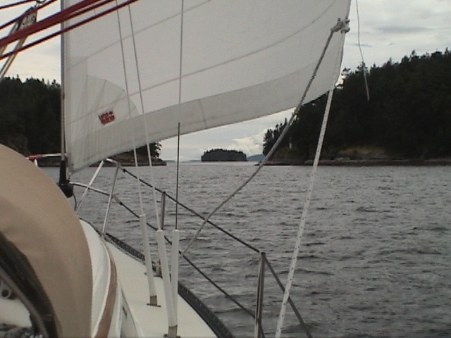
Successfully sailed through Dodd Narrows. The wind was a bit light with just enough speed to maintain steerage. The cell phone rang just as I was entering it with video camera in hand. Carey on the line. It got a bit busy with about five knots of current still with us. Now we’re on a broad reach headed for Decourcy Island. Time to call Carey back.
1345hrs
The smoke of the pulp mill at Crofton shows a SE wind and I’m running out of NW wind here. Close ashore on Decourcy now running wing & wing. There must be about 15 sailboats headed my way, all powering as they head for slack at Dodd Narrows. Looks like a parade. The waters around Thetis Island are flat and glassy
1400hrs
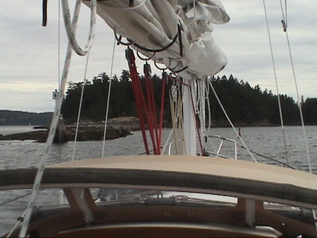
1445hrs
The anchor is down, only two sailboats here, very nice and quite. Time for something to drink and eat! Clean up first though.
2110hrs
The sun has just set behind the trees to the NW and the few clouds in the sky are turning pink along with edges, purple inside. There is still a gentle, cool breeze blowing from the SE with barely a ripple in the water. The tide is high and covers the reef at the entrance to the cove. It’s a bit busier now than when I arrived, about 10 boats in here. That’s still not bad for Pirates Cove in summer!
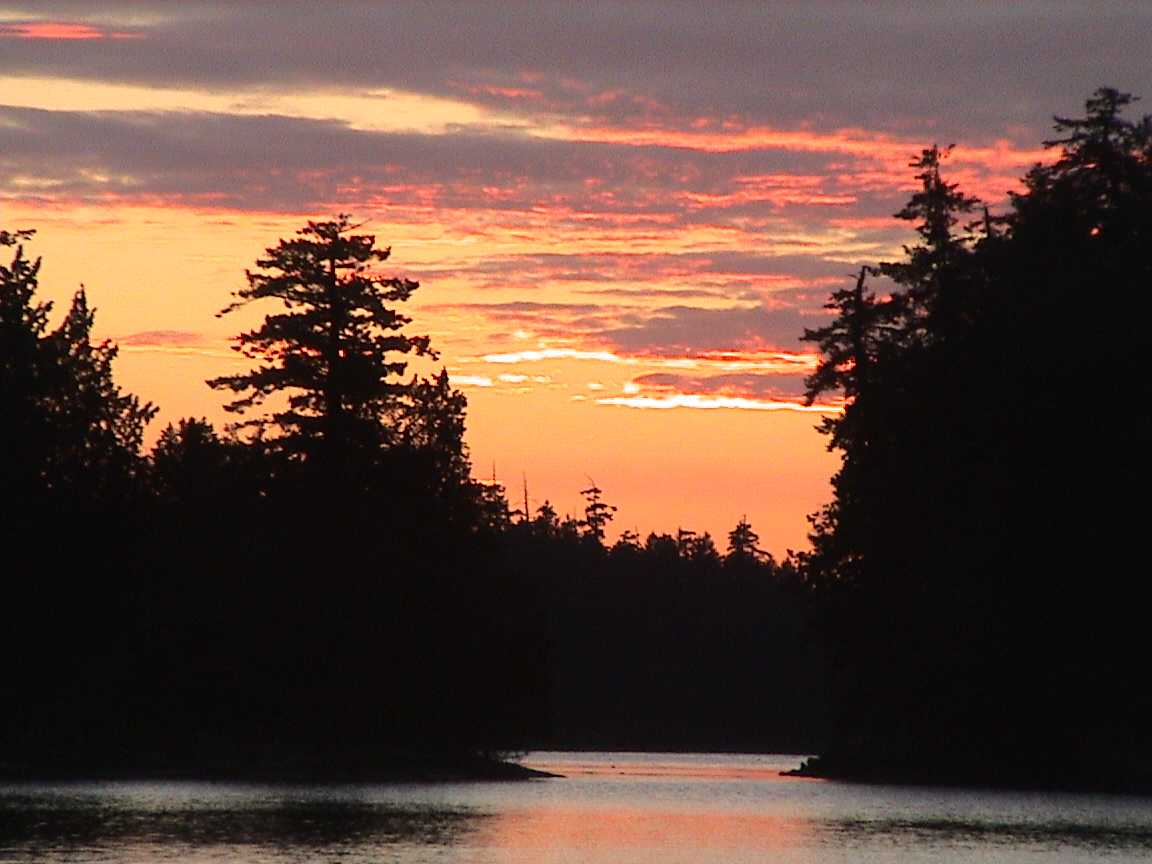
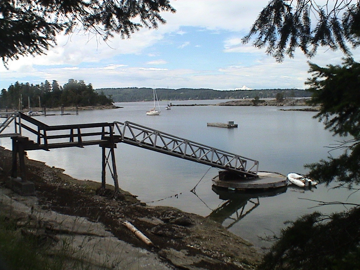
The sky is one of those paint by number types of skies tonight. Lots of pale blue with touches of purple and pink clouds. The weather types are calling for SE tomorrow with a chance of showers. The sky to the south is clouded over so maybe they’re right. Now the mosquitoes are eating me alive and it’s time to go inside and light up a couple of coils.
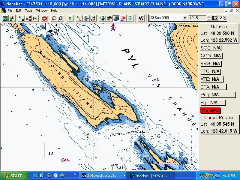
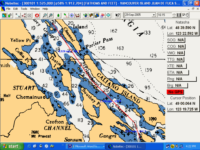
|
Fulford Harbour |
|
|
0615 |
6.2 ft |
|
1030 |
7.2 |
|
1420 |
4.3 |
|
2350 |
11.2 |
19.5 nm
0830hrs
Things are good this morning! Not that the weather is anything to write home about, it’s cloudy this morning with not a ripple on the water. But I think the boat is back to running as normal. I got up this morning at 0545hrs after a restless night. Last night I couldn’t get to sleep, thinking about the necessity of going into the water this morning to clear the prop. But then I started thinking about alternatives. If I could see the prop with a mirror, why couldn’t I clear it? Strap a knife to the boat hook and cut the weeds away that way? Well, that’s what I did this morning. After a coffee and the last of the honey cake for a quick breakfast I used electrical ties to strap the large knife to the boat hook pole. Then I tied the dinghy to the stern and, using the mirror again, located the prop. Then it was poke and rip the weed ball. After about an hour (and very cold arms) I know I have most of the weed off the prop and the leading edge of the rudder where it was jammed up against the hull! There is a bit of weed left on the shaft boss but that shouldn’t cause too much of a problem. We’ll see how it works when we pull out of here this morning.
Then, while I was working anyway, I checked out the furling drum. On Sunday the line wrapped around the outside of the drum case, unusual. Anyway, I discovered that the nut under the drum had backed off! The forestay could not have let go as the wire twist would have kept the drum from backing all the way out. Anyway, tightened that up. Then checked the backstay tension for accuracy on the gauge. It’s right up to speed. Then tightened the upper stays six half turns each side. I’ll leave the inners until I can get someone on board and going to windward. The rig feels tighter already. Then fixed the port side lifeline tension as well as the throttle cable tension to keep the throttle from backing off at speed. We’ll see if that’s going to be tight enough. Inside I repaired both of the lights that were not working (not that we needed them this time of year!). All in all, not a bad morning’s work. Now it’s time for another cup of tea and then maybe a proper breakfast. There’s no hurry to get out of here yet, there is no wind and the tide doesn’t start to fall until 1120hrs. The weather gurus are saying 15 knots from the SE with clearing skies this afternoon. We’ll see. If everything is right I may be able to make it to Montague or Annette Inlet before the tide changes into a full blown flood.
1115hrs
Powering out of Pirates Cove. It looks pretty flat out there but the tide is now dropping and I’ve got a few miles to put on. About 20 to be exact if I can make it to Prevost Island today. It’s completely cloudy and the motor is working as expected so far, but we’re not out of the anchorage yet either.
1125hrs
We’re set on course southbound, a very light ripple on the water from the east. We’re back up to speed, the RPM and knots match again! There does seem to be a bit more vibration but there is a bit more weed down there as well.
1140hrs
The engine is off, there is a light easterly breeze building so we’ll try to sail for a while. Hopefully it will build into something useful.
1220hrs
Well, I tried for as long as I could. No wind to speak of now and the power is back on. We’re off the south end of Pylades Island. No break in the clouds yet. There are a couple of boats headed for Dodd Narrows already.
1230hrs
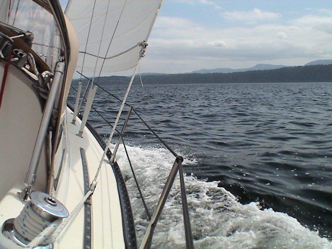
1315hrs
We’re just north of Poulier Pass. We’re had a nice sail to windward for the past little while. The current is with us although not that much yet. The power is back on now as it’s glassy calm as far south as the eye can see. It’s starting to clear up a bit to the NW.
1400hrs
We’ve got past Poulier Pass and are just north of the start of the Secretary Islands. A SE breeze has started up and is quite a bit cooler than this morning’s air temperature. You could see the wind coming as the seas to the south darkened. The sails are back in action, the engine off. Hard on the wind. We’re still 11 miles from Prevost Island.
1445hrs
Close to Victoria Shoal in Trincomali Channel. A great sail so far, hard on the wind with a great current pushing us south. Great tacking angles! We’re going about 5.5 to windward and about 6.6 over the bottom! There are a few sailboats around, a Hans Christian going our way but he’s powering.
1555hrs
Close to Nose Point on Saltspring Island. I just put a reef in the main. The wind has picked up a bit and there are whitecaps around. We were over on our side a bit too much. The tuning of the rig has helped quite a bit, the boat is going to weather like a freight train. A few boats going north now, all powering with just a jib or main out. It’s blowing a good 15 knots from the SE. We’re still doing 6.3 over the bottom. I spoke to Carey before I’ll lose the signal at Prevost. She was at work of course and busy when I phoned. She called back a few minutes later. I asked if Natasha was coming over this weekend and she will see if those arrangements can be made, now that I will be home for the weekend.
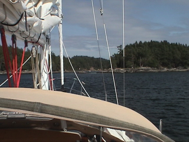
The sails just came down at the entrance to Annette Inlet. The power is back on to get in there. Almost clear skies.
2045hrs
Sitting in the cockpit with my sweater on, a blanket over my legs and a glass of wine close at hand. Although it’s clear overhead, the sun is now obscured by clouds to the west, the next front approaching from the northwest. The southeast wind is still blowing about 12 –15 knots, it’s a bit chilly.
It was a great sail this afternoon! More sunshine would have been nice but the wind was there none-the-less. With a large ebbing tide the tacks down Trincomali were at great angles. The boat was heeled right over with the rail almost in the water, chugging to windward at 5.5 – 6 knots. The speed on the GPS was even better. Not a whole lot of boats out, a few going northbound, all with only one sail up and the motor running. Once into Captain’s Passage the current got a bit weird and it took a while to tack my way to the front of Annette Inlet. The wind was up and down and at one point I had a reef in the main, then took it out. Lots of practice tacking and doing it well. Anyway, I got into Annette to find one sailboat and one power boat in the main anchorage. Powered in and dropped the anchor off the floating home on the east shore. Lots of crab trap floats around. The sun was out and I made myself a rum & coke along with a can of chips as an appy once the boat was settled into place. Finished my book, "Big Bad Wolf", which doesn’t come to any real conclusion and only leads to a sequel should I want to read that. Oh well. A couple of guys come in a Beneteau 37 from Sidney. Of course, although they have the entire bay, they anchor right in front of me. I 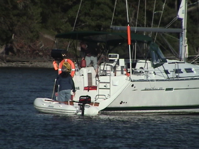 could have hit them with an egg toss, let alone a throw. Once I figured out that they were planning on staying, I started the engine and walked forward to raise the anchor (not a big deal seeing we’re in only 15 ft of water). The skipper apologies for invading my privacy! I told him that collision during the night was my concern, and that I needed the exercise anyway! I moved back about 100 ft and dropped again. The joke was that he and his buddy went on a dinghy trip with their trusty little Mercury outboard and were gone for quite a while. Then I noticed them rowing back into the inlet against the wind. I guess they forgot to fill up the fuel tank. What a shame!
By 1900hrs the BBQ was going for three pieces of chicken left in the cooler. By 1930hrs that was going down the hatch very will. Very tasty although I couldn’t finish all three breasts. One went to the benefit of the seal that has been hanging around all evening.
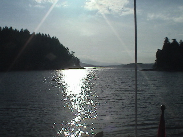
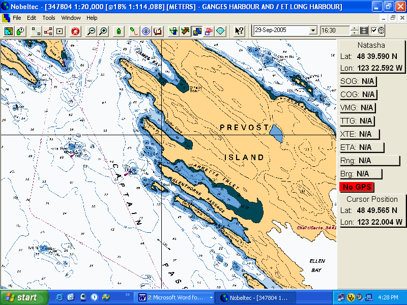
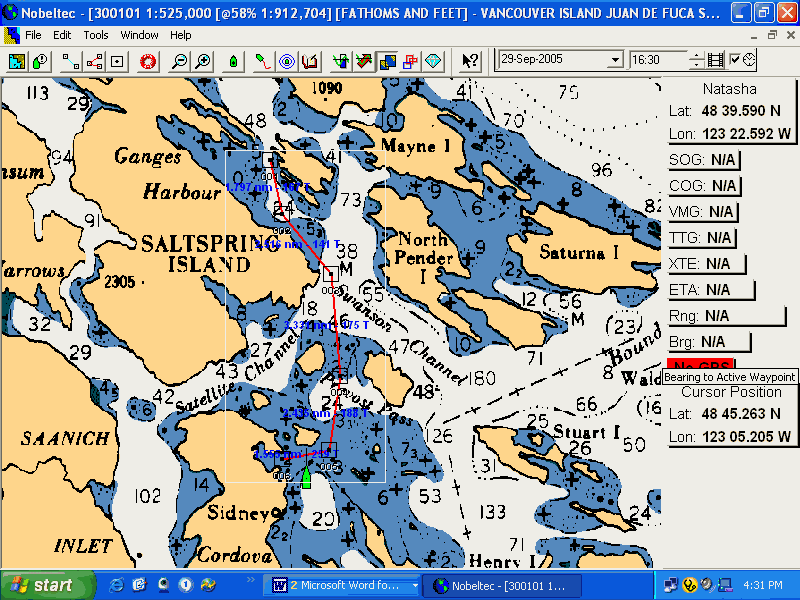
|
Fulford Harbour |
|
|
0705 |
4.9 ft |
|
1250 |
7.2 |
|
1715 |
5.9 |
0815 hrs
Just hauled the anchor up! It looks like a good morning for sailing! There is a light SE breeze through the anchorage this morning and I’m sailing off the hook. Of course, hauling up 120 ft of line out of 20 ft of water against the breeze with the main already up is enough to give a guy a heart attack! Anyway, drifting downwind to the entrance, the sky a solid overcast. There is a rising tide this morning so it will be against us, but it’s only a 3 ft difference. That shouldn’t create too much current in Captain’s Passage.
Had a very good night’s sleep last night so the wind must have died shortly after I crashed at 2245hrs. Left all the hatches open, no mosquitoes! Kind of nice for a change. Woke up this morning to a dead calm at about 0600hrs and then must have fallen back to sleep because the next thing I know I’m being woken by the rigging rattling in the wind at 0700hrs. Up and at’em. I was planning on doing some cleaning and repairs this morning before the tide change at about noon, but with the wind already blowing, I had scrambled eggs for breakfast, a quick cleanup and now I’m headed out.
0825hr
We’re out past U62 in about 12 – 15 knots of wind, right on the nose, close hauled towards the other side of Captain’s Passage. There aren’t a whole lot of boats out here. One lone sailboat powering out of Ganges Harbour with his main up.
0930hrs
The wind has lightened a bit, we’re at Beaver Point already. Had a great sail to windward along the Saltspring Island side of the passage, lots of tacks. The other sailboat finally decided to also go sailing and he’s so far behind now that I can’t make out how big the boat is anymore. I think it was a Catalina 30. The wind is curling around Beaver Point a bit so I think we’ll head over to Thieves Bay. It looks like there’s more wind over there.
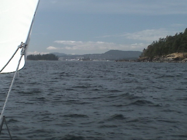
Already off Thieves Bay and tacked to go towards Morsby Pass. Not much current to speak of and the wind is much stronger over here. Hard on the wind on a port tack, looks like I can lay the pass from here.
1015hrs
Into Morsby Pass, sharing it with the Spirit of Vancouver Island. The wind has eased again and I’ll have to tack over to the light to clear the reefs around Portland Island. The skys are clearing.
1100hrs
Just in past the tip of Coal Island. We did have to throw in one tack in Morsby Pass and then it was a hard on the increasing wind to here. Almost completely clear skies now, but the wind is very cold.
1115hrs
The engine is on as I power into the harbour. The wind is still picking up and it’s cold. Lots of sun around though.
1430hrs